

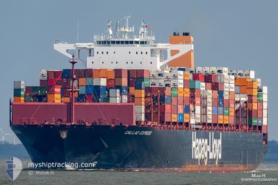
CALLAO EXPRESS
Cargo A

Current Trip
| Trip Time | 1 day |
|---|---|
| Trip Distance | 307.70 nm |
| AVG Speed | 13.1 Knots |
| MAX Speed | 18.3 Knots |
| Draught | 11.2 m |
| AVG Wind | 12 knots |
| MAX Wind | 18 knots |
| MIN Temp | 6.4°C / 43.52°F |
| MAX Temp | 10.2°C / 50.36°F |
| Position Received | 1 m ago |
Current Position
| Longitude | --- |
|---|---|
| Latitude | --- |
| Status | Under way using engine |
| Speed | 6.5 Knots |
| Course | 90° |
| Area | North Sea |
| Station | T-AIS |
| Position Received | 1 m ago |
Information
The current position of CALLAO EXPRESS is in North Sea with coordinates 53.54147° / 9.91469° as reported on 2025-03-29 18:40 by AIS to our vessel tracker app. The vessel's current speed is 6.5 Knots and is currently inside the port of HAMBURG.
The vessel CALLAO EXPRESS (IMO: 9777606, MMSI: 218839000) is a Cargo A It's sailing under the flag of [DE] Germany.
In this page you can find informations about the vessels current position, last detected port calls, and current voyage information. If the vessels is not in coverage by AIS you will find the latest position.
The current position of CALLAO EXPRESS is detected by our AIS receivers and we are not responsible for the reliability of the data. The last position was recorded while the vessel was in Coverage by the Ais receivers of our vessel tracking app.
The current draught of CALLAO EXPRESS as reported by AIS is 11.2 meters
Weather
| Temperature | 6.8°C / 44.24°F |
|---|---|
| Wind Speed | 5 knots |
| Direction | 287° WNW |
| Pressure | 1017.7 hPa |
| Humidity | 76.3 % |
| Cloud Coverage | 7 % |


Featured Company
Last Port Calls
| Port | Arrival | Departure | Time In Port |
|---|---|---|---|
| 2025-03-29 19:23 | |||
| 2025-03-25 22:24 | 2025-03-28 04:20 | 2 d | |
| 2025-03-14 21:08 | 2025-03-16 17:27 | 1 d | |
| 2025-03-12 08:30 | 2025-03-13 10:18 | 1 d | |
| 2025-03-10 20:58 | 2025-03-11 12:03 | 15 h | |
| 2025-03-06 20:41 | 2025-03-07 22:08 | 1 d | |
| 2025-03-03 22:02 | 2025-03-05 01:26 | 1 d | |
| 2025-02-26 15:44 | 2025-03-01 02:21 | 2 d | |
| 2025-02-21 07:22 | 2025-02-22 05:30 | 22 h | |
| 2025-02-14 16:43 | 2025-02-15 07:41 | 14 h |
Most Visited Ports (Last year)
| Port | Arrivals | |
|---|---|---|
| 10 | ||
| 10 | ||
| 8 | ||
| 8 | ||
| 6 | ||
| 6 |
Last Trips
| Origin | Departure | Destination | Arrival | Distance | |
|---|---|---|---|---|---|
| 2025-03-28 04:20 | 2025-03-29 19:23 | 307.70 nm | |||
| 2025-03-16 17:27 | 2025-03-25 22:24 | 4112.28 nm | |||
| 2025-03-13 10:18 | 2025-03-14 21:08 | 616.97 nm | |||
| 2025-03-11 12:03 | 2025-03-12 08:30 | 282.82 nm | |||
| 2025-03-07 22:08 | 2025-03-10 20:58 | 838.96 nm | |||
| 2025-03-05 01:26 | 2025-03-06 20:41 | 682.07 nm | |||
| 2025-03-01 02:21 | 2025-03-03 22:02 | 1341.12 nm | |||
| 2025-02-22 05:30 | 2025-02-26 15:44 | 1355.09 nm | |||
| 2025-02-15 07:41 | 2025-02-21 07:22 | 1294.45 nm | |||
| 2025-02-13 01:46 | 2025-02-14 16:43 | 411.49 nm |
Events
| Time | Event | Details | Position / Dest | Info |
|---|---|---|---|---|
| 2025-03-29 18:23 | PORT ARRIVAL |
|
53.54434 / 9.85834
[DE] HAMBURG
|
Speed: 7.2 kn Course: 106° |
| 2025-03-29 17:30 | Draught Changed | 11.2 11 |
53.56686 / 9.67503
NLRTM>DEHAM
|
Speed: 9.2 kn Course: 97.8° |
| 2025-03-29 17:30 | ETA Changed | 2025/03/29 11:30 |
53.56686 / 9.67503
NLRTM>DEHAM
|
Speed: 9.2 kn Course: 97.8° |
| 2025-03-29 17:24 | Draught Changed | 11 11.2 |
53.57106 / 9.64997
NLRTM>DEHAM
|
Speed: 9.5 kn Course: 117.7° |
| 2025-03-29 11:14 | Status Changed | Under way using engine Default |
54.06608 / 7.81817
NLRTM>DEHAM
|
Speed: 0.4 kn Course: 267° |
| 2025-03-29 11:14 | START Moving | 7.02 nm, South West of HELGOLAND |
54.06608 / 7.81817
NLRTM>DEHAM
|
Speed: 3.4 kn Course: 6° |
| 2025-03-29 11:08 | Status Changed | Default At anchor |
54.06358 / 7.82111
NLRTM>DEHAM
|
Speed: 0.5 kn Course: 285° |
| 2025-03-29 11:04 | Status Changed | At anchor Default |
54.06356 / 7.82139
NLRTM>DEHAM
|
Speed: 0.5 kn Course: 293° |
| 2025-03-29 10:31 | Status Changed | Default At anchor |
54.06270 / 7.82236
NLRTM>DEHAM
|
Speed: Course: 280° |
| 2025-03-29 10:30 | Draught Changed | 11.2 11.5 |
54.06270 / 7.82234
NLRTM>DEHAM
|
Speed: Course: 280° |