
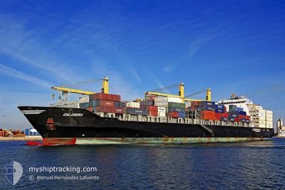
CALANDRA
Container Ship
Current Trip
| Trip Time | 3 days |
|---|---|
| Trip Distance | 1134.64 nm |
| AVG Speed | 13.2 Knots |
| MAX Speed | 16.8 Knots |
| Draught | 9 m |
| AVG Wind | 12.7 knots |
| MAX Wind | 21 knots |
| MIN Temp | 23.4°C / 74.12°F |
| MAX Temp | 29.5°C / 85.1°F |
| Position Received | 2 d ago |
Current Position
| Longitude | -81.18111° |
|---|---|
| Latitude | 19.51915° |
| Status | Under way using engine |
| Speed | 15.6 Knots |
| Course | 116.3° |
| Area | Caribbean Sea |
| Station | T-AIS |
| Position Received | 2 d ago |
Info
Information
The current position of CALANDRA is in Caribbean Sea with coordinates 19.51915° / -81.18111° as reported on 2024-05-19 08:14 by AIS to our vessel tracker app. The vessel's current speed is 15.6 Knots and is currently inside the port of KINGSTON (JM).
The vessel CALANDRA (IMO: 9445887, MMSI: 305538000) is a Container Ship that was built in 2010 ( 14 years old ). It's sailing under the flag of [AG] Antigua Barbuda.
In this page you can find informations about the vessels current position, last detected port calls, and current voyage information. If the vessels is not in coverage by AIS you will find the latest position.
The current position of CALANDRA is detected by our AIS receivers and we are not responsible for the reliability of the data. The last position was recorded while the vessel was in Coverage by the Ais receivers of our vessel tracking app.
The current draught of CALANDRA as reported by AIS is 9 meters
Weather
| Temperature | 22.5°C / 72.5°F |
|---|---|
| Wind Speed | 2 knots |
| Direction | 76° ENE |
| Pressure | 1011.3 hPa |
| Humidity | 86.3 % |
| Cloud Coverage | 50 % |
Featured Company
Last Port Calls
| Port | Arrival | Departure | Time In Port |
|---|---|---|---|
| 2024-05-20 06:54 | |||
| 2024-05-16 09:38 | 2024-05-16 22:50 | 13 h | |
| 2024-05-13 14:21 | 2024-05-14 06:55 | 16 h | |
| 2024-05-11 17:34 | 2024-05-12 02:29 | 8 h | |
| 2024-05-09 20:46 | 2024-05-11 01:22 | 1 d | |
| 2024-05-05 21:11 | 2024-05-06 13:10 | 15 h | |
| 2024-04-24 11:45 | 2024-04-24 11:51 | 5 m | |
| 2024-04-22 05:41 | 2024-04-23 07:56 | 1 d | |
| 2024-04-19 04:51 | 2024-04-19 18:59 | 14 h | |
| 2024-04-17 10:41 | 2024-04-18 01:46 | 15 h |
Most Visited Ports (Last year)
| Port | Arrivals | |
|---|---|---|
| 8 | ||
| 5 | ||
| 4 | ||
| 4 | ||
| 4 | ||
| 3 |
Last Trips
| Origin | Departure | Destination | Arrival | Distance | |
|---|---|---|---|---|---|
| 2024-05-16 17:50 | 2024-05-20 01:54 | 1134.64 nm | |||
| 2024-05-14 01:55 | 2024-05-16 04:38 | 516.67 nm | |||
| 2024-05-11 21:29 | 2024-05-13 09:21 | 498.39 nm | |||
| 2024-05-10 20:22 | 2024-05-11 12:34 | 240.01 nm | |||
| 2024-05-06 08:10 | 2024-05-09 15:46 | 1215.39 nm | |||
| 2024-04-24 08:51 | 2024-05-05 16:11 | 4262.31 nm | |||
| 2024-04-23 04:56 | 2024-04-24 08:45 | 234.22 nm | |||
| 2024-04-19 15:59 | 2024-04-22 02:41 | 187.28 nm | |||
| 2024-04-17 22:46 | 2024-04-19 01:51 | 76.42 nm | |||
| 2024-04-02 01:08 | 2024-04-17 07:41 | 4496.68 nm |
Events
| Time | Event | Details | Position / Dest | Info |
|---|---|---|---|---|
| 2024-05-20 07:46 | STOP Moving |
17.98664 / -76.83675
[JM] KINGSTON (JM)
|
Speed: 0.1 kn Course: 195° |
|
| 2024-05-20 06:54 | PORT ARRIVAL |
|
17.96746 / -76.83369
[JM] KINGSTON (JM)
|
Speed: 5.7 kn Course: 64° |
| 2024-05-19 08:26 | Status Changed | Default Under way using engine |
19.49515 / -81.13026
JMKIN
|
Speed: 15.6 kn Course: 116.3° |
| 2024-05-19 08:14 | OUT of Coverage |
19.51915 / -81.18111
Caribbean Sea
JMKIN
|
Speed: 15.6 kn Course: 116.3° |
|
| 2024-05-19 07:52 | Change Sea Area | Cayman Islands part of the Caribbean Sea United States part of the Gulf of Mexico |
19.56162 / -81.27158
Caribbean Sea
JMKIN
|
Speed: 15.6 kn Course: 116.3° |
| 2024-05-19 07:52 | Status Changed | Under way using engine Default |
19.56162 / -81.27158
JMKIN
|
Speed: 15.4 kn Course: 117° |
| 2024-05-19 07:42 | IN Coverage |
19.56162 / -81.27158
Caribbean Sea
JMKIN
|
Speed: 15.6 kn Course: 116.3° |
|
| 2024-05-17 05:14 | Status Changed | Default Under way using engine |
29.38276 / -87.48437
JMKIN
|
Speed: 15.2 kn Course: 175.7° |
| 2024-05-17 05:00 | OUT of Coverage |
29.43942 / -87.48928
Gulf of Mexico
JMKIN
|
Speed: 15.2 kn Course: 175.7° |
|
| 2024-05-17 03:37 | Status Changed | Under way using engine Default |
29.72368 / -87.70606
JMKIN
|
Speed: 14.5 kn Course: 150° |