
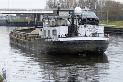
CALA JONDAL
Cargo
Current Trip
VOORUIT ,__
| Time Travelled | 3 days |
|---|---|
| Remaining Time | --- |
| Distance Travelled | 92.64 nm |
| Remaining Distance | --- |
| AVG Speed | 6 Knots |
| MAX Speed | 8.4 Knots |
| AVG Wind | 6.8 knots |
| MAX Wind | 10.2 knots |
| MIN Temp | 6.2°C / 43.16°F |
| MAX Temp | 12.2°C / 53.96°F |
| Draught | 0 m |
| Position Received | 1 d ago |
Current Position
| Longitude | --- |
|---|---|
| Latitude | --- |
| Status | Under way using engine |
| Speed | 6.8 Knots |
| Course | 27.4° |
| Area | North Sea |
| Station | T-AIS |
| Position Received | 1 d ago |
Info
Information
The current position of CALA JONDAL is in North Sea with coordinates 51.07653° / 5.82313° as reported on 2025-12-12 09:27 by AIS to our vessel tracker app. The vessel's current speed is 6.8 Knots
The vessel CALA JONDAL (MMSI: 244750439) is a Cargo It's sailing under the flag of [NL] Netherlands.
In this page you can find informations about the vessels current position, last detected port calls, and current voyage information. If the vessels is not in coverage by AIS you will find the latest position.
The current position of CALA JONDAL is detected by our AIS receivers and we are not responsible for the reliability of the data. The last position was recorded while the vessel was in Coverage by the Ais receivers of our vessel tracking app.
Weather
| Temperature | 7.6°C / 45.68°F |
|---|---|
| Wind Speed | 4 knots |
| Direction | 158° SSE |
| Pressure | 1020.7 hPa |
| Humidity | 88.6 % |
| Cloud Coverage | 100 % |
Featured Company
Last Port Calls
| Port | Arrival | Departure | Time In Port |
|---|---|---|---|
| 2025-12-09 20:49 | 2025-12-10 09:01 | 12 h | |
| 2025-12-09 10:56 | 2025-12-09 13:29 | 2 h | |
| 2025-12-01 12:07 | 2025-12-01 12:17 | 10 m | |
| 2025-12-01 08:40 | 2025-12-01 09:14 | 34 m | |
| 2025-11-21 09:48 | 2025-11-21 14:04 | 4 h | |
| 2025-11-20 06:48 | 2025-11-20 07:17 | 29 m | |
| 2025-11-19 15:11 | 2025-11-19 15:40 | 28 m | |
| 2025-11-19 07:26 | 2025-11-19 08:10 | 43 m | |
| 2025-11-18 18:46 | 2025-11-18 19:27 | 40 m | |
| 2025-11-17 09:30 | 2025-11-17 10:02 | 32 m |
Last Trips
| Origin | Departure | Destination | Arrival | Distance | |
|---|---|---|---|---|---|
| 2025-12-09 13:29 | 2025-12-09 20:49 | 37.50 nm | |||
| 2025-12-01 12:17 | 2025-12-09 10:56 | 205.97 nm | |||
| 2025-12-01 09:14 | 2025-12-01 12:07 | 1.74 nm | |||
| 2025-12-01 09:14 | 2025-12-01 08:40 | 1.74 nm | |||
| 2025-11-20 07:17 | 2025-11-21 09:48 | 39.90 nm | |||
| 2025-11-19 15:40 | 2025-11-20 06:48 | 7.00 nm | |||
| 2025-11-19 08:10 | 2025-11-19 15:11 | 14.41 nm | |||
| 2025-11-18 19:27 | 2025-11-19 07:26 | 6.92 nm | |||
| 2025-11-17 10:02 | 2025-11-18 18:46 | 55.09 nm | |||
| 2025-11-10 09:54 | 2025-11-17 09:30 | 176.45 nm |
Events
| Time | Event | Details | Position / Dest | Info |
|---|---|---|---|---|
| 2025-12-12 09:27 | OUT of Coverage |
51.07653 / 5.82313
North Sea
|
Speed: 6.8 kn Course: 27.4° |
|
| 2025-12-12 09:07 | START Moving | 0.87 nm, South West of BARGE TERMINAL BORN |
51.04854 / 5.80086
VOORUIT ,__
|
Speed: 5.6 kn Course: 172.2° |
| 2025-12-12 08:02 | STOP Moving | 0.75 nm, South West of BARGE TERMINAL BORN |
51.05069 / 5.80182
VOORUIT ,__
|
Speed: 0.2 kn Course: 511° |
| 2025-12-12 07:58 | START Moving | 0.82 nm, South West of BARGE TERMINAL BORN |
51.04937 / 5.80127
VOORUIT ,__
|
Speed: 5.1 kn Course: 46.8° |
| 2025-12-12 06:59 | STOP Moving | 0.93 nm, South West of BARGE TERMINAL BORN |
51.04753 / 5.80025
VOORUIT ,__
|
Speed: 0.3 kn Course: 511° |
| 2025-12-12 06:36 | IN Coverage |
51.08675 / 5.83153
North Sea
|
Speed: 8.2 kn Course: 207.3° |
|
| 2025-12-11 14:41 | OUT of Coverage |
51.43968 / 5.69320
North Sea
|
Speed: 7.6 kn Course: 164.5° |
|
| 2025-12-11 14:38 | Status Changed | Under way using engine Default |
51.44532 / 5.69208
VOORUIT ,__
|
Speed: 8.1 kn Course: 188° |
| 2025-12-11 14:37 | IN Coverage |
51.44063 / 5.69276
North Sea
|
Speed: 7.3 kn Course: 165.3° |
|
| 2025-12-11 10:01 | OUT of Coverage |
51.49228 / 5.68054
North Sea
|
Speed: 6.2 kn Course: 339.1° |