
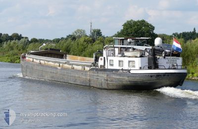
CALA JONDAL
Cargo
Current Trip
VOORUIT ,__
| Time Travelled | 14 days |
|---|---|
| Remaining Time | --- |
| Distance Travelled | 111.15 nm |
| Remaining Distance | --- |
| AVG Speed | 6.1 Noeuds |
| MAX Speed | 9.6 Noeuds |
| AVG Wind | 10.3 knots |
| MAX Wind | 13.4 knots |
| MIN Temp | 4.9°C / 40.82°F |
| MAX Temp | 18.8°C / 65.84°F |
| Tirant d eau | 0 m |
| Position reçue | 11 h, 29 m depuis |
Current Position
| Longitude | 5.69223° |
|---|---|
| Latitude | 51.44482° |
| Etat | Under way using engine |
| Vitesse | 6.5 Noeuds |
| Parcours | 1.6° |
| Zone | North Sea |
| Station | T-AIS |
| Position reçue | 11 h, 29 m depuis |
Info
Information
The current position of CALA JONDAL is in North Sea with coordinates 51.44482° / 5.69223° as reported on 2024-05-07 14:06 by AIS to our vessel tracker app. The vessel's current speed is 6.5 Noeuds
The vessel CALA JONDAL (MMSI: 244750439) is a Cargo It's sailing under the flag of [NL] Netherlands.
In this page you can find informations about the vessels current position, last detected port calls, and current voyage information. If the vessels is not in coverage by AIS you will find the latest position.
The current position of CALA JONDAL is detected by our AIS receivers and we are not responsible for the reliability of the data. The last position was recorded while the vessel was in Coverage by the Ais receivers of our vessel tracking app.
Weather
| Temperature | 18.8°C / 65.84°F |
|---|---|
| Wind Speed | 9 knots |
| Direction | 27° NNE |
| Pressure | 1019.1 hPa |
| Humidity | 54.6 % |
| Cloud Coverage | 41 % |
Featured Company
Last Port Calls
| Port | Arrival | Departure | Time In Port |
|---|---|---|---|
| 2024-04-23 08:38 | 2024-04-23 12:04 | 3 h | |
| 2024-04-17 18:35 | 2024-04-18 05:44 | 11 h | |
| 2024-04-12 09:18 | |||
| 2024-04-11 19:10 | |||
| 2024-04-11 19:10 | |||
| 2024-04-11 18:02 | |||
| 2024-04-08 07:46 | 2024-04-08 11:51 | 4 h | |
| 2024-04-03 15:22 | |||
| 2024-04-02 00:09 | |||
| 2024-03-26 07:57 | 2024-03-26 11:37 | 3 h |
Most Visited Ports (Last year)
| Port | Arrivals | |
|---|---|---|
| 23 | ||
| 21 | ||
| 11 | ||
| 8 | ||
| 6 | ||
| 4 |
Last Trips
| Origin | Departure | Destination | Arrival | Distance | |
|---|---|---|---|---|---|
| 2024-04-18 07:44 | 2024-04-23 10:38 | 91.92 nm | |||
| 2024-04-12 11:18 | 2024-04-17 20:35 | 104.71 nm | |||
| 2024-04-11 21:10 | 2024-04-11 21:10 | --- | |||
| 2024-04-08 13:51 | 2024-04-11 20:02 | 111.12 nm | |||
| 2024-04-03 17:22 | 2024-04-08 09:46 | 94.70 nm | |||
| 2024-03-26 12:37 | 2024-04-02 02:09 | 168.74 nm | |||
| 2024-03-22 08:06 | 2024-03-26 08:57 | 105.78 nm | |||
| 2024-03-18 17:00 | 2024-03-21 18:16 | 117.89 nm | |||
| 2024-03-12 20:05 | 2024-03-18 12:17 | 88.96 nm | |||
| 2024-03-12 13:04 | 2024-03-12 19:14 | 41.06 nm |
Events
| Heure | Evenement | Détails | Position/ Destination | Info |
|---|---|---|---|---|
| 2024-05-07 14:06 | Hors de la zone couverte |
51.44482 / 5.69223
North Sea
|
Vitesse: 6.5 kn Parcours: 1.6° |
|
| 2024-05-07 14:03 | Dans la zone couverte |
51.44257 / 5.69229
North Sea
|
Vitesse: 6.8 kn Parcours: 355.4° |
|
| 2024-05-07 12:17 | Hors de la zone couverte |
51.35634 / 5.74235
North Sea
|
Vitesse: 4 kn Parcours: 352° |
|
| 2024-05-07 12:14 | Démarrage | 7.97 nm, South East of HELMOND |
51.35358 / 5.74278
VOORUIT ,__
|
Vitesse: 3.8 kn Parcours: 355.3° |
| 2024-05-07 11:59 | Arret | 8.18 nm, South East of HELMOND |
51.34999 / 5.74340
VOORUIT ,__
|
Vitesse: 0.3 kn Parcours: 511° |
| 2024-05-07 11:43 | Démarrage | 9.07 nm, South of HELMOND |
51.33454 / 5.74603
VOORUIT ,__
|
Vitesse: 3.8 kn Parcours: 355.9° |
| 2024-05-07 11:25 | Arret | 9.33 nm, South of HELMOND |
51.33012 / 5.74678
VOORUIT ,__
|
Vitesse: Parcours: 511° |
| 2024-05-07 09:45 | Dans la zone couverte |
51.21184 / 5.81940
North Sea
|
Vitesse: 4.5 kn Parcours: 330.4° |
|
| 2024-05-06 11:14 | Hors de la zone couverte |
51.24728 / 6.00861
North Sea
|
Vitesse: 9.4 kn Parcours: 11.3° |
|
| 2024-05-06 11:10 | Dans la zone couverte |
51.23830 / 6.00574
North Sea
|
Vitesse: 9.6 kn Parcours: 18° |