

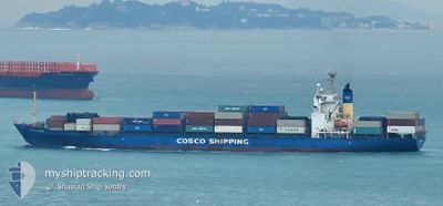
CAIYUNHE
Container Ship

Current Trip
CN XMN
| Time Travelled | 2 days |
|---|---|
| Remaining Time | --- |
| Distance Travelled | 812.78 nm |
| Remaining Distance | --- |
| AVG Speed | 15.4 Knots |
| MAX Speed | 17.8 Knots |
| AVG Wind | 12.1 knots |
| MAX Wind | 18.7 knots |
| MIN Temp | 17.8°C / 64.04°F |
| MAX Temp | 23.5°C / 74.3°F |
| Draught | 7.9 m |
| Position Received | 5 m ago |
Current Position
| Longitude | --- |
|---|---|
| Latitude | --- |
| Status | Under way using engine |
| Speed | 16.6 Knots |
| Course | 37.2° |
| Area | Eastern China Sea |
| Station | T-AIS |
| Position Received | 5 m ago |
Information
The current position of CAIYUNHE is in Eastern China Sea with coordinates 30.91864° / 130.95727° as reported on 2025-03-26 15:06 by AIS to our vessel tracker app. The vessel's current speed is 16.6 Knots
The vessel CAIYUNHE (IMO: 9228758, MMSI: 355474000) is a Container Ship that was built in 2000 ( 25 years old ). It's sailing under the flag of [PA] Panama.
In this page you can find informations about the vessels current position, last detected port calls, and current voyage information. If the vessels is not in coverage by AIS you will find the latest position.
The current position of CAIYUNHE is detected by our AIS receivers and we are not responsible for the reliability of the data. The last position was recorded while the vessel was in Coverage by the Ais receivers of our vessel tracking app.
The current draught of CAIYUNHE as reported by AIS is 7.9 meters
Weather
| Temperature | 19.6°C / 67.28°F |
|---|---|
| Wind Speed | 10 knots |
| Direction | 202° SSW |
| Pressure | 1010.6 hPa |
| Humidity | 93.3 % |
| Cloud Coverage | 78 % |


Featured Company
Last Port Calls
| Port | Arrival | Departure | Time In Port |
|---|---|---|---|
| 2025-03-23 18:40 | 2025-03-24 10:25 | 15 h | |
| 2025-03-22 06:08 | 2025-03-22 16:02 | 9 h | |
| 2025-03-19 01:21 | 2025-03-19 05:49 | 4 h | |
| 2025-03-17 04:42 | 2025-03-17 15:04 | 10 h | |
| 2025-03-16 12:30 | 2025-03-16 22:19 | 9 h | |
| 2025-03-15 15:43 | 2025-03-15 23:46 | 8 h | |
| 2025-03-11 22:49 | 2025-03-12 02:57 | 4 h | |
| 2025-03-09 22:13 | 2025-03-10 08:41 | 10 h | |
| 2025-03-08 13:48 | 2025-03-09 01:07 | 11 h | |
| 2025-03-08 03:35 | 2025-03-08 12:19 | 8 h |
Last Trips
| Origin | Departure | Destination | Arrival | Distance | |
|---|---|---|---|---|---|
| 2025-03-23 00:02 | 2025-03-24 02:40 | 324.66 nm | |||
| 2025-03-19 13:49 | 2025-03-22 14:08 | 650.26 nm | |||
| 2025-03-17 23:04 | 2025-03-19 09:21 | 410.24 nm | |||
| 2025-03-17 06:19 | 2025-03-17 12:42 | 71.55 nm | |||
| 2025-03-16 07:46 | 2025-03-16 20:30 | 142.20 nm | |||
| 2025-03-12 11:57 | 2025-03-15 23:43 | 1205.91 nm | |||
| 2025-03-10 17:41 | 2025-03-12 07:49 | 433.67 nm | |||
| 2025-03-09 10:07 | 2025-03-10 07:13 | 202.40 nm | |||
| 2025-03-08 21:19 | 2025-03-08 22:48 | 13.07 nm | |||
| 2025-03-03 16:09 | 2025-03-08 12:35 | 1368.05 nm |
Events
| Time | Event | Details | Position / Dest | Info |
|---|---|---|---|---|
| 2025-03-26 14:58 | Status Changed | Under way using engine Default |
30.89157 / 130.93316
CN XMN
|
Speed: 16.8 kn Course: 48° |
| 2025-03-26 14:50 | Status Changed | Default Under way using engine |
30.86384 / 130.90041
CN XMN
|
Speed: 17.1 kn Course: 71.3° |
| 2025-03-26 12:13 | Status Changed | Under way using engine Default |
30.57714 / 130.14979
CN XMN
|
Speed: 16.1 kn Course: 62° |
| 2025-03-26 12:10 | Status Changed | Default Under way using engine |
30.57036 / 130.13519
CN XMN
|
Speed: 16.3 kn Course: 62.3° |
| 2025-03-26 12:07 | Status Changed | Under way using engine Default |
30.56482 / 130.12328
CN XMN
|
Speed: 16.7 kn Course: 62° |
| 2025-03-26 11:58 | Status Changed | Default Under way using engine |
30.54390 / 130.07719
CN XMN
|
Speed: 17.6 kn Course: 62.1° |
| 2025-03-26 11:47 | Change Sea Area | Japanese part of the Eastern China Sea Chinese part of the South China Sea |
30.52046 / 130.02541
Eastern China Sea
|
Speed: 17.7 kn Course: 62° |
| 2025-03-26 11:47 | Status Changed | Under way using engine Default |
30.52046 / 130.02541
CN XMN
|
Speed: 17.8 kn Course: 62° |
| 2025-03-26 11:38 | IN Coverage |
30.52046 / 130.02541
Eastern China Sea
|
Speed: 17.7 kn Course: 62° |
|
| 2025-03-24 10:25 | PORT DEPARTURE |
|
24.50393 / 118.07133
CN XMN
|
Speed: 6.5 kn Course: 212° |