

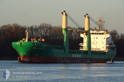
BREB COURTESY
General Cargo

Current Trip
| Time Travelled | 8 days |
|---|---|
| Remaining Time | 13 h, 5 mins |
| Distance Travelled | 1030.00 nm |
| Remaining Distance | 213.81 nm |
| AVG Speed | 8.3 Knots |
| MAX Speed | 11 Knots |
| AVG Wind | 10 knots |
| MAX Wind | 27 knots |
| MIN Temp | 8.3°C / 46.94°F |
| MAX Temp | 18.6°C / 65.48°F |
| Draught | 7.3 m |
| Position Received | 1 d ago |
Current Position
| Longitude | --- |
|---|---|
| Latitude | --- |
| Status | Under way using engine |
| Speed | 7.9 Knots |
| Course | 298.1° |
| Area | Mediterranean Sea - Eastern Basin |
| Station | T-AIS |
| Position Received | 1 d ago |
Information
The current position of BREB COURTESY is in Mediterranean Sea - Eastern Basin with coordinates 36.22204° / 14.18367° as reported on 2025-03-26 20:31 by AIS to our vessel tracker app. The vessel's current speed is 7.9 Knots and is heading at the port of BEJAIA. The estimated time of arrival as calculated by MyShipTracking vessel tracking app is 2025-03-29 10:08 LT
The vessel BREB COURTESY (IMO: 9421130, MMSI: 255806044) is a General Cargo that was built in 2009 ( 16 years old ). It's sailing under the flag of [PT] Portugal.
In this page you can find informations about the vessels current position, last detected port calls, and current voyage information. If the vessels is not in coverage by AIS you will find the latest position.
The current position of BREB COURTESY is detected by our AIS receivers and we are not responsible for the reliability of the data. The last position was recorded while the vessel was in Coverage by the Ais receivers of our vessel tracking app.
The current draught of BREB COURTESY as reported by AIS is 7.3 meters
Weather
| Temperature | 15.5°C / 59.9°F |
|---|---|
| Wind Speed | 9 knots |
| Direction | 318° NW |
| Pressure | 1013.3 hPa |
| Humidity | 68.8 % |
| Cloud Coverage | 7 % |


Featured Company
Last Port Calls
| Port | Arrival | Departure | Time In Port |
|---|---|---|---|
| 2025-03-16 14:34 | 2025-03-20 15:55 | 4 d | |
| 2025-03-11 14:12 | |||
| 2025-02-28 23:42 | 2025-03-06 12:43 | 5 d | |
| 2025-02-15 22:47 | 2025-02-18 15:57 | 2 d | |
| 2025-02-13 10:48 | 2025-02-15 15:42 | 2 d | |
| 2025-02-02 16:35 | 2025-02-05 19:50 | 3 d | |
| 2025-01-23 21:58 | 2025-01-27 16:58 | 3 d | |
| 2025-01-21 14:30 | 2025-01-23 08:58 | 1 d | |
| 2025-01-10 11:23 | 2025-01-11 23:35 | 1 d | |
| 2025-01-07 21:31 | 2025-01-09 04:38 | 1 d |
Last Trips
| Origin | Departure | Destination | Arrival | Distance | |
|---|---|---|---|---|---|
| 2025-03-11 14:12 | 2025-03-16 14:34 | 987.56 nm | |||
| 2025-02-18 15:57 | 2025-02-28 23:42 | 1224.17 nm | |||
| 2025-02-15 15:42 | 2025-02-15 22:47 | 65.65 nm | |||
| 2025-02-05 19:50 | 2025-02-13 10:48 | 1140.53 nm | |||
| 2025-01-27 16:58 | 2025-02-02 16:35 | 942.86 nm | |||
| 2025-01-23 08:58 | 2025-01-23 21:58 | 72.54 nm | |||
| 2025-01-11 23:35 | 2025-01-21 14:30 | 2088.80 nm | |||
| 2025-01-09 04:38 | 2025-01-10 11:23 | 338.79 nm | |||
| 2025-01-05 17:12 | 2025-01-07 21:31 | 519.29 nm | |||
| 2024-12-26 15:50 | 2025-01-04 14:08 | 1600.87 nm |
Events
| Time | Event | Details | Position / Dest | Info |
|---|---|---|---|---|
| 2025-03-26 20:56 | Status Changed | Default Under way using engine |
36.24804 / 14.12282
BEJAIA
|
Speed: 7.9 kn Course: 298.1° |
| 2025-03-26 20:31 | OUT of Coverage |
36.22204 / 14.18367
Mediterranean Sea - Eastern Basin
BEJAIA
|
Speed: 7.9 kn Course: 298.1° |
|
| 2025-03-26 18:34 | Status Changed | Under way using engine Default |
36.09126 / 14.48417
BEJAIA
|
Speed: 9.1 kn Course: 307° |
| 2025-03-26 18:10 | Status Changed | Default Under way using engine |
36.05376 / 14.54376
BEJAIA
|
Speed: 8.9 kn Course: 308.2° |
| 2025-03-26 17:17 | ETA Changed | 2025/03/28 23:00 2025/03/28 08:00 |
35.96791 / 14.67032
BEJAIA
|
Speed: 9.5 kn Course: 317.7° |
| 2025-03-26 16:43 | Status Changed | Under way using engine Default |
35.90232 / 14.75097
BEJAIA
|
Speed: 9.7 kn Course: 316° |
| 2025-03-26 16:33 | START Moving | 11.38 nm, East of MARSAXLOKK |
35.88441 / 14.76797
BEJAIA
|
Speed: 6.8 kn Course: 339° |
| 2025-03-26 16:33 | IN Coverage |
35.90325 / 14.74984
Mediterranean Sea - Eastern Basin
BEJAIA
|
Speed: 9.7 kn Course: 315.9° |
|
| 2025-03-26 06:33 | Status Changed | Default At anchor |
35.87902 / 14.77203
BEJAIA
|
Speed: 0.2 kn Course: 233° |
| 2025-03-26 06:27 | OUT of Coverage |
35.87929 / 14.77173
Mediterranean Sea - Eastern Basin
BEJAIA
|
Speed: 0.2 kn Course: 167.4° |