
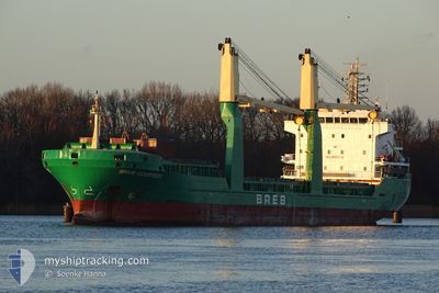
BREB COURTESY
General Cargo
Current Trip
| Time Travelled | 8 days |
|---|---|
| Remaining Time | 3 h, 48 mins |
| Distance Travelled | 1994.48 nm |
| Remaining Distance | 44.04 nm |
| AVG Speed | 9.6 Knop |
| MAX Speed | 13 Knop |
| AVG Wind | 14.9 knots |
| MAX Wind | 38 knots |
| MIN Temp | 9.7°C / 49.46°F |
| MAX Temp | 18.7°C / 65.66°F |
| Djupgående | 7.2 m |
| Position mottagen | 19 h, 54 m sen |
Current Position
| Longitud | --- |
|---|---|
| Latitude | --- |
| Status | Under way using engine |
| Fart | 9.1 Knop |
| Kurs | 315.8° |
| Område | Adriatic Sea |
| Station | T-AIS |
| Position mottagen | 19 h, 54 m sen |
Info
Information
The current position of BREB COURTESY is in Adriatic Sea with coordinates 42.56811° / 15.81564° as reported on 2025-12-05 08:35 by AIS to our vessel tracker app. The vessel's current speed is 9.1 Knop and is heading at the port of RAVENNA. The estimated time of arrival as calculated by MyShipTracking vessel tracking app is 2025-12-06 09:18 LT
The vessel BREB COURTESY (IMO: 9421130, MMSI: 255806044) is a General Cargo that was built in 2009 ( 16 År gammal ). It's sailing under the flag of [PT] Portugal.
In this page you can find informations about the vessels current position, last detected port calls, and current voyage information. If the vessels is not in coverage by AIS you will find the latest position.
The current position of BREB COURTESY is detected by our AIS receivers and we are not responsible for the reliability of the data. The last position was recorded while the vessel was in Coverage by the Ais receivers of our vessel tracking app.
The current draught of BREB COURTESY as reported by AIS is 7.2 meters
Weather
| Temperature | 12.5°C / 54.5°F |
|---|---|
| Wind Speed | 15 knots |
| Direction | 338° NNW |
| Pressure | 1012.5 hPa |
| Humidity | 73 % |
| Cloud Coverage | 72 % |
Featured Company
Last Port Calls
| Port | Arrival | Departure | Time In Port |
|---|---|---|---|
| 2025-11-24 15:21 | 2025-11-27 07:32 | 2 d | |
| 2025-11-19 19:54 | 2025-11-23 05:54 | 3 d | |
| 2025-11-04 20:32 | 2025-11-14 22:08 | 10 d | |
| 2025-10-28 21:29 | 2025-10-30 16:45 | 1 d | |
| 2025-10-20 23:28 | 2025-10-23 03:31 | 2 d | |
| 2025-10-16 07:19 | 2025-10-18 09:15 | 2 d | |
| 2025-10-09 08:49 | 2025-10-11 15:11 | 2 d | |
| 2025-10-02 19:35 | 2025-10-07 11:52 | 4 d |
Last Trips
| Origin | Departure | Destination | Arrival | Distance | |
|---|---|---|---|---|---|
| 2025-11-23 05:54 | 2025-11-24 15:21 | 195.72 nm | |||
| 2025-11-14 22:08 | 2025-11-19 19:54 | 970.62 nm | |||
| 2025-10-30 16:45 | 2025-11-04 20:32 | 14.32 nm | |||
| 2025-10-23 03:31 | 2025-10-28 21:29 | 1221.59 nm | |||
| 2025-10-18 09:15 | 2025-10-20 23:28 | 105.37 nm | |||
| 2025-10-11 15:11 | 2025-10-16 07:19 | 1017.09 nm | |||
| 2025-10-07 11:52 | 2025-10-09 08:49 | 416.98 nm | |||
| 2025-09-25 08:08 | 2025-10-02 19:35 | 1473.77 nm |
Events
| Tid | Event | Detaljer | Position / Dest | Information |
|---|---|---|---|---|
| 2025-12-05 08:46 | Status ändrad | Default Under way using engine |
42.58743 / 15.79041
IT RAN
|
Fart: 9.1 kn Kurs: 315.8° |
| 2025-12-05 08:35 | UTANFÖR täckningsområde |
42.56811 / 15.81564
Adriatic Sea
IT RAN
|
Fart: 9.1 kn Kurs: 315.8° |
|
| 2025-12-05 05:22 | ETA ändrat | 2025/12/06 01:00 2025/12/05 21:00 |
42.23754 / 16.28819
IT RAN
|
Fart: 8.7 kn Kurs: 309.6° |
| 2025-12-05 05:19 | Byter havsområde | Croatian part of the Adriatic Sea Italian part of the Adriatic Sea |
42.23435 / 16.29315
Adriatic Sea
IT RAN
|
Fart: 8.7 kn Kurs: 311.6° |
| 2025-12-05 05:18 | Status ändrad | Under way using engine Default |
42.23194 / 16.29683
IT RAN
|
Fart: 8.7 kn Kurs: 310° |
| 2025-12-05 05:17 | I täckningsområde |
42.23435 / 16.29315
Adriatic Sea
IT RAN
|
Fart: 8.7 kn Kurs: 311.6° |
|
| 2025-12-04 11:15 | Status ändrad | Default Under way using engine |
40.69167 / 18.44167
IT RAN
|
Fart: 1.7 kn Kurs: 83° |
| 2025-12-04 10:23 | UTANFÖR täckningsområde |
40.67197 / 18.46185
Adriatic Sea
IT RAN
|
Fart: 1.7 kn Kurs: 303.2° |
|
| 2025-12-04 09:37 | Status ändrad | Under way using engine Default |
40.58676 / 18.52663
IT RAN
|
Fart: 9.6 kn Kurs: 333° |
| 2025-12-04 09:25 | Status ändrad | Default Under way using engine |
40.55767 / 18.54987
IT RAN
|
Fart: 9.5 kn Kurs: 331.9° |