
BOW COMPASS
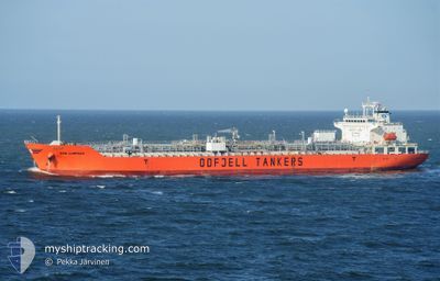
Oil/Chemical Tanker
Current Trip
CNZHU
| Time Travelled | 8 days |
|---|---|
| Remaining Time | --- |
| Distance Travelled | 2506.68 nm |
| Remaining Distance | --- |
| AVG Speed | 12.8 Knots |
| MAX Speed | 15 Knots |
| AVG Wind | 9.6 knots |
| MAX Wind | 29 knots |
| MIN Temp | 20°C / 68°F |
| MAX Temp | 28.6°C / 83.48°F |
| Draught | 11.5 m |
| Position Received | 6 d ago |
Current Position
| Longitude | --- |
|---|---|
| Latitude | --- |
| Status | Under way using engine |
| Speed | 13.6 Knots |
| Course | 120.2° |
| Area | Gulf of Oman |
| Station | T-AIS |
| Position Received | 6 d ago |
Info
Information
The current position of BOW COMPASS is in Gulf of Oman with coordinates 24.95637° / 56.95508° as reported on 2024-12-27 04:11 by AIS to our vessel tracker app. The vessel's current speed is 13.6 Knots
The vessel BOW COMPASS (IMO: 9412737, MMSI: 257199000) is a Oil/Chemical Tanker that was built in 2009 ( 16 years old ). It's sailing under the flag of [NO] Norway.
In this page you can find informations about the vessels current position, last detected port calls, and current voyage information. If the vessels is not in coverage by AIS you will find the latest position.
The current position of BOW COMPASS is detected by our AIS receivers and we are not responsible for the reliability of the data. The last position was recorded while the vessel was in Coverage by the Ais receivers of our vessel tracking app.
The current draught of BOW COMPASS as reported by AIS is 11.5 meters
Weather
| Temperature | 24.7°C / 76.46°F |
|---|---|
| Wind Speed | 12 knots |
| Direction | 306° NW |
| Pressure | 1012.3 hPa |
| Humidity | 90.9 % |
| Cloud Coverage | 100 % |
Featured Company
Last Port Calls
| Port | Arrival | Departure | Time In Port |
|---|---|---|---|
| 2024-12-21 08:24 | 2024-12-25 12:04 | 4 d | |
| 2024-12-18 11:21 | 2024-12-20 05:24 | 1 d | |
| 2024-12-14 21:17 | 2024-12-15 13:24 | 16 h | |
| 2024-12-13 03:44 | 2024-12-13 17:43 | 13 h | |
| 2024-11-21 09:22 | 2024-11-22 09:08 | 23 h | |
| 2024-11-08 14:52 | 2024-11-09 07:44 | 16 h |
Most Visited Ports (Last year)
| Port | Arrivals | |
|---|---|---|
| 5 | ||
| 3 | ||
| 3 | ||
| 3 | ||
| 2 | ||
| 2 |
Last Trips
| Origin | Departure | Destination | Arrival | Distance | |
|---|---|---|---|---|---|
| 2024-12-20 08:24 | 2024-12-21 11:24 | 32.87 nm | |||
| 2024-12-15 17:24 | 2024-12-18 14:21 | 350.06 nm | |||
| 2024-12-13 20:43 | 2024-12-15 01:17 | 224.29 nm | |||
| 2024-11-22 14:38 | 2024-12-13 06:44 | 1769.31 nm | |||
| 2024-11-09 13:14 | 2024-11-21 14:52 | 2083.11 nm | |||
| 2024-10-29 06:44 | 2024-11-08 20:22 | 3295.40 nm |
Events
| Time | Event | Details | Position / Dest | Info |
|---|---|---|---|---|
| 2024-12-27 04:22 | Status Changed | Default Under way using engine |
24.93611 / 56.99175
CNZHU
|
Speed: 13.6 kn Course: 120.2° |
| 2024-12-27 04:11 | OUT of Coverage |
24.95637 / 56.95508
Gulf of Oman
CNZHU
|
Speed: 13.6 kn Course: 120.2° |
|
| 2024-12-27 03:50 | Status Changed | Under way using engine Default |
24.99698 / 56.88004
CNZHU
|
Speed: 13.4 kn Course: 117° |
| 2024-12-27 03:42 | Status Changed | Default Under way using engine |
25.01344 / 56.85099
CNZHU
|
Speed: 13.4 kn Course: 117.5° |
| 2024-12-27 03:24 | Change Sea Area | Omani part of the Gulf of Oman United Arab Emirates part of the Gulf of Oman |
25.04658 / 56.78606
Gulf of Oman
CNZHU
|
Speed: 13.2 kn Course: 121.4° |
| 2024-12-27 03:09 | Status Changed | Under way using engine Default |
25.08005 / 56.73778
CNZHU
|
Speed: 13.7 kn Course: 176° |
| 2024-12-27 02:34 | Status Changed | Default Under way using engine |
25.21254 / 56.72277
CNZHU
|
Speed: 13.5 kn Course: 173.1° |
| 2024-12-27 02:05 | Status Changed | Under way using engine Default |
25.31989 / 56.71524
CNZHU
|
Speed: 13.1 kn Course: 175° |
| 2024-12-27 01:56 | Status Changed | Default Under way using engine |
25.35239 / 56.71218
CNZHU
|
Speed: 13.1 kn Course: 173.9° |
| 2024-12-27 01:54 | Status Changed | Under way using engine Default |
25.36037 / 56.71148
CNZHU
|
Speed: 13.3 kn Course: 176° |