img
No Internet
SWIPE TO GO BACK
TRIP
POSITION
INFO
PORT CALLS
VISITED PORTS
LAST TRIPS
EVENTS
WEATHER
image
Upload Photo
Type
IMO 9412737
MMSI 257199000
Pavillon
Flag Norway
Call Sign LACQ8
taille 170 x 26 m
GT 19,440 Tonnes
DWT 33,609 Tonnes
Construit 2009 ( 16 Age )
Etat Active
Propriétaire

Current Trip

Flag JPHIB
ATD
2025-02-06 22:17 (UTC)
9 days ago
Flag MAJFL
ETA*
2025-03-21 03:00 (UTC)
Time Travelled 9 days
Remaining Time ---
Distance Travelled 2792.27 nm
Remaining Distance ---
AVG Speed 11.7 Noeuds
MAX Speed 15.6 Noeuds
AVG Wind 13.1 knots
MAX Wind 37 knots
MIN Temp 2.7°C / 36.86°F
MAX Temp 28.5°C / 83.3°F
Tirant d eau 11.8 m
Position reçue 4 m depuis

Current Position

Longitude ---
Latitude ---
Etat At anchor
Vitesse
Parcours 107°
Zone Singapore Strait
Station T-AIS
Position reçue 4 m depuis

Info

info

Information

The current position of BOW COMPASS is in Singapore Strait with coordinates 1.18120° / 103.75353° as reported on 2025-02-16 16:50 by AIS to our vessel tracker app. The vessel's current speed is 0 Noeuds

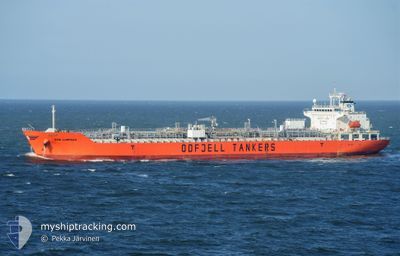
The vessel BOW COMPASS (IMO: 9412737, MMSI: 257199000) is a Oil/Chemical Tanker that was built in 2009 ( 16 Age ). It's sailing under the flag of [NO] Norway.

In this page you can find informations about the vessels current position, last detected port calls, and current voyage information. If the vessels is not in coverage by AIS you will find the latest position.

The current position of BOW COMPASS is detected by our AIS receivers and we are not responsible for the reliability of the data. The last position was recorded while the vessel was in Coverage by the Ais receivers of our vessel tracking app.

The current draught of BOW COMPASS as reported by AIS is 11.8 meters

Weather

Temperature 26.6°C / 79.88°F
Wind Speed 9 knots
Direction 29° NNE
Pressure 1011.9 hPa
Humidity 75.8 %
Cloud Coverage 99 %

Featured Company

Last Port Calls

Port Arrival Departure Time In Port
Flag HIBI 2025-02-04 23:37 2025-02-06 22:17 1 d
Flag SAGANOSEKI 2025-01-29 07:01 2025-01-29 23:48 16 h
Flag SHANGHAI 2025-01-25 01:58 2025-01-26 03:54 1 d
Flag SHANGHAI 2025-01-22 09:19 2025-01-25 01:49 2 d
Flag ZHUHAI 2025-01-13 04:48 2025-01-19 01:25 5 d
Flag AL JUBAIL 2024-12-21 08:24 2024-12-25 12:04 4 d
Flag AL JUBAIL 2024-12-18 11:21 2024-12-20 05:24 1 d
Flag KHALIFA 2024-12-14 21:17 2024-12-15 13:24 16 h
Flag MESAIEED 2024-12-13 03:44 2024-12-13 17:43 13 h
Show More

Most Visited Ports (Last year)

Port Arrivals
Flag BOTLEK - ROTTERDAM 5
Flag AL JUBAIL 3
Flag SHANGHAI 2
Flag PARANAGUA 2
Flag SAN NICOLAS 2
Flag CARTEYA GUADARRANQUE 2

Last Trips

Origin Departure Destination Arrival Distance
Flag SAGANOSEKI 2025-01-30 08:48 Flag HIBI 2025-02-05 08:37 668.15 nm
Flag SHANGHAI 2025-01-26 11:54 Flag SAGANOSEKI 2025-01-29 16:01 717.21 nm
Flag SHANGHAI 2025-01-25 09:49 Flag SHANGHAI 2025-01-25 09:58 0.91 nm
Flag ZHUHAI 2025-01-19 09:25 Flag SHANGHAI 2025-01-22 17:19 979.74 nm
Flag AL JUBAIL 2024-12-25 15:04 Flag ZHUHAI 2025-01-13 12:48 5297.24 nm
Flag AL JUBAIL 2024-12-20 08:24 Flag AL JUBAIL 2024-12-21 11:24 32.87 nm
Flag KHALIFA 2024-12-15 17:24 Flag AL JUBAIL 2024-12-18 14:21 350.06 nm
Flag MESAIEED 2024-12-13 20:43 Flag KHALIFA 2024-12-15 01:17 224.29 nm
Flag KANDLA 2024-11-22 14:38 Flag MESAIEED 2024-12-13 06:44 1769.31 nm

Events

Heure Evenement Détails Position/ Destination Info
2025-02-16 16:10 Tirant d'eau modifié 11.8
11.3
1.18120 / 103.75356
MAJFL
Vitesse:
Parcours: 108°
2025-02-16 16:10 Changement de destination MAJFL
SGSIN PGBG
1.18120 / 103.75356
MAJFL
Vitesse:
Parcours: 108°
2025-02-16 16:10 Changement d'ETA 2025/03/21 03:00
2025/02/16 04:00
1.18120 / 103.75356
MAJFL
Vitesse:
Parcours: 108°
2025-02-16 10:53 Etat Changé At anchor
Default
1.18126 / 103.75639
SGSIN PGBG
Vitesse:
Parcours: 243°
2025-02-16 10:47 Etat Changé Default
At anchor
1.18139 / 103.75646
SGSIN PGBG
Vitesse:
Parcours: 248°
2025-02-16 10:17 Etat Changé At anchor
Default
1.18104 / 103.75608
SGSIN PGBG
Vitesse: 0.2 kn
Parcours: 243°
2025-02-16 10:11 Etat Changé Default
At anchor
1.18115 / 103.75624
SGSIN PGBG
Vitesse: 0.2 kn
Parcours: 235°
2025-02-16 09:29 Etat Changé At anchor
Default
1.18086 / 103.75610
SGSIN PGBG
Vitesse: 0.1 kn
Parcours: 247°
2025-02-16 09:23 Etat Changé Default
At anchor
1.18114 / 103.75610
SGSIN PGBG
Vitesse: 0.1 kn
Parcours: 240°
2025-02-16 04:47 Arret 3.25 nm, South of BUKOM ISLAND
1.18209 / 103.75285
SGSIN PGBG
Vitesse: 0.2 kn
Parcours: 111°
Show More