

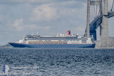
BOREALIS
Passengers Ship

Current Trip
| Time Travelled | 1 day |
|---|---|
| Remaining Time | 1 day |
| Distance Travelled | 506.63 nm |
| Remaining Distance | 832.71 nm |
| AVG Speed | 14.3 Knots |
| MAX Speed | 17.7 Knots |
| AVG Wind | 14.6 knots |
| MAX Wind | 19 knots |
| MIN Temp | 6.2°C / 43.16°F |
| MAX Temp | 13°C / 55.4°F |
| Draught | 8.4 m |
| Position Received | 16 h, 44 m ago |
Current Position
| Longitude | --- |
|---|---|
| Latitude | --- |
| Status | Under way using engine |
| Speed | 16.1 Knots |
| Course | 204.7° |
| Area | Celtic Sea |
| Station | T-AIS |
| Position Received | 16 h, 44 m ago |
Information
The current position of BOREALIS is in Celtic Sea with coordinates 48.44729° / -6.19962° as reported on 2025-02-16 13:09 by AIS to our vessel tracker app. The vessel's current speed is 16.1 Knots and is heading at the port of CASABLANCA. The estimated time of arrival as calculated by MyShipTracking vessel tracking app is 2025-02-19 03:24 LT
The vessel BOREALIS (IMO: 9122552, MMSI: 311000987) is a Passengers Ship that was built in 1997 ( 28 years old ). It's sailing under the flag of [BS] Bahamas.
In this page you can find informations about the vessels current position, last detected port calls, and current voyage information. If the vessels is not in coverage by AIS you will find the latest position.
The current position of BOREALIS is detected by our AIS receivers and we are not responsible for the reliability of the data. The last position was recorded while the vessel was in Coverage by the Ais receivers of our vessel tracking app.
The current draught of BOREALIS as reported by AIS is 8.4 meters
Weather
| Temperature | 13°C / 55.4°F |
|---|---|
| Wind Speed | 18 knots |
| Direction | 198° SSW |
| Pressure | 1014.1 hPa |
| Humidity | 88.4 % |
| Cloud Coverage | 100 % |


Featured Company
Last Port Calls
| Port | Arrival | Departure | Time In Port |
|---|---|---|---|
| 2025-02-15 05:03 | 2025-02-15 19:49 | 14 h | |
| 2025-02-12 07:18 | 2025-02-12 16:04 | 8 h | |
| 2025-02-10 05:49 | 2025-02-10 14:13 | 8 h | |
| 2025-02-09 14:24 | 2025-02-09 15:09 | 44 m | |
| 2025-02-08 06:16 | 2025-02-09 06:44 | 1 d | |
| 2025-02-06 14:13 | 2025-02-07 18:52 | 1 d | |
| 2025-02-04 06:22 | 2025-02-04 17:51 | 11 h | |
| 2025-02-01 06:00 | 2025-02-01 21:38 | 15 h | |
| 2025-01-21 11:44 | 2025-01-22 17:23 | 1 d | |
| 2025-01-20 11:22 | 2025-01-21 00:57 | 13 h |
Most Visited Ports (Last year)
| Port | Arrivals | |
|---|---|---|
| 15 | ||
| 6 | ||
| 6 | ||
| 6 | ||
| 5 | ||
| 4 |
Last Trips
| Origin | Departure | Destination | Arrival | Distance | |
|---|---|---|---|---|---|
| 2025-02-12 17:04 | 2025-02-15 05:03 | 702.98 nm | |||
| 2025-02-10 15:13 | 2025-02-12 08:18 | 623.03 nm | |||
| 2025-02-09 16:09 | 2025-02-10 06:49 | 218.66 nm | |||
| 2025-02-09 07:44 | 2025-02-09 15:24 | 120.01 nm | |||
| 2025-02-07 19:52 | 2025-02-08 07:16 | 153.47 nm | |||
| 2025-02-04 18:51 | 2025-02-06 15:13 | 713.01 nm | |||
| 2025-02-01 21:38 | 2025-02-04 07:22 | 878.70 nm | |||
| 2025-01-22 13:23 | 2025-02-01 06:00 | 3614.63 nm | |||
| 2025-01-20 20:57 | 2025-01-21 07:44 | 138.17 nm | |||
| 2025-01-19 18:03 | 2025-01-20 07:22 | 196.29 nm |
Events
| Time | Event | Details | Position / Dest | Info |
|---|---|---|---|---|
| 2025-02-16 13:15 | Status Changed | Default Under way using engine |
48.42204 / -6.21725
MACAS
|
Speed: 16.1 kn Course: 204.7° |
| 2025-02-16 13:09 | OUT of Coverage |
48.44729 / -6.19962
Celtic Sea
MACAS
|
Speed: 16.1 kn Course: 204.7° |
|
| 2025-02-16 12:55 | Status Changed | Under way using engine Default |
48.50074 / -6.15410
MACAS
|
Speed: 16.3 kn Course: 212° |
| 2025-02-16 12:47 | Status Changed | Default Under way using engine |
48.53099 / -6.12572
MACAS
|
Speed: 16.3 kn Course: 205.8° |
| 2025-02-16 12:30 | Status Changed | Under way using engine Default |
48.59919 / -6.07369
MACAS
|
Speed: 16.4 kn Course: 206° |
| 2025-02-16 12:19 | Status Changed | Default Under way using engine |
48.64393 / -6.04030
MACAS
|
Speed: 16.6 kn Course: 207.5° |
| 2025-02-16 12:00 | Status Changed | Under way using engine Default |
48.72244 / -5.98260
MACAS
|
Speed: 16.7 kn Course: 205° |
| 2025-02-16 11:55 | Status Changed | Default Under way using engine |
48.74262 / -5.96753
MACAS
|
Speed: 16.6 kn Course: 205.1° |
| 2025-02-16 11:39 | Status Changed | Under way using engine Default |
48.81134 / -5.91618
MACAS
|
Speed: 16.7 kn Course: 221° |
| 2025-02-16 11:35 | Status Changed | Default Under way using engine |
48.82404 / -5.89974
MACAS
|
Speed: 16.8 kn Course: 220.8° |