
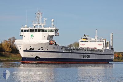
BORE WIND
Cargo
Current Trip
| Time Travelled | 1 day |
|---|---|
| Remaining Time | 7 h, 34 mins |
| Distance Travelled | 496.25 nm |
| Remaining Distance | 102.59 nm |
| AVG Speed | 13 Knots |
| MAX Speed | 14.2 Knots |
| AVG Wind | 23.6 knots |
| MAX Wind | 33 knots |
| MIN Temp | 2.2°C / 35.96°F |
| MAX Temp | 8.8°C / 47.84°F |
| Draught | 5.7 m |
| Position Received | Now |
Current Position
| Longitude | --- |
|---|---|
| Latitude | --- |
| Status | Under way using engine |
| Speed | 12.9 Knots |
| Course | 318.8° |
| Area | Gulf of Bothnia |
| Station | T-AIS |
| Position Received | Now |
Info
Information
The current position of BORE WIND is in Gulf of Bothnia with coordinates 60.19280° / 19.11389° as reported on 2026-03-26 20:22 by AIS to our vessel tracker app. The vessel's current speed is 12.9 Knots and is heading at the port of RAUMA. The estimated time of arrival as calculated by MyShipTracking vessel tracking app is 2026-03-27 05:56 LT
The vessel BORE WIND (IMO: 9892901, MMSI: 246000000) is a Cargo It's sailing under the flag of [NL] Netherlands.
In this page you can find informations about the vessels current position, last detected port calls, and current voyage information. If the vessels is not in coverage by AIS you will find the latest position.
The current position of BORE WIND is detected by our AIS receivers and we are not responsible for the reliability of the data. The last position was recorded while the vessel was in Coverage by the Ais receivers of our vessel tracking app.
The current draught of BORE WIND as reported by AIS is 5.7 meters
Weather
| Temperature | 2.4°C / 36.32°F |
|---|---|
| Wind Speed | 12 knots |
| Direction | 234° SW |
| Pressure | 1001.3 hPa |
| Humidity | 87 % |
| Cloud Coverage | 10 % |
Featured Company
Last Port Calls
| Port | Arrival | Departure | Time In Port |
|---|---|---|---|
| 2026-03-23 15:36 | 2026-03-25 07:33 | 1 d | |
| 2026-03-20 06:02 | 2026-03-21 14:02 | 1 d | |
| 2026-03-16 13:46 | 2026-03-18 07:07 | 1 d | |
| 2026-03-13 02:46 | 2026-03-14 11:40 | 1 d | |
| 2026-03-09 15:41 | 2026-03-11 07:46 | 1 d | |
| 2026-03-06 05:44 | 2026-03-07 13:10 | 1 d | |
| 2026-03-02 15:29 | 2026-03-04 06:23 | 1 d | |
| 2026-02-27 05:43 | 2026-02-28 15:08 | 1 d | |
| 2026-02-23 15:32 | 2026-02-25 13:27 | 1 d | |
| 2026-02-20 06:53 | 2026-02-21 12:30 | 1 d |
Most Visited Ports (Last year)
| Port | Arrivals | |
|---|---|---|
| 50 | ||
| 50 | ||
| 1 | ||
| 1 | ||
| 1 |
Last Trips
| Origin | Departure | Destination | Arrival | Distance | |
|---|---|---|---|---|---|
| 2026-03-21 14:02 | 2026-03-23 15:36 | 943.83 nm | |||
| 2026-03-18 07:07 | 2026-03-20 06:02 | 593.52 nm | |||
| 2026-03-14 11:40 | 2026-03-16 13:46 | 594.96 nm | |||
| 2026-03-11 07:46 | 2026-03-13 02:46 | 593.35 nm | |||
| 2026-03-07 13:10 | 2026-03-09 15:41 | 886.76 nm | |||
| 2026-03-04 06:23 | 2026-03-06 05:44 | 593.08 nm | |||
| 2026-02-28 15:08 | 2026-03-02 15:29 | 590.07 nm | |||
| 2026-02-25 13:27 | 2026-02-27 05:43 | 590.36 nm | |||
| 2026-02-21 12:30 | 2026-02-23 15:32 | 589.42 nm | |||
| 2026-02-18 12:13 | 2026-02-20 06:53 | 594.54 nm |
Events
| Time | Event | Details | Position / Dest | Info |
|---|---|---|---|---|
| 2026-03-26 17:56 | Change Sea Area | Finnish part of the Gulf of Bothnia Finnish part of the Baltic Sea |
59.78145 / 19.79597
Gulf of Bothnia
|
Speed: 13.6 kn Course: 318° |
| 2026-03-26 16:47 | Status Changed | Under way using engine Default |
59.58843 / 20.14058
FIRAU
|
Speed: 12.9 kn Course: 320° |
| 2026-03-26 16:37 | Status Changed | Default Under way using engine |
59.55936 / 20.16248
FIRAU
|
Speed: 13.3 kn Course: 359.5° |
| 2026-03-26 16:33 | Change Sea Area | Finnish part of the Baltic Sea Swedish part of the Baltic Sea |
59.54203 / 20.16288
Baltic Sea
|
Speed: 13.3 kn Course: 359.5° |
| 2026-03-26 16:33 | Status Changed | Under way using engine Default |
59.54203 / 20.16288
FIRAU
|
Speed: 13.2 kn Course: 358° |
| 2026-03-26 16:17 | IN Coverage |
59.54203 / 20.16288
Baltic Sea
|
Speed: 13.3 kn Course: 359.5° |
|
| 2026-03-26 11:29 | Status Changed | Default Under way using engine |
58.64677 / 18.86548
FIRAU
|
Speed: 13 kn Course: 36.6° |
| 2026-03-26 11:22 | OUT of Coverage |
58.62543 / 18.83406
Baltic Sea
|
Speed: 13 kn Course: 36.6° |
|
| 2026-03-26 11:20 | Status Changed | Under way using engine Default |
58.62072 / 18.82712
FIRAU
|
Speed: 13.1 kn Course: 37° |
| 2026-03-26 11:17 | Status Changed | Default Under way using engine |
58.61202 / 18.81440
FIRAU
|
Speed: 13 kn Course: 38.2° |