
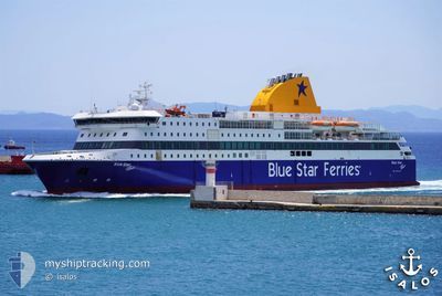
BLUE STAR PATMOS
Ro-Ro/Passenger Ship
Current Trip
| Time Travelled | 52 mins |
|---|---|
| Remaining Time | -8 mins |
| Distance Travelled | 13.57 nm |
| Remaining Distance | 3.64 nm |
| AVG Speed | 24.4 Knots |
| MAX Speed | 24.7 Knots |
| AVG Wind | 11.7 knots |
| MAX Wind | 15.5 knots |
| MIN Temp | 17.9°C / 64.22°F |
| MAX Temp | 18.7°C / 65.66°F |
| Draught | 5.9 m |
| Position Received | 17 m ago |
Current Position
| Longitude | 27.37470° |
|---|---|
| Latitude | 36.47933° |
| Status | Under way using engine |
| Speed | 24.2 Knots |
| Course | 136.6° |
| Area | Aegean Sea |
| Station | T-AIS |
| Position Received | 17 m ago |
Info
Information
The current position of BLUE STAR PATMOS is in Aegean Sea with coordinates 36.47933° / 27.37470° as reported on 2024-05-03 03:16 by AIS to our vessel tracker app. The vessel's current speed is 24.2 Knots and is heading at the port of TILOS. The estimated time of arrival as calculated by MyShipTracking vessel tracking app is 2024-05-03 03:26 LT
The vessel BLUE STAR PATMOS (IMO: 9565041, MMSI: 241159000) is a Ro-Ro/Passenger Ship that was built in 2012 ( 12 years old ). It's sailing under the flag of [GR] Greece.
In this page you can find informations about the vessels current position, last detected port calls, and current voyage information. If the vessels is not in coverage by AIS you will find the latest position.
The current position of BLUE STAR PATMOS is detected by our AIS receivers and we are not responsible for the reliability of the data. The last position was recorded while the vessel was in Coverage by the Ais receivers of our vessel tracking app.
The current draught of BLUE STAR PATMOS as reported by AIS is 5.9 meters
Weather
| Temperature | 18.7°C / 65.66°F |
|---|---|
| Wind Speed | 15 knots |
| Direction | 305° NW |
| Pressure | 1009.7 hPa |
| Humidity | 76.2 % |
| Cloud Coverage | --- |
Featured Company
Last Port Calls
| Port | Arrival | Departure | Time In Port |
|---|---|---|---|
| 2024-05-03 02:21 | 2024-05-03 02:42 | 20 m | |
| 2024-05-03 00:45 | 2024-05-03 01:21 | 36 m | |
| 2024-05-02 23:17 | 2024-05-03 00:08 | 51 m | |
| 2024-05-02 21:34 | 2024-05-02 21:50 | 16 m | |
| 2024-05-02 20:43 | 2024-05-02 21:11 | 27 m | |
| 2024-05-02 19:06 | 2024-05-02 19:34 | 28 m | |
| 2024-05-02 15:56 | 2024-05-02 16:10 | 14 m | |
| 2024-05-02 05:31 | 2024-05-02 12:19 | 6 h | |
| 2024-05-01 22:06 | 2024-05-01 22:27 | 20 m | |
| 2024-05-01 21:16 | 2024-05-01 21:37 | 20 m |
Last Trips
| Origin | Departure | Destination | Arrival | Distance | |
|---|---|---|---|---|---|
| 2024-05-03 04:21 | 2024-05-03 05:21 | 23.68 nm | |||
| 2024-05-03 03:08 | 2024-05-03 03:45 | 14.45 nm | |||
| 2024-05-03 00:50 | 2024-05-03 02:17 | 30.87 nm | |||
| 2024-05-03 00:11 | 2024-05-03 00:34 | 8.52 nm | |||
| 2024-05-02 22:34 | 2024-05-02 23:43 | 27.39 nm | |||
| 2024-05-02 19:10 | 2024-05-02 22:06 | 68.00 nm | |||
| 2024-05-02 15:19 | 2024-05-02 18:56 | 83.28 nm | |||
| 2024-05-02 01:27 | 2024-05-02 08:31 | 162.90 nm | |||
| 2024-05-02 00:37 | 2024-05-02 01:06 | 10.68 nm | |||
| 2024-05-01 23:38 | 2024-05-02 00:16 | 13.36 nm |
Events
| Time | Event | Details | Position / Dest | Info |
|---|---|---|---|---|
| 2024-05-03 02:42 | PORT DEPARTURE |
|
36.63443 / 27.17527
AK-P-L-K-K-N-T-S-R-M
|
Speed: 11.6 kn Course: 27° |
| 2024-05-03 02:36 | START Moving |
36.61760 / 27.14058
[GR] NISYROS
|
Speed: 10.3 kn Course: 22° |
|
| 2024-05-03 02:24 | STOP Moving |
36.61626 / 27.13896
[GR] NISYROS
|
Speed: 0.1 kn Course: 300° |
|
| 2024-05-03 02:21 | PORT ARRIVAL |
|
36.61806 / 27.14300
[GR] NISYROS
|
Speed: 10.4 kn Course: 224.1° |
| 2024-05-03 02:01 | Change Sea Area | Greek part of the Aegean Sea Turkish part of the Aegean Sea |
36.71544 / 27.24438
Aegean Sea
AK-P-L-K-K-N-T-S-R-M
|
Speed: 24.4 kn Course: 218.9° |
| 2024-05-03 01:55 | Change Sea Area | Turkish part of the Aegean Sea Greek part of the Aegean Sea |
36.74678 / 27.27520
Aegean Sea
AK-P-L-K-K-N-T-S-R-M
|
Speed: 24.2 kn Course: 218.2° |
| 2024-05-03 01:21 | PORT DEPARTURE |
|
36.90426 / 27.30850
AK-P-L-K-K-N-T-S-R-M
|
Speed: 21.7 kn Course: 88° |
| 2024-05-03 01:19 | START Moving |
36.90188 / 27.29548
[GR] KOS
|
Speed: 14.5 kn Course: 60° |
|
| 2024-05-03 00:52 | STOP Moving |
36.89947 / 27.29173
[GR] KOS
|
Speed: 0.2 kn Course: 35° |
|
| 2024-05-03 00:45 | PORT ARRIVAL |
|
36.90905 / 27.29318
[GR] KOS
|
Speed: 18.4 kn Course: 184.2° |