
BLUE RIDGE HIGHWAY
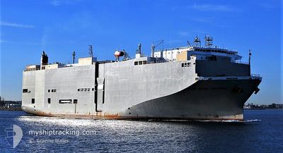
Vehicles Carrier
Current Trip
| Time Travelled | 2 days |
|---|---|
| Remaining Time | 9 h, 52 mins |
| Distance Travelled | 420.32 nm |
| Remaining Distance | 88.31 nm |
| AVG Speed | 8.6 Knots |
| MAX Speed | 17.2 Knots |
| AVG Wind | 12.9 knots |
| MAX Wind | 20 knots |
| MIN Temp | 12.1°C / 53.78°F |
| MAX Temp | 15.6°C / 60.08°F |
| Draught | 8.1 m |
| Position Received | 1 m ago |
Current Position
| Longitude | --- |
|---|---|
| Latitude | --- |
| Status | Under way using engine |
| Speed | 9.2 Knots |
| Course | 308° |
| Area | North Pacific Ocean |
| Station | T-AIS |
| Position Received | 1 m ago |
Information
The current position of BLUE RIDGE HIGHWAY is in North Pacific Ocean with coordinates 36.95929° / -122.65824° as reported on 2025-03-27 21:56 by AIS to our vessel tracker app. The vessel's current speed is 9.2 Knots and is heading at the port of BENICIA. The estimated time of arrival as calculated by MyShipTracking vessel tracking app is 2025-03-28 07:49 LT
The vessel BLUE RIDGE HIGHWAY (IMO: 9510151, MMSI: 355558000) is a Vehicles Carrier that was built in 2009 ( 16 years old ). It's sailing under the flag of [PA] Panama.
In this page you can find informations about the vessels current position, last detected port calls, and current voyage information. If the vessels is not in coverage by AIS you will find the latest position.
The current position of BLUE RIDGE HIGHWAY is detected by our AIS receivers and we are not responsible for the reliability of the data. The last position was recorded while the vessel was in Coverage by the Ais receivers of our vessel tracking app.
The current draught of BLUE RIDGE HIGHWAY as reported by AIS is 8.1 meters
Weather
| Temperature | 12.7°C / 54.86°F |
|---|---|
| Wind Speed | 12 knots |
| Direction | 222° SW |
| Pressure | 1017.7 hPa |
| Humidity | 85.8 % |
| Cloud Coverage | 100 % |
Featured Company
Last Port Calls
| Port | Arrival | Departure | Time In Port |
|---|---|---|---|
| 2025-03-24 11:04 | 2025-03-25 06:23 | 19 h | |
| 2025-03-18 11:35 | 2025-03-20 00:36 | 1 d | |
| 2025-03-09 15:50 | 2025-03-10 03:29 | 11 h | |
| 2025-02-27 21:02 | 2025-02-28 07:17 | 10 h | |
| 2025-02-26 21:42 | 2025-02-27 06:44 | 9 h | |
| 2025-02-22 21:33 | 2025-02-23 08:21 | 10 h | |
| 2025-02-14 13:19 | 2025-02-14 18:21 | 5 h | |
| 2025-02-12 06:16 | 2025-02-12 18:56 | 12 h | |
| 2025-01-29 21:50 | 2025-01-31 05:32 | 1 d | |
| 2025-01-18 03:16 | 2025-01-18 11:49 | 8 h |
Most Visited Ports (Last year)
| Port | Arrivals | |
|---|---|---|
| 19 | ||
| 16 | ||
| 9 | ||
| 9 | ||
| 8 | ||
| 2 |
Last Trips
| Origin | Departure | Destination | Arrival | Distance | |
|---|---|---|---|---|---|
| 2025-03-19 18:36 | 2025-03-24 04:04 | 1398.79 nm | |||
| 2025-03-09 17:29 | 2025-03-18 05:35 | 3179.04 nm | |||
| 2025-02-28 16:17 | 2025-03-09 05:50 | 3603.31 nm | |||
| 2025-02-27 15:44 | 2025-02-28 06:02 | 201.06 nm | |||
| 2025-02-23 17:21 | 2025-02-27 06:42 | 380.90 nm | |||
| 2025-02-15 02:21 | 2025-02-23 06:33 | 2822.97 nm | |||
| 2025-02-13 01:56 | 2025-02-14 21:19 | 647.66 nm | |||
| 2025-01-31 07:32 | 2025-02-12 13:16 | 4588.29 nm | |||
| 2025-01-18 17:19 | 2025-01-29 23:50 | 4148.18 nm | |||
| 2025-01-16 20:25 | 2025-01-18 08:46 | 494.21 nm |
Events
| Time | Event | Details | Position / Dest | Info |
|---|---|---|---|---|
| 2025-03-27 18:10 | ETA Changed | 2025/03/28 04:00 2025/03/28 02:00 |
36.72263 / -122.40478
US BNC
|
Speed: 1.6 kn Course: 184° |
| 2025-03-27 17:20 | START Moving | 17.02 nm, South West of SANTA CRUZ CA |
36.79903 / -122.31353
US BNC
|
Speed: 3.1 kn Course: 233° |
| 2025-03-27 12:24 | Status Changed | Under way using engine Default |
36.70745 / -122.47423
US BNC
|
Speed: 1.8 kn Course: 260° |
| 2025-03-27 12:23 | Status Changed | Default Under way using engine |
36.70721 / -122.47486
US BNC
|
Speed: 1.7 kn Course: 259° |
| 2025-03-27 12:07 | Status Changed | Under way using engine Default |
36.70355 / -122.48426
US BNC
|
Speed: 2 kn Course: 258° |
| 2025-03-27 12:03 | Status Changed | Default Under way using engine |
36.70267 / -122.48665
US BNC
|
Speed: 2 kn Course: 257° |
| 2025-03-27 09:47 | Status Changed | Under way using engine Default |
36.67021 / -122.57704
US BNC
|
Speed: 2 kn Course: 269° |
| 2025-03-27 09:38 | Status Changed | Default Under way using engine |
36.66781 / -122.58312
US BNC
|
Speed: 2.2 kn Course: 267° |
| 2025-03-27 06:44 | STOP Moving |
36.59800 / -122.64641
US BNC
|
Speed: 0.1 kn Course: 177° |
|
| 2025-03-25 23:59 | Status Changed | Under way using engine Default |
35.15870 / -121.51438
US BNC
|
Speed: 8.3 kn Course: 335° |