
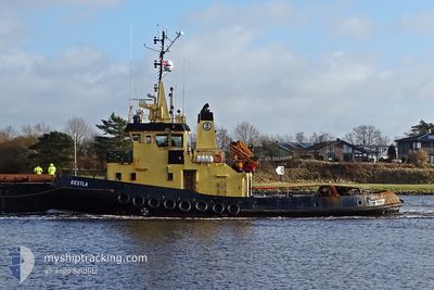
BESTLA
Tug
Current Trip
| Time Travelled | 2 days |
|---|---|
| Remaining Time | --- |
| Distance Travelled | 359.17 nm |
| Remaining Distance | --- |
| AVG Speed | 5.7 Knots |
| MAX Speed | 13 Knots |
| AVG Wind | 15.1 knots |
| MAX Wind | 26.9 knots |
| MIN Temp | -2.4°C / 27.68°F |
| MAX Temp | 3.2°C / 37.76°F |
| Draught | 4.3 m |
| Position Received | 58 m ago |
Current Position
| Longitude | --- |
|---|---|
| Latitude | --- |
| Status | Restricted manoeuverability |
| Speed | 5 Knots |
| Course | 178.8° |
| Area | North Sea |
| Station | T-AIS |
| Position Received | 58 m ago |
Info
Information
The current position of BESTLA is in North Sea with coordinates 55.18362° / 7.09082° as reported on 2026-02-18 19:33 by AIS to our vessel tracker app. The vessel's current speed is 5 Knots and is heading at the port of AVEIRO. The estimated time of arrival as calculated by MyShipTracking vessel tracking app is 2026-03-02 07:00 LT
The vessel BESTLA (IMO: 8027779, MMSI: 219829000) is a Tug that was built in 1981 ( 45 years old ). It's sailing under the flag of [DK] Denmark.
In this page you can find informations about the vessels current position, last detected port calls, and current voyage information. If the vessels is not in coverage by AIS you will find the latest position.
The current position of BESTLA is detected by our AIS receivers and we are not responsible for the reliability of the data. The last position was recorded while the vessel was in Coverage by the Ais receivers of our vessel tracking app.
The current draught of BESTLA as reported by AIS is 4.3 meters
Weather
| Temperature | 1°C / 33.8°F |
|---|---|
| Wind Speed | 12 knots |
| Direction | 139° SE |
| Pressure | 1012.3 hPa |
| Humidity | 69.8 % |
| Cloud Coverage | 22 % |
Featured Company
Most Visited Ports (Last year)
| Port | Arrivals | |
|---|---|---|
| 11 | ||
| 4 | ||
| 4 | ||
| 4 | ||
| 2 | ||
| 2 |
Events
| Time | Event | Details | Position / Dest | Info |
|---|---|---|---|---|
| 2026-02-18 18:59 | Change Sea Area | German part of the North Sea Danish part of the North Sea |
55.23070 / 7.09326
North Sea
PTAVE
|
Speed: 4.8 kn Course: 184.8° |
| 2026-02-18 18:59 | Status Changed | Restricted manoeuverability Default |
55.23070 / 7.09326
PTAVE
|
Speed: 4 kn Course: -1° |
| 2026-02-18 18:50 | Status Changed | Default Restricted manoeuverability |
55.24166 / 7.09333
PTAVE
|
Speed: 5 kn Course: 184.1° |
| 2026-02-18 18:33 | Status Changed | Restricted manoeuverability Default |
55.26568 / 7.09779
PTAVE
|
Speed: 5 kn Course: 204° |
| 2026-02-18 18:33 | IN Coverage |
55.26502 / 7.09769
North Sea
PTAVE
|
Speed: 5 kn Course: 184.1° |
|
| 2026-02-18 17:20 | Status Changed | Default Restricted manoeuverability |
55.36500 / 7.15333
PTAVE
|
Speed: 5 kn Course: 192.3° |
| 2026-02-18 17:02 | OUT of Coverage |
55.39106 / 7.15820
North Sea
PTAVE
|
Speed: 5 kn Course: 192.3° |
|
| 2026-02-18 06:54 | Status Changed | Restricted manoeuverability Default |
56.23480 / 7.41331
PTAVE
|
Speed: 5 kn Course: 190° |
| 2026-02-18 06:53 | Status Changed | Default Restricted manoeuverability |
56.23656 / 7.41434
PTAVE
|
Speed: 4.9 kn Course: 199° |
| 2026-02-18 06:46 | Status Changed | Restricted manoeuverability Default |
56.24604 / 7.41987
PTAVE
|
Speed: 4.9 kn Course: 199° |