
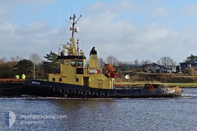
BESTLA
Tug
Current Trip
FALSTERBO
| Time Travelled | 1 day |
|---|---|
| Remaining Time | --- |
| Distance Travelled | 197.28 nm |
| Remaining Distance | --- |
| AVG Speed | 7.3 Knopen |
| MAX Speed | 8.5 Knopen |
| AVG Wind | 12.4 knots |
| MAX Wind | 16.3 knots |
| MIN Temp | 2.7°C / 36.86°F |
| MAX Temp | 4.7°C / 40.46°F |
| Diepgang | 4.3 M |
| Positie ontvangen | Nu |
Current Position
| Lengtegraad | --- |
|---|---|
| Breedtegraat | --- |
| Status | Under way using engine |
| Snelheid | 7.8 Knopen |
| Koers | 131° |
| Gebied | Kattegat |
| Station | T-AIS |
| Positie ontvangen | Nu |
Info
Information
The current position of BESTLA is in Kattegat with coordinates 56.16299° / 12.42176° as reported on 2025-03-01 20:54 by AIS to our vessel tracker app. The vessel's current speed is 7.8 Knopen
The vessel BESTLA (IMO: 8027779, MMSI: 219829000) is a Tug that was built in 1981 ( 44 Jaar oud ). It's sailing under the flag of [DK] Denmark.
In this page you can find informations about the vessels current position, last detected port calls, and current voyage information. If the vessels is not in coverage by AIS you will find the latest position.
The current position of BESTLA is detected by our AIS receivers and we are not responsible for the reliability of the data. The last position was recorded while the vessel was in Coverage by the Ais receivers of our vessel tracking app.
The current draught of BESTLA as reported by AIS is 4.3 meters
Weather
| Temperature | 3.5°C / 38.3°F |
|---|---|
| Wind Speed | 15 knots |
| Direction | 269° W |
| Pressure | 1028.4 hPa |
| Humidity | 83.7 % |
| Cloud Coverage | 100 % |
Featured Company
Last Port Calls
| Port | Arrival | Departure | Time In Port |
|---|---|---|---|
| 2025-02-17 06:15 | 2025-02-28 18:46 | 11 d | |
| 2025-02-06 08:39 | 2025-02-06 11:58 | 3 h | |
| 2025-01-13 03:17 | 2025-02-05 22:10 | 23 d |
Last Trips
| Origin | Departure | Destination | Arrival | Distance | |
|---|---|---|---|---|---|
| 2025-02-06 11:58 | 2025-02-17 06:15 | 2143.97 nm | |||
| 2025-02-05 22:10 | 2025-02-06 08:39 | 106.31 nm | |||
| 2024-12-16 19:45 | 2025-01-13 03:17 | 1515.94 nm |
Events
| Tijd | Evenement | Details | Positie / Bestemming | Info |
|---|---|---|---|---|
| 2025-03-01 19:59 | Wijzig zee gebeid | Danish part of the Kattegat Swedish part of the Kattegat |
56.24383 / 12.27117
Kattegat
FALSTERBO
|
Snelheid: 7.4 kn Koers: 140.2° |
| 2025-03-01 18:44 | Wijzig zee gebeid | Swedish part of the Kattegat Danish part of the Kattegat |
56.37275 / 12.11515
Kattegat
FALSTERBO
|
Snelheid: 7.3 kn Koers: 145.5° |
| 2025-03-01 05:07 | Wijzig zee gebeid | Danish part of the Kattegat Danish part of the Skaggerak |
57.77877 / 10.85826
Kattegat
FALSTERBO
|
Snelheid: 7.7 kn Koers: 114.3° |
| 2025-02-28 18:02 | ETA Changed | 2025/03/02 05:00 2025/03/02 07:00 |
57.15297 / 8.62959
FALSTERBO
|
Snelheid: 7.3 kn Koers: 57.7° |
| 2025-02-28 18:02 | Status Changed | Under way using engine Moored |
57.15275 / 8.62896
FALSTERBO
|
Snelheid: 7.3 kn Koers: 57.1° |
| 2025-02-28 17:49 | Wijzig zee gebeid | Danish part of the Skaggerak Danish part of the North Sea |
57.13483 / 8.59721
Skaggerak
FALSTERBO
|
Snelheid: 7 kn Koers: 16.2° |
| 2025-02-28 17:46 | Vertrekhaven |
|
57.12911 / 8.59328
FALSTERBO
|
Snelheid: 6.8 kn Koers: 26° |
| 2025-02-28 17:40 | ETA Changed | 2025/03/02 07:00 2025/02/17 07:00 |
57.12212 / 8.59373
[DK] HANSTHOLM
|
Snelheid: 3.2 kn Koers: 273° |
| 2025-02-28 17:37 | Start beweging |
57.12273 / 8.59676
[DK] HANSTHOLM
|
Snelheid: 3.3 kn Koers: 308° |
|
| 2025-02-28 17:27 | Destination Changed | FALSTERBO HANSTHOLM |
57.12130 / 8.59886
[DK] HANSTHOLM
|
Snelheid: Koers: 152° |