
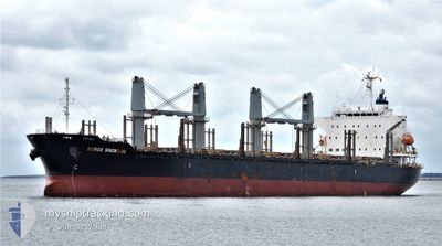
BERGE SNOWDON
Cargo
Current Trip
| Time Travelled | 5 days |
|---|---|
| Remaining Time | --- |
| Distance Travelled | 1237.23 nm |
| Remaining Distance | --- |
| AVG Speed | 10.3 Knots |
| MAX Speed | 12.7 Knots |
| AVG Wind | 9.2 knots |
| MAX Wind | 26.6 knots |
| MIN Temp | 3.7°C / 38.66°F |
| MAX Temp | 15.4°C / 59.72°F |
| Draught | 9.8 m |
| Position Received | 2 d ago |
Current Position
| Longitude | -56.83414° |
|---|---|
| Latitude | -38.53319° |
| Status | Under way using engine |
| Speed | 10.9 Knots |
| Course | 207.3° |
| Area | South Atlantic Ocean |
| Station | T-AIS |
| Position Received | 2 d ago |
Info
Information
The current position of BERGE SNOWDON is in South Atlantic Ocean with coordinates -38.53319° / -56.83414° as reported on 2024-05-18 13:15 by AIS to our vessel tracker app. The vessel's current speed is 10.9 Knots and is heading at the port of TAURANGA. The estimated time of arrival as calculated by MyShipTracking vessel tracking app is 2024-06-08 03:00 LT
The vessel BERGE SNOWDON (IMO: 9738882, MMSI: 636021972) is a Cargo It's sailing under the flag of [LR] Liberia.
In this page you can find informations about the vessels current position, last detected port calls, and current voyage information. If the vessels is not in coverage by AIS you will find the latest position.
The current position of BERGE SNOWDON is detected by our AIS receivers and we are not responsible for the reliability of the data. The last position was recorded while the vessel was in Coverage by the Ais receivers of our vessel tracking app.
The current draught of BERGE SNOWDON as reported by AIS is 9.8 meters
Weather
| Temperature | 8.1°C / 46.58°F |
|---|---|
| Wind Speed | 9 knots |
| Direction | 271° W |
| Pressure | 1000.3 hPa |
| Humidity | 73.9 % |
| Cloud Coverage | 2 % |
Featured Company
Last Port Calls
| Port | Arrival | Departure | Time In Port |
|---|---|---|---|
| 2024-05-15 06:33 | |||
| 2024-05-04 12:05 | |||
| 2024-05-04 12:05 | |||
| 2024-05-02 18:28 | |||
| 2024-04-28 03:05 | 2024-05-02 14:02 | 4 d | |
| 2024-04-24 13:35 | 2024-04-27 09:53 | 2 d | |
| 2024-04-21 10:17 | 2024-04-23 20:25 | 2 d |
Last Trips
| Origin | Departure | Destination | Arrival | Distance | |
|---|---|---|---|---|---|
| 2024-05-04 12:05 | 2024-05-04 12:05 | --- | |||
| 2024-05-02 14:02 | 2024-05-02 18:28 | 40.16 nm | |||
| 2024-04-27 09:53 | 2024-04-28 03:05 | 119.69 nm | |||
| 2024-04-23 20:25 | 2024-04-24 13:35 | 178.19 nm | |||
| 2024-02-28 08:30 | 2024-04-21 10:17 | 13124.23 nm |
Events
| Time | Event | Details | Position / Dest | Info |
|---|---|---|---|---|
| 2024-05-18 13:21 | Status Changed | Default Under way using engine |
-38.54783 / -56.84470
NZTRG
|
Speed: 10.9 kn Course: 207.3° |
| 2024-05-18 13:15 | OUT of Coverage |
-38.53319 / -56.83414
South Atlantic Ocean
NZTRG
|
Speed: 10.9 kn Course: 207.3° |
|
| 2024-05-18 12:54 | Destination Changed | NZTRG TUARANGA NEW ZEALAND |
-38.46995 / -56.79025
NZTRG
|
Speed: 10.7 kn Course: 211.2° |
| 2024-05-18 12:54 | ETA Changed | 2024/06/07 15:00 2024/06/09 20:00 |
-38.46995 / -56.79025
NZTRG
|
Speed: 10.7 kn Course: 211.2° |
| 2024-05-18 12:46 | Status Changed | Under way using engine Default |
-38.45616 / -56.78056
TUARANGA NEW ZEALAND
|
Speed: 10.6 kn Course: 205° |
| 2024-05-18 12:32 | Status Changed | Default Under way using engine |
-38.41893 / -56.75584
TUARANGA NEW ZEALAND
|
Speed: 10.8 kn Course: 209.7° |
| 2024-05-18 12:26 | Status Changed | Under way using engine Default |
-38.40360 / -56.74606
TUARANGA NEW ZEALAND
|
Speed: 10.9 kn Course: 204° |
| 2024-05-18 12:17 | IN Coverage |
-38.40360 / -56.74606
South Atlantic Ocean
TUARANGA NEW ZEALAND
|
Speed: 10.8 kn Course: 209.7° |
|
| 2024-05-18 11:04 | Status Changed | Default Under way using engine |
-38.19264 / -56.59539
TUARANGA NEW ZEALAND
|
Speed: 10.4 kn Course: 208.2° |
| 2024-05-18 10:51 | OUT of Coverage |
-38.15956 / -56.57172
South Atlantic Ocean
TUARANGA NEW ZEALAND
|
Speed: 10.4 kn Course: 208.2° |