
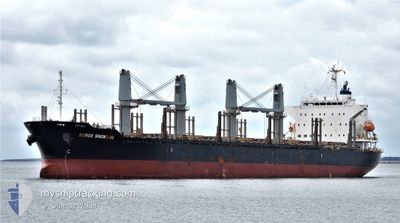
BERGE SNOWDON
Cargo
Current Trip
| Time Travelled | 12 days |
|---|---|
| Remaining Time | --- |
| Distance Travelled | 1959.81 nm |
| Remaining Distance | --- |
| AVG Speed | 10.2 Knots |
| MAX Speed | 13.1 Knots |
| AVG Wind | 17.7 knots |
| MAX Wind | 40.7 knots |
| MIN Temp | 11.6°C / 52.88°F |
| MAX Temp | 31.7°C / 89.06°F |
| Dybgang | 8.5 m |
| Position Modtaget | 3 d siden |
Current Position
| Longitude | --- |
|---|---|
| Latitude | --- |
| Status | Under way using engine |
| Fart | 7.8 Knots |
| Kurs | 92.1° |
| Område | Tasman Sea |
| Station | T-AIS |
| Position Modtaget | 3 d siden |
Info
Information
The current position of BERGE SNOWDON is in Tasman Sea with coordinates -43.66480° / 149.41413° as reported on 2025-02-13 11:42 by AIS to our vessel tracker app. The vessel's current speed is 7.8 Knots and is heading at the port of BALBOA. The estimated time of arrival as calculated by MyShipTracking vessel tracking app is 2025-03-11 11:00 LT
The vessel BERGE SNOWDON (IMO: 9738882, MMSI: 636021972) is a Cargo It's sailing under the flag of [LR] Liberia.
In this page you can find informations about the vessels current position, last detected port calls, and current voyage information. If the vessels is not in coverage by AIS you will find the latest position.
The current position of BERGE SNOWDON is detected by our AIS receivers and we are not responsible for the reliability of the data. The last position was recorded while the vessel was in Coverage by the Ais receivers of our vessel tracking app.
The current draught of BERGE SNOWDON as reported by AIS is 8.5 meters
Weather
| Temperature | 14.4°C / 57.92°F |
|---|---|
| Wind Speed | 16 knots |
| Direction | 70° ENE |
| Pressure | 1008.9 hPa |
| Humidity | 92.6 % |
| Cloud Coverage | 100 % |
Featured Company
Last Port Calls
| Port | Arrival | Departure | Time In Port |
|---|---|---|---|
| 2025-01-23 01:36 | 2025-02-04 23:52 | 12 d | |
| 2024-12-25 16:09 | 2024-12-28 04:17 | 2 d | |
| 2024-12-02 21:30 | 2024-12-05 14:56 | 2 d | |
| 2024-12-01 04:44 | 2024-12-02 19:58 | 1 d |
Most Visited Ports (Last year)
| Port | Arrivals | |
|---|---|---|
| 2 | ||
| 2 | ||
| 2 | ||
| 2 | ||
| 1 | ||
| 1 |
Events
| Tid | Hændelsen | Detaljer | Position / Dest | Info |
|---|---|---|---|---|
| 2025-02-13 11:48 | Status er ændret | Default Under way using engine |
-43.66388 / 149.43425
PA BLB
|
Fart: 7.8 kn Kurs: 92.1° |
| 2025-02-13 11:42 | Status er ændret | Under way using engine Default |
-43.66480 / 149.41413
PA BLB
|
Fart: 7.3 kn Kurs: 94° |
| 2025-02-13 11:42 | Udenfor Dækning |
-43.66480 / 149.41413
Tasman Sea
PA BLB
|
Fart: 7.8 kn Kurs: 92.1° |
|
| 2025-02-13 11:26 | Status er ændret | Default Under way using engine |
-43.66616 / 149.37148
PA BLB
|
Fart: 7.4 kn Kurs: 91° |
| 2025-02-13 11:18 | Status er ændret | Under way using engine Default |
-43.66639 / 149.34690
PA BLB
|
Fart: 7.1 kn Kurs: 82° |
| 2025-02-13 11:16 | Status er ændret | Default Under way using engine |
-43.66631 / 149.33992
PA BLB
|
Fart: 7.4 kn Kurs: 104.4° |
| 2025-02-13 10:58 | Status er ændret | Under way using engine Default |
-43.66550 / 149.29014
PA BLB
|
Fart: 6.9 kn Kurs: 87° |
| 2025-02-13 10:56 | Status er ændret | Default Under way using engine |
-43.66565 / 149.28407
PA BLB
|
Fart: 7.1 kn Kurs: 71.1° |
| 2025-02-13 10:55 | Status er ændret | Under way using engine Default |
-43.66572 / 149.28185
PA BLB
|
Fart: 6.6 kn Kurs: 89° |
| 2025-02-13 10:52 | Status er ændret | Default Under way using engine |
-43.66539 / 149.27350
PA BLB
|
Fart: 7.4 kn Kurs: 86.2° |