

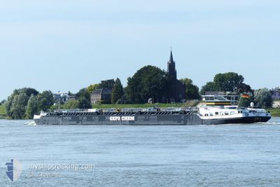
BELLOTTO
Tanker

Current Trip
| Time Travelled | 22 h, 11 mins |
|---|---|
| Remaining Time | 2 h, 17 mins |
| Distance Travelled | 146.85 nm |
| Remaining Distance | 16.73 nm |
| AVG Speed | 7.1 Knots |
| MAX Speed | 10.1 Knots |
| AVG Wind | 4.4 knots |
| MAX Wind | 9.5 knots |
| MIN Temp | 8°C / 46.4°F |
| MAX Temp | 15.8°C / 60.44°F |
| Draught | 1.6 m |
| Position Received | 1 m ago |
Current Position
| Longitude | --- |
|---|---|
| Latitude | --- |
| Status | Under way using engine |
| Speed | 5.5 Knots |
| Course | 198.6° |
| Area | North Sea |
| Station | T-AIS |
| Position Received | 1 m ago |
Information
The current position of BELLOTTO is in North Sea with coordinates 51.15726° / 6.79336° as reported on 2025-03-24 20:16 by AIS to our vessel tracker app. The vessel's current speed is 5.5 Knots and is heading at the port of LEVERKUSEN. The estimated time of arrival as calculated by MyShipTracking vessel tracking app is 2025-03-24 22:35 LT
The vessel BELLOTTO (MMSI: 218000710) is a Tanker It's sailing under the flag of [DE] Germany.
In this page you can find informations about the vessels current position, last detected port calls, and current voyage information. If the vessels is not in coverage by AIS you will find the latest position.
The current position of BELLOTTO is detected by our AIS receivers and we are not responsible for the reliability of the data. The last position was recorded while the vessel was in Coverage by the Ais receivers of our vessel tracking app.
The current draught of BELLOTTO as reported by AIS is 1.6 meters
Weather
| Temperature | 11.7°C / 53.06°F |
|---|---|
| Wind Speed | 5 knots |
| Direction | 340° NNW |
| Pressure | 1017.4 hPa |
| Humidity | 74.4 % |
| Cloud Coverage | 77 % |


Featured Company
Last Port Calls
| Port | Arrival | Departure | Time In Port |
|---|---|---|---|
| 2025-03-23 12:43 | 2025-03-23 22:07 | 9 h | |
| 2025-03-21 23:51 | 2025-03-22 17:55 | 18 h | |
| 2025-03-21 18:19 | |||
| 2025-03-17 19:31 | 2025-03-18 05:14 | 9 h | |
| 2025-03-16 02:40 | 2025-03-17 02:14 | 23 h | |
| 2025-03-15 12:56 | 2025-03-15 13:45 | 48 m | |
| 2025-03-14 17:28 | 2025-03-15 03:20 | 9 h | |
| 2025-03-13 08:24 | 2025-03-13 22:51 | 14 h | |
| 2025-03-12 12:43 | 2025-03-12 13:38 | 55 m | |
| 2025-03-11 17:11 | 2025-03-12 05:39 | 12 h |
Last Trips
| Origin | Departure | Destination | Arrival | Distance | |
|---|---|---|---|---|---|
| 2025-03-22 18:55 | 2025-03-23 13:43 | 158.26 nm | |||
| 2025-03-21 19:19 | 2025-03-22 00:51 | 27.77 nm | |||
| 2025-03-17 03:14 | 2025-03-17 20:31 | 155.79 nm | |||
| 2025-03-15 14:45 | 2025-03-16 03:40 | 77.13 nm | |||
| 2025-03-15 04:20 | 2025-03-15 13:56 | 77.79 nm | |||
| 2025-03-13 23:51 | 2025-03-14 18:28 | 155.90 nm | |||
| 2025-03-12 14:38 | 2025-03-13 09:24 | 128.37 nm | |||
| 2025-03-12 06:39 | 2025-03-12 13:43 | 28.55 nm | |||
| 2025-03-10 23:58 | 2025-03-11 18:11 | 158.26 nm | |||
| 2025-03-10 12:38 | 2025-03-10 13:40 | 6.03 nm |
Events
| Time | Event | Details | Position / Dest | Info |
|---|---|---|---|---|
| 2025-03-24 17:11 | Status Changed | Under way using engine Default |
51.34627 / 6.66745
KAI BAYER LEVERKUSEN
|
Speed: 6 kn Course: 144° |
| 2025-03-24 17:07 | Status Changed | Default Under way using engine |
51.35058 / 6.65716
KAI BAYER LEVERKUSEN
|
Speed: 6.1 kn Course: 157.3° |
| 2025-03-24 14:42 | Status Changed | Under way using engine Default |
51.52393 / 6.70089
KAI BAYER LEVERKUSEN
|
Speed: 6.7 kn Course: 206° |
| 2025-03-24 14:23 | Status Changed | Default Under way using engine |
51.55125 / 6.67934
KAI BAYER LEVERKUSEN
|
Speed: 6.8 kn Course: 172.2° |
| 2025-03-24 14:11 | IN Coverage |
51.57131 / 6.68459
North Sea
KAI BAYER LEVERKUSEN
|
Speed: 6.5 kn Course: 149.5° |
|
| 2025-03-24 12:44 | OUT of Coverage |
51.65935 / 6.58010
North Sea
KAI BAYER LEVERKUSEN
|
Speed: 6.8 kn Course: 99.6° |
|
| 2025-03-24 12:34 | IN Coverage |
51.65752 / 6.55119
North Sea
KAI BAYER LEVERKUSEN
|
Speed: 6.9 kn Course: 87.1° |
|
| 2025-03-24 09:49 | Status Changed | Default Under way using engine |
51.82815 / 6.22092
KAI BAYER LEVERKUSEN
|
Speed: 6.5 kn Course: 124.8° |
| 2025-03-24 09:31 | OUT of Coverage |
51.83768 / 6.17460
North Sea
KAI BAYER LEVERKUSEN
|
Speed: 6.5 kn Course: 124.8° |
|
| 2025-03-24 03:17 | Status Changed | Under way using engine Default |
51.81206 / 5.19033
KAI BAYER LEVERKUSEN
|
Speed: 7.3 kn Course: 76° |