
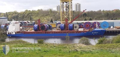
BBC KIMBERLEY
General Cargo
Current Trip
| Time Travelled | 9 days |
|---|---|
| Remaining Time | --- |
| Distance Travelled | 2815.52 nm |
| Remaining Distance | --- |
| AVG Speed | 13.1 Knots |
| MAX Speed | 15.3 Knots |
| AVG Wind | 10.8 knots |
| MAX Wind | 29.1 knots |
| MIN Temp | 3.2°C / 37.76°F |
| MAX Temp | 22°C / 71.6°F |
| Draught | 7.8 m |
| Position Received | 2 h, 25 m ago |
Current Position
| Longitude | -22.81881° |
|---|---|
| Latitude | 17.99324° |
| Status | Under way using engine |
| Speed | 14.4 Knots |
| Course | 199.2° |
| Area | North Atlantic Ocean |
| Station | T-AIS |
| Position Received | 2 h, 25 m ago |
Info
Information
The current position of BBC KIMBERLEY is in North Atlantic Ocean with coordinates 17.99324° / -22.81881° as reported on 2024-04-26 03:08 by AIS to our vessel tracker app. The vessel's current speed is 14.4 Knots and is heading at the port of BAIA DE VITORIA. The estimated time of arrival as calculated by MyShipTracking vessel tracking app is 2024-05-04 21:00 LT
The vessel BBC KIMBERLEY (IMO: 9407586, MMSI: 305392000) is a General Cargo that was built in 2009 ( 15 years old ). It's sailing under the flag of [AG] Antigua Barbuda.
In this page you can find informations about the vessels current position, last detected port calls, and current voyage information. If the vessels is not in coverage by AIS you will find the latest position.
The current position of BBC KIMBERLEY is detected by our AIS receivers and we are not responsible for the reliability of the data. The last position was recorded while the vessel was in Coverage by the Ais receivers of our vessel tracking app.
The current draught of BBC KIMBERLEY as reported by AIS is 7.8 meters
Weather
| Temperature | 21.7°C / 71.06°F |
|---|---|
| Wind Speed | 10 knots |
| Direction | 350° N |
| Pressure | 1011.5 hPa |
| Humidity | 83.8 % |
| Cloud Coverage | 98 % |
Featured Company
Last Port Calls
| Port | Arrival | Departure | Time In Port |
|---|---|---|---|
| 2024-04-16 03:29 | 2024-04-16 21:31 | 18 h | |
| 2024-04-12 16:08 | 2024-04-12 17:04 | 55 m | |
| 2024-04-06 01:25 | 2024-04-08 08:19 | 2 d | |
| 2024-03-04 09:25 | 2024-04-03 12:02 | ||
| 2024-02-21 21:06 | 2024-02-22 21:58 | 1 d | |
| 2024-02-01 22:47 | 2024-02-02 16:51 | 18 h |
Most Visited Ports (Last year)
| Port | Arrivals | |
|---|---|---|
| 1 | ||
| 1 | ||
| 1 | ||
| 1 | ||
| 1 | ||
| 1 |
Last Trips
| Origin | Departure | Destination | Arrival | Distance | |
|---|---|---|---|---|---|
| 2024-04-12 18:04 | 2024-04-16 05:29 | 418.67 nm | |||
| 2024-04-08 10:19 | 2024-04-12 17:08 | 1047.18 nm | |||
| 2024-04-03 14:02 | 2024-04-06 03:25 | 754.33 nm | |||
| 2024-02-22 18:28 | 2024-03-04 10:25 | 3433.79 nm | |||
| 2024-02-02 13:51 | 2024-02-21 17:36 | 5442.58 nm | |||
| 2024-01-31 19:34 | 2024-02-01 19:47 | 339.57 nm |
Events
| Time | Event | Details | Position / Dest | Info |
|---|---|---|---|---|
| 2024-04-26 03:11 | Status Changed | Default Under way using engine |
17.98096 / -22.82402
BRVIX
|
Speed: 14.4 kn Course: 199.2° |
| 2024-04-26 03:08 | Status Changed | Under way using engine Default |
17.99324 / -22.81881
BRVIX
|
Speed: 14.1 kn Course: 203° |
| 2024-04-26 03:08 | OUT of Coverage |
17.99324 / -22.81881
North Atlantic Ocean
BRVIX
|
Speed: 14.4 kn Course: 199.2° |
|
| 2024-04-26 02:30 | Status Changed | Default Under way using engine |
18.13478 / -22.76580
BRVIX
|
Speed: 14.2 kn Course: 198.7° |
| 2024-04-26 02:25 | Change Sea Area | Cape Verdean part of the North Atlantic Ocean High seas of the North Atlantic Ocean |
18.15295 / -22.75950
North Atlantic Ocean
BRVIX
|
Speed: 14.2 kn Course: 198.7° |
| 2024-04-26 02:24 | Status Changed | Under way using engine Default |
18.15675 / -22.75815
BRVIX
|
Speed: 14.3 kn Course: 202° |
| 2024-04-26 02:08 | IN Coverage |
18.15295 / -22.75950
North Atlantic Ocean
BRVIX
|
Speed: 14.2 kn Course: 198.7° |
|
| 2024-04-22 10:38 | Status Changed | Default Under way using engine |
36.70361 / -14.12661
BRVIX
|
Speed: 13.7 kn Course: 205.6° |
| 2024-04-22 10:37 | Status Changed | Under way using engine Default |
36.70677 / -14.12482
BRVIX
|
Speed: 13.5 kn Course: 202° |
| 2024-04-22 10:37 | OUT of Coverage |
36.70677 / -14.12482
North Atlantic Ocean
BRVIX
|
Speed: 13.7 kn Course: 205.6° |