
BARRINGTON ISLAND
Reefer
Current Trip
| Time Travelled | 7 days |
|---|---|
| Remaining Time | --- |
| Distance Travelled | 2597.46 nm |
| Remaining Distance | --- |
| AVG Speed | 14.1 Knots |
| MAX Speed | 19.2 Knots |
| AVG Wind | 15.7 knots |
| MAX Wind | 27.5 knots |
| MIN Temp | 0.8°C / 33.44°F |
| MAX Temp | 22.8°C / 73.04°F |
| Draught | 8.8 m |
| Position Received | 5 h, 34 m ago |
Current Position
| Longitude | --- |
|---|---|
| Latitude | --- |
| Status | At anchor |
| Speed | 0.3 Knots |
| Course | 31° |
| Area | North Atlantic Ocean |
| Station | T-AIS |
| Position Received | 5 h, 34 m ago |
Info
Information
The current position of BARRINGTON ISLAND is in North Atlantic Ocean with coordinates 14.58551° / -17.34130° as reported on 2026-01-08 07:44 by AIS to our vessel tracker app. The vessel's current speed is 0.3 Knots
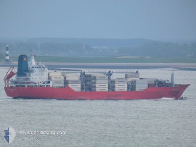
The vessel BARRINGTON ISLAND (IMO: 9059614, MMSI: 308701000) is a Reefer that was built in 1993 ( 33 years old ). It's sailing under the flag of [BS] Bahamas.
In this page you can find informations about the vessels current position, last detected port calls, and current voyage information. If the vessels is not in coverage by AIS you will find the latest position.
The current position of BARRINGTON ISLAND is detected by our AIS receivers and we are not responsible for the reliability of the data. The last position was recorded while the vessel was in Coverage by the Ais receivers of our vessel tracking app.
The current draught of BARRINGTON ISLAND as reported by AIS is 8.8 meters
Weather
| Temperature | 20.9°C / 69.62°F |
|---|---|
| Wind Speed | 11 knots |
| Direction | 51° NE |
| Pressure | 1016.6 hPa |
| Humidity | 60.7 % |
| Cloud Coverage | 15 % |
Featured Company
Last Port Calls
| Port | Arrival | Departure | Time In Port |
|---|---|---|---|
| 2025-12-22 09:17 | 2025-12-31 15:42 | 9 d | |
| 2025-12-20 16:26 | 2025-12-21 17:39 | 1 d | |
| 2025-12-19 01:11 | 2025-12-20 04:46 | 1 d | |
| 2025-12-07 07:26 | 2025-12-09 03:05 | 1 d | |
| 2025-12-05 04:02 | 2025-12-05 14:35 | 10 h | |
| 2025-12-02 05:48 | 2025-12-04 11:37 | 2 d | |
| 2025-11-30 07:49 | 2025-11-30 21:57 | 14 h | |
| 2025-11-28 17:10 | 2025-11-29 02:07 | 8 h | |
| 2025-11-27 08:19 | 2025-11-28 02:07 | 17 h | |
| 2025-11-26 06:18 | 2025-11-27 00:58 | 18 h |
Most Visited Ports (Last year)
| Port | Arrivals | |
|---|---|---|
| 9 | ||
| 7 | ||
| 6 | ||
| 5 | ||
| 5 | ||
| 5 |
Last Trips
| Origin | Departure | Destination | Arrival | Distance | |
|---|---|---|---|---|---|
| 2025-12-21 17:39 | 2025-12-22 09:17 | 223.97 nm | |||
| 2025-12-20 04:46 | 2025-12-20 16:26 | 214.24 nm | |||
| 2025-12-09 03:05 | 2025-12-19 01:11 | 4155.14 nm | |||
| 2025-12-05 14:35 | 2025-12-07 07:26 | 662.58 nm | |||
| 2025-12-04 11:37 | 2025-12-05 04:02 | 279.82 nm | |||
| 2025-11-30 21:57 | 2025-12-02 05:48 | 617.89 nm | |||
| 2025-11-29 02:07 | 2025-11-30 07:49 | 519.54 nm | |||
| 2025-11-28 02:07 | 2025-11-28 17:10 | 273.35 nm | |||
| 2025-11-27 00:58 | 2025-11-27 08:19 | 110.19 nm | |||
| 2025-11-18 04:58 | 2025-11-26 06:18 | 3646.04 nm |
Events
| Time | Event | Details | Position / Dest | Info |
|---|---|---|---|---|
| 2026-01-08 07:59 | Status Changed | Default At anchor |
14.58551 / -17.34130
SNDKR
|
Speed: 0.3 kn Course: 31° |
| 2026-01-08 07:44 | OUT of Coverage |
14.58551 / -17.34130
North Atlantic Ocean
|
Speed: 0.3 kn Course: 47.3° |
|
| 2026-01-08 01:41 | Status Changed | At anchor Default |
14.58546 / -17.34127
SNDKR
|
Speed: 0.2 kn Course: 28° |
| 2026-01-08 01:38 | Status Changed | Default At anchor |
14.58545 / -17.34130
SNDKR
|
Speed: 0.2 kn Course: 13° |
| 2026-01-07 15:35 | Status Changed | At anchor Default |
14.58528 / -17.34029
SNDKR
|
Speed: 0.1 kn Course: 203° |
| 2026-01-07 15:32 | Status Changed | Default At anchor |
14.58527 / -17.34034
SNDKR
|
Speed: 0.3 kn Course: 355° |
| 2026-01-07 13:28 | Status Changed | At anchor Under way using engine |
14.58534 / -17.34000
SNDKR
|
Speed: 0.2 kn Course: 345° |
| 2026-01-07 09:53 | STOP Moving | 5.99 nm, South East of GOREE |
14.58670 / -17.34038
SNDKR
|
Speed: 0.3 kn Course: 0° |
| 2026-01-07 06:19 | Status Changed | Under way using engine Default |
14.95924 / -17.66826
SNDKR
|
Speed: 13.3 kn Course: 175° |
| 2026-01-07 06:19 | Status Changed | Default Under way using engine |
14.96229 / -17.66854
SNDKR
|
Speed: 13.2 kn Course: 174.9° |