

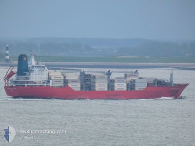
BARRINGTON ISLAND
Reefer

Current Trip
| Time Travelled | 6 days |
|---|---|
| Remaining Time | --- |
| Distance Travelled | 2388.02 nm |
| Remaining Distance | --- |
| AVG Speed | 16.7 Knots |
| MAX Speed | 19.2 Knots |
| AVG Wind | 13.5 knots |
| MAX Wind | 32 knots |
| MIN Temp | 9.4°C / 48.92°F |
| MAX Temp | 21.3°C / 70.34°F |
| Dybgang | 8.5 m |
| Position Modtaget | 2 d siden |
Current Position
| Longitude | --- |
|---|---|
| Latitude | --- |
| Status | Under way using engine |
| Fart | 17.8 Knots |
| Kurs | 237.3° |
| Område | North Atlantic Ocean |
| Station | T-AIS |
| Position Modtaget | 2 d siden |
Information
The current position of BARRINGTON ISLAND is in North Atlantic Ocean with coordinates 36.34777° / -25.71295° as reported on 2025-02-26 01:36 by AIS to our vessel tracker app. The vessel's current speed is 17.8 Knots and is heading at the port of POINTE A PITRE. The estimated time of arrival as calculated by MyShipTracking vessel tracking app is 2025-03-03 10:00 LT
The vessel BARRINGTON ISLAND (IMO: 9059614, MMSI: 308701000) is a Reefer that was built in 1993 ( 32 år gamle ). It's sailing under the flag of [BS] Bahamas.
In this page you can find informations about the vessels current position, last detected port calls, and current voyage information. If the vessels is not in coverage by AIS you will find the latest position.
The current position of BARRINGTON ISLAND is detected by our AIS receivers and we are not responsible for the reliability of the data. The last position was recorded while the vessel was in Coverage by the Ais receivers of our vessel tracking app.
The current draught of BARRINGTON ISLAND as reported by AIS is 8.5 meters
Weather
| Temperature | 21.3°C / 70.34°F |
|---|---|
| Wind Speed | 13 knots |
| Direction | 85° E |
| Pressure | 1026.8 hPa |
| Humidity | 78.2 % |
| Cloud Coverage | 100 % |


Featured Company
Last Port Calls
| Port | Arrival | Departure | Time In Port |
|---|---|---|---|
| 2025-02-21 12:43 | 2025-02-22 02:22 | 13 h | |
| 2025-02-18 02:49 | 2025-02-20 16:55 | 2 d | |
| 2025-02-17 06:17 | 2025-02-17 18:51 | 12 h | |
| 2025-02-02 02:49 | 2025-02-02 12:16 | 9 h | |
| 2025-01-29 00:18 | 2025-01-31 05:54 | 2 d | |
| 2025-01-21 16:10 | 2025-01-22 00:32 | 8 h | |
| 2025-01-19 04:43 | 2025-01-19 12:11 | 7 h | |
| 2025-01-16 20:51 | 2025-01-18 10:03 | 1 d | |
| 2025-01-14 16:19 | 2025-01-14 22:48 | 6 h | |
| 2025-01-14 00:56 | 2025-01-14 07:41 | 6 h |
Most Visited Ports (Last year)
| Port | Arrivals | |
|---|---|---|
| 8 | ||
| 7 | ||
| 7 | ||
| 6 | ||
| 6 | ||
| 6 |
Last Trips
| Origin | Departure | Destination | Arrival | Distance | |
|---|---|---|---|---|---|
| 2025-02-20 17:55 | 2025-02-21 13:43 | 267.33 nm | |||
| 2025-02-17 18:51 | 2025-02-18 03:49 | 97.62 nm | |||
| 2025-02-02 07:16 | 2025-02-17 06:17 | 5757.08 nm | |||
| 2025-01-31 00:54 | 2025-02-01 21:49 | 330.81 nm | |||
| 2025-01-21 20:32 | 2025-01-28 19:18 | 2018.86 nm | |||
| 2025-01-19 08:11 | 2025-01-21 12:10 | 689.89 nm | |||
| 2025-01-18 07:03 | 2025-01-19 00:43 | 215.82 nm | |||
| 2025-01-14 18:48 | 2025-01-16 17:51 | 658.41 nm | |||
| 2025-01-14 03:41 | 2025-01-14 12:19 | 111.69 nm | |||
| 2025-01-03 22:46 | 2025-01-13 20:56 | 4005.40 nm |
Events
| Tid | Hændelsen | Detaljer | Position / Dest | Info |
|---|---|---|---|---|
| 2025-02-26 01:58 | Status er ændret | Default Under way using engine |
36.28570 / -25.82672
GPPTP
|
Fart: 17.8 kn Kurs: 237.3° |
| 2025-02-26 01:36 | Udenfor Dækning |
36.34777 / -25.71295
North Atlantic Ocean
GPPTP
|
Fart: 17.8 kn Kurs: 237.3° |
|
| 2025-02-25 20:26 | Fundet i havområde | Portuguese (Azores) part of the North Atlantic Ocean |
37.10074 / -24.03199
North Atlantic Ocean
GPPTP
|
Fart: 18.1 kn Kurs: 238.7° |
| 2025-02-25 20:26 | Status er ændret | Under way using engine Default |
37.10074 / -24.03199
GPPTP
|
Fart: 17.8 kn Kurs: 240° |
| 2025-02-25 20:12 | Indenfor Dækning |
37.10074 / -24.03199
North Atlantic Ocean
GPPTP
|
Fart: 18.1 kn Kurs: 238.7° |
|
| 2025-02-22 15:16 | Status er ændret | Default Under way using engine |
49.51705 / -4.16690
GPPTP
|
Fart: 15.9 kn Kurs: 239.3° |
| 2025-02-22 15:07 | Udenfor Dækning |
49.53715 / -4.11498
English Channel
GPPTP
|
Fart: 15.9 kn Kurs: 239.3° |
|
| 2025-02-22 15:00 | Status er ændret | Under way using engine Default |
49.55268 / -4.07272
GPPTP
|
Fart: 16.1 kn Kurs: 241° |
| 2025-02-22 14:59 | Status er ændret | Default Under way using engine |
49.55383 / -4.06959
GPPTP
|
Fart: 15.8 kn Kurs: 240.2° |
| 2025-02-22 14:01 | Status er ændret | Under way using engine Default |
49.68392 / -3.71865
GPPTP
|
Fart: 16.1 kn Kurs: 240° |