
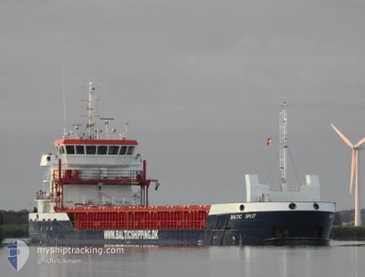
BALTIC SPLIT
Cargo
Current Trip
| Time Travelled | 2 days |
|---|---|
| Remaining Time | 2 days |
| Distance Travelled | 550.82 nm |
| Remaining Distance | 498.31 nm |
| AVG Speed | 7.8 Knots |
| MAX Speed | 12.9 Knots |
| AVG Wind | 17.4 knots |
| MAX Wind | 29.8 knots |
| MIN Temp | -3.6°C / 25.52°F |
| MAX Temp | 9.7°C / 49.46°F |
| Draught | 5.4 m |
| Position Received | 5 h, 43 m ago |
Current Position
| Longitude | --- |
|---|---|
| Latitude | --- |
| Status | Under way using engine |
| Speed | 7.9 Knots |
| Course | 266° |
| Area | English Channel |
| Station | T-AIS |
| Position Received | 5 h, 43 m ago |
Info
Information
The current position of BALTIC SPLIT is in English Channel with coordinates 50.42232° / -2.07792° as reported on 2026-02-16 14:19 by AIS to our vessel tracker app. The vessel's current speed is 7.9 Knots and is heading at the port of PASAJES. The estimated time of arrival as calculated by MyShipTracking vessel tracking app is 2026-02-19 12:40 LT
The vessel BALTIC SPLIT (IMO: 9962952, MMSI: 255915585) is a Cargo It's sailing under the flag of [PT] Portugal.
In this page you can find informations about the vessels current position, last detected port calls, and current voyage information. If the vessels is not in coverage by AIS you will find the latest position.
The current position of BALTIC SPLIT is detected by our AIS receivers and we are not responsible for the reliability of the data. The last position was recorded while the vessel was in Coverage by the Ais receivers of our vessel tracking app.
The current draught of BALTIC SPLIT as reported by AIS is 5.4 meters
Weather
| Temperature | 8.8°C / 47.84°F |
|---|---|
| Wind Speed | 26 knots |
| Direction | 298° WNW |
| Pressure | 1006.4 hPa |
| Humidity | 78.7 % |
| Cloud Coverage | 4 % |
Featured Company
Last Port Calls
| Port | Arrival | Departure | Time In Port |
|---|---|---|---|
| 2026-02-10 17:48 | 2026-02-13 22:53 | 3 d | |
| 2026-02-10 13:17 | 2026-02-10 15:29 | 2 h | |
| 2026-02-10 08:20 | |||
| 2026-02-10 01:05 | |||
| 2026-02-09 20:17 | |||
| 2026-02-09 13:05 | |||
| 2026-02-09 08:05 | |||
| 2026-02-09 00:47 | |||
| 2026-02-08 19:28 | |||
| 2026-02-08 12:34 |
Most Visited Ports (Last year)
| Port | Arrivals | |
|---|---|---|
| 5 | ||
| 5 | ||
| 3 | ||
| 3 | ||
| 2 | ||
| 2 |
Last Trips
| Origin | Departure | Destination | Arrival | Distance | |
|---|---|---|---|---|---|
| 2026-02-10 15:29 | 2026-02-10 17:48 | 25.73 nm | |||
| 2026-02-06 17:21 | 2026-02-10 13:17 | 250.93 nm | |||
| 2026-02-06 17:21 | 2026-02-10 08:20 | 250.69 nm | |||
| 2026-02-06 17:21 | 2026-02-10 01:05 | 250.37 nm | |||
| 2026-02-06 17:21 | 2026-02-09 20:17 | 250.19 nm | |||
| 2026-02-06 17:21 | 2026-02-09 13:05 | 249.72 nm | |||
| 2026-02-06 17:21 | 2026-02-09 08:05 | 249.38 nm | |||
| 2026-02-06 17:21 | 2026-02-09 00:47 | 248.92 nm | |||
| 2026-02-06 17:21 | 2026-02-08 19:28 | 248.65 nm | |||
| 2026-02-06 17:21 | 2026-02-08 12:34 | 248.21 nm |
Events
| Time | Event | Details | Position / Dest | Info |
|---|---|---|---|---|
| 2026-02-16 14:27 | Status Changed | Default Under way using engine |
50.42077 / -2.10799
ESPAS
|
Speed: 7.9 kn Course: 266° |
| 2026-02-16 14:19 | OUT of Coverage |
50.42232 / -2.07792
English Channel
ESPAS
|
Speed: 7.9 kn Course: 266° |
|
| 2026-02-16 12:46 | Status Changed | Under way using engine Default |
50.44556 / -1.73357
ESPAS
|
Speed: 8.5 kn Course: 262° |
| 2026-02-16 12:39 | Status Changed | Default Under way using engine |
50.44701 / -1.70901
ESPAS
|
Speed: 8.4 kn Course: 265.8° |
| 2026-02-16 12:27 | Status Changed | Under way using engine Default |
50.44933 / -1.66556
ESPAS
|
Speed: 8.9 kn Course: 266° |
| 2026-02-16 12:15 | Status Changed | Default Under way using engine |
50.45100 / -1.61766
ESPAS
|
Speed: 9.4 kn Course: 267.3° |
| 2026-02-16 12:09 | Status Changed | Under way using engine Default |
50.45140 / -1.59679
ESPAS
|
Speed: 9 kn Course: 268° |
| 2026-02-16 12:07 | Status Changed | Default Under way using engine |
50.45161 / -1.58743
ESPAS
|
Speed: 9.2 kn Course: 268.8° |
| 2026-02-16 11:21 | Status Changed | Under way using engine Default |
50.45651 / -1.41851
ESPAS
|
Speed: 7.4 kn Course: 266° |
| 2026-02-16 11:07 | Status Changed | Default Under way using engine |
50.45851 / -1.37146
ESPAS
|
Speed: 7.1 kn Course: 269° |