
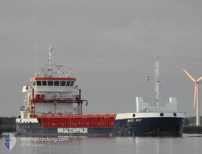
BALTIC SPLIT
Cargo
Current Trip
| Time Travelled | 16 days |
|---|---|
| Remaining Time | --- |
| Distance Travelled | 2647.54 nm |
| Remaining Distance | --- |
| AVG Speed | 6.9 Knots |
| MAX Speed | 11.5 Knots |
| AVG Wind | 19.7 knots |
| MAX Wind | 35.7 knots |
| MIN Temp | 1.1°C / 33.98°F |
| MAX Temp | 16.9°C / 62.42°F |
| Dybgang | 5.5 m |
| Position Modtaget | 4 m siden |
Current Position
| Longitude | --- |
|---|---|
| Latitude | --- |
| Status | Under way using engine |
| Fart | 0.4 Knots |
| Kurs | 332° |
| Område | North Sea |
| Station | T-AIS |
| Position Modtaget | 4 m siden |
Info
Information
The current position of BALTIC SPLIT is in North Sea with coordinates 55.13271° / -1.03780° as reported on 2026-01-05 03:07 by AIS to our vessel tracker app. The vessel's current speed is 0.4 Knots and is heading at the port of MIDDLESBROUGH. The estimated time of arrival as calculated by MyShipTracking vessel tracking app is 2026-01-03 13:00 LT
The vessel BALTIC SPLIT (IMO: 9962952, MMSI: 255915585) is a Cargo It's sailing under the flag of [PT] Portugal.
In this page you can find informations about the vessels current position, last detected port calls, and current voyage information. If the vessels is not in coverage by AIS you will find the latest position.
The current position of BALTIC SPLIT is detected by our AIS receivers and we are not responsible for the reliability of the data. The last position was recorded while the vessel was in Coverage by the Ais receivers of our vessel tracking app.
The current draught of BALTIC SPLIT as reported by AIS is 5.5 meters
Weather
| Temperature | 3.1°C / 37.58°F |
|---|---|
| Wind Speed | 27 knots |
| Direction | 306° NW |
| Pressure | 1007.8 hPa |
| Humidity | 74 % |
| Cloud Coverage | 100 % |
Featured Company
Last Port Calls
| Port | Arrival | Departure | Time In Port |
|---|---|---|---|
| 2025-12-19 19:52 | 2025-12-19 23:53 | 4 h | |
| 2025-12-16 11:08 | 2025-12-17 16:25 | 1 d | |
| 2025-12-09 13:09 |
Most Visited Ports (Last year)
| Port | Arrivals | |
|---|---|---|
| 3 | ||
| 3 | ||
| 3 | ||
| 2 | ||
| 2 | ||
| 2 |
Last Trips
| Origin | Departure | Destination | Arrival | Distance | |
|---|---|---|---|---|---|
| 2025-12-17 18:25 | 2025-12-19 20:52 | 496.76 nm | |||
| 2025-12-09 14:09 | 2025-12-16 13:08 | 765.52 nm |
Events
| Tid | Hændelsen | Detaljer | Position / Dest | Info |
|---|---|---|---|---|
| 2026-01-05 03:03 | Status er ændret | Under way using engine Default |
55.13232 / -1.03838
GBMID
|
Fart: 0.3 kn Kurs: 337° |
| 2026-01-05 03:03 | Status er ændret | Default Under way using engine |
55.13231 / -1.03836
GBMID
|
Fart: 0.9 kn Kurs: 336° |
| 2026-01-05 03:03 | STOP Sejllads | 15.25 nm, East of SEATON SLUICE |
55.13231 / -1.03836
GBMID
|
Fart: 0.3 kn Kurs: 337° |
| 2026-01-05 02:57 | Status er ændret | Under way using engine Default |
55.13190 / -1.03909
GBMID
|
Fart: 0.7 kn Kurs: 343° |
| 2026-01-05 02:54 | Status er ændret | Default Under way using engine |
55.13147 / -1.03956
GBMID
|
Fart: 0.9 kn Kurs: 340° |
| 2026-01-05 02:42 | Status er ændret | Under way using engine Default |
55.12997 / -1.04127
GBMID
|
Fart: 1.3 kn Kurs: 340° |
| 2026-01-05 02:34 | Status er ændret | Default Under way using engine |
55.12883 / -1.04214
GBMID
|
Fart: 0.8 kn Kurs: 343° |
| 2026-01-05 02:24 | Status er ændret | Under way using engine Default |
55.12744 / -1.04292
GBMID
|
Fart: 0.4 kn Kurs: 344° |
| 2026-01-05 02:19 | Status er ændret | Default Under way using engine |
55.12664 / -1.04328
GBMID
|
Fart: 1.1 kn Kurs: 352° |
| 2026-01-05 02:12 | Status er ændret | Under way using engine Default |
55.12552 / -1.04335
GBMID
|
Fart: 0.7 kn Kurs: 342° |