

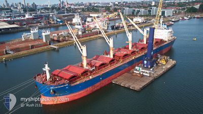
BALTIC SCORPION
Cargo

Current Trip
| Trip Time | 30 days |
|---|---|
| Trip Distance | 6567.98 nm |
| AVG Speed | 10.1 Knots |
| MAX Speed | 13.2 Knots |
| Draught | 10.2 m |
| AVG Wind | 11.6 knots |
| MAX Wind | 24 knots |
| MIN Temp | 14.7°C / 58.46°F |
| MAX Temp | 34.3°C / 93.74°F |
| Position Received | 7 d ago |
Current Position
| Longitude | --- |
|---|---|
| Latitude | --- |
| Status | Under way using engine |
| Speed | 9.1 Knots |
| Course | 276.6° |
| Area | Rio de La Plata |
| Station | T-AIS |
| Position Received | 7 d ago |
Information
The current position of BALTIC SCORPION is in Rio de La Plata with coordinates -35.16756° / -56.35677° as reported on 2025-01-27 19:30 by AIS to our vessel tracker app. The vessel's current speed is 9.1 Knots and is currently inside the port of SAN NICOLAS.
The vessel BALTIC SCORPION (IMO: 9729477, MMSI: 538005968) is a Cargo It's sailing under the flag of [MH] Marshall Is.
In this page you can find informations about the vessels current position, last detected port calls, and current voyage information. If the vessels is not in coverage by AIS you will find the latest position.
The current position of BALTIC SCORPION is detected by our AIS receivers and we are not responsible for the reliability of the data. The last position was recorded while the vessel was in Coverage by the Ais receivers of our vessel tracking app.
The current draught of BALTIC SCORPION as reported by AIS is 10.2 meters
Weather
| Temperature | 22°C / 71.6°F |
|---|---|
| Wind Speed | 2 knots |
| Direction | 153° SSE |
| Pressure | 1006.9 hPa |
| Humidity | 36.6 % |
| Cloud Coverage | 4 % |


Featured Company
Last Port Calls
| Port | Arrival | Departure | Time In Port |
|---|---|---|---|
| 2025-01-29 07:36 | |||
| 2024-12-25 19:15 | 2024-12-30 00:11 | 4 d | |
| 2024-12-08 11:14 | 2024-12-21 21:26 | 13 d |
Most Visited Ports (Last year)
| Port | Arrivals | |
|---|---|---|
| 3 | ||
| 2 | ||
| 2 | ||
| 2 | ||
| 2 | ||
| 1 |
Last Trips
| Origin | Departure | Destination | Arrival | Distance | |
|---|---|---|---|---|---|
| 2024-12-30 00:11 | 2025-01-29 07:36 | 6567.98 nm | |||
| 2024-12-21 21:26 | 2024-12-25 19:15 | 831.40 nm | |||
| 2024-10-29 10:44 | 2024-12-08 11:14 | 6928.17 nm |
Events
| Time | Event | Details | Position / Dest | Info |
|---|---|---|---|---|
| 2025-01-29 10:51 | STOP Moving |
-33.36385 / -60.13531
[AR] SAN NICOLAS
|
Speed: 0.3 kn Course: 282° |
|
| 2025-01-29 10:36 | PORT ARRIVAL |
|
-33.36315 / -60.13559
[AR] SAN NICOLAS
|
Speed: 3.6 kn Course: 281° |
| 2025-01-29 05:35 | START Moving | 1.45 nm, South East of SAN PEDRO (AR) |
-33.68230 / -59.62424
ARSNS
|
Speed: 5 kn Course: 341° |
| 2025-01-28 20:59 | STOP Moving | 1.86 nm, South East of SAN PEDRO (AR) |
-33.68624 / -59.61754
ARSNS
|
Speed: 0.1 kn Course: 318° |
| 2025-01-27 19:30 | Status Changed | Default Under way using engine |
-35.16752 / -56.35727
ARSNS
|
Speed: 9.1 kn Course: 276.6° |
| 2025-01-27 19:30 | OUT of Coverage |
-35.16756 / -56.35677
Rio de La Plata
|
Speed: 9.1 kn Course: 276.6° |
|
| 2025-01-27 19:24 | Status Changed | Under way using engine Default |
-35.16922 / -56.33868
ARSNS
|
Speed: 9.2 kn Course: 278° |
| 2025-01-27 19:22 | Status Changed | Default Under way using engine |
-35.16989 / -56.33244
ARSNS
|
Speed: 9.5 kn Course: 267.5° |
| 2025-01-27 19:07 | Status Changed | Under way using engine Default |
-35.17059 / -56.28277
ARSNS
|
Speed: 9.8 kn Course: 268° |
| 2025-01-27 19:06 | Status Changed | Default Under way using engine |
-35.17055 / -56.28112
ARSNS
|
Speed: 9.8 kn Course: 268.7° |