
BALTIC GRAIN
Cargo
Current Trip
| Time Travelled | 3 days |
|---|---|
| Remaining Time | 23 h, 6 mins |
| Distance Travelled | 743.94 nm |
| Remaining Distance | 240.58 nm |
| AVG Speed | 8.6 Knots |
| MAX Speed | 13.6 Knots |
| AVG Wind | 7.1 knots |
| MAX Wind | 20.7 knots |
| MIN Temp | -2.9°C / 26.78°F |
| MAX Temp | 3.9°C / 39.02°F |
| Draught | 4.9 m |
| Position Received | 1 m ago |
Current Position
| Longitude | --- |
|---|---|
| Latitude | --- |
| Status | Under way using engine |
| Speed | 10.5 Knots |
| Course | 36.9° |
| Area | Baltic Sea |
| Station | T-AIS |
| Position Received | 1 m ago |
Info
Information
The current position of BALTIC GRAIN is in Baltic Sea with coordinates 57.25165° / 19.09241° as reported on 2025-02-17 04:07 by AIS to our vessel tracker app. The vessel's current speed is 10.5 Knots and is heading at the port of TALLINN OLD HARBOR. The estimated time of arrival as calculated by MyShipTracking vessel tracking app is 2025-02-18 03:14 LT
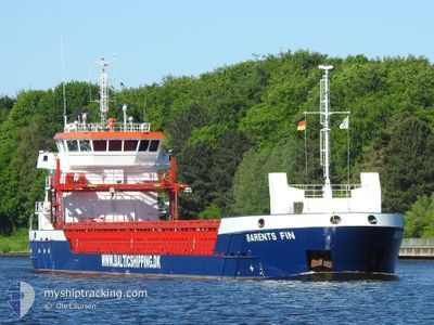
The vessel BALTIC GRAIN (IMO: 9962940, MMSI: 255915584) is a Cargo It's sailing under the flag of [PT] Portugal.
In this page you can find informations about the vessels current position, last detected port calls, and current voyage information. If the vessels is not in coverage by AIS you will find the latest position.
The current position of BALTIC GRAIN is detected by our AIS receivers and we are not responsible for the reliability of the data. The last position was recorded while the vessel was in Coverage by the Ais receivers of our vessel tracking app.
The current draught of BALTIC GRAIN as reported by AIS is 4.9 meters
Weather
| Temperature | -0.9°C / 30.38°F |
|---|---|
| Wind Speed | 15 knots |
| Direction | 296° WNW |
| Pressure | 1019.5 hPa |
| Humidity | 71.3 % |
| Cloud Coverage | 97 % |
Featured Company
Last Port Calls
| Port | Arrival | Departure | Time In Port |
|---|---|---|---|
| 2025-02-08 11:17 | 2025-02-13 18:46 | 5 d | |
| 2025-02-07 17:46 | 2025-02-08 09:22 | 15 h | |
| 2025-01-26 11:02 | 2025-02-01 15:35 | 6 d | |
| 2025-01-19 17:46 | 2025-01-19 20:02 | 2 h | |
| 2025-01-15 20:54 | 2025-01-17 14:10 | 1 d | |
| 2025-01-13 07:44 | 2025-01-14 07:56 | 1 d | |
| 2025-01-07 19:41 | 2025-01-09 19:53 | 2 d | |
| 2025-01-06 18:41 | 2025-01-07 17:02 | 22 h | |
| 2024-12-30 23:21 | 2025-01-02 18:16 | 2 d | |
| 2024-12-28 17:48 | 2024-12-30 20:11 | 2 d |
Most Visited Ports (Last year)
| Port | Arrivals | |
|---|---|---|
| 6 | ||
| 4 | ||
| 4 | ||
| 3 | ||
| 3 | ||
| 2 |
Last Trips
| Origin | Departure | Destination | Arrival | Distance | |
|---|---|---|---|---|---|
| 2025-02-08 10:22 | 2025-02-08 12:17 | 10.14 nm | |||
| 2025-02-01 15:35 | 2025-02-07 18:46 | 976.08 nm | |||
| 2025-01-19 21:02 | 2025-01-26 11:02 | 1370.95 nm | |||
| 2025-01-17 15:10 | 2025-01-19 18:46 | 404.78 nm | |||
| 2025-01-14 08:56 | 2025-01-15 21:54 | 23.36 nm | |||
| 2025-01-09 20:53 | 2025-01-13 08:44 | 707.92 nm | |||
| 2025-01-07 18:02 | 2025-01-07 20:41 | 23.31 nm | |||
| 2025-01-02 19:16 | 2025-01-06 19:41 | 820.92 nm | |||
| 2024-12-30 21:11 | 2024-12-31 00:21 | 34.68 nm | |||
| 2024-12-24 14:43 | 2024-12-28 18:48 | 1011.81 nm |
Events
| Time | Event | Details | Position / Dest | Info |
|---|---|---|---|---|
| 2025-02-17 03:44 | Status Changed | Under way using engine Default |
57.19857 / 19.01941
EETLL
|
Speed: 10.2 kn Course: 35° |
| 2025-02-17 03:41 | Status Changed | Default Under way using engine |
57.19192 / 19.01060
EETLL
|
Speed: 10.3 kn Course: 36.8° |
| 2025-02-17 03:22 | Status Changed | Under way using engine Default |
57.14630 / 18.94781
EETLL
|
Speed: 10.2 kn Course: 37° |
| 2025-02-17 03:17 | Status Changed | Default Under way using engine |
57.13637 / 18.93402
EETLL
|
Speed: 10.4 kn Course: 36.1° |
| 2025-02-17 03:03 | Status Changed | Under way using engine Default |
57.10428 / 18.89008
EETLL
|
Speed: 10.5 kn Course: 36° |
| 2025-02-17 02:45 | Status Changed | Default Under way using engine |
57.06289 / 18.83319
EETLL
|
Speed: 10.4 kn Course: 37.1° |
| 2025-02-17 02:39 | Status Changed | Under way using engine Default |
57.04881 / 18.81352
EETLL
|
Speed: 10.3 kn Course: 37° |
| 2025-02-17 02:37 | IN Coverage |
57.04881 / 18.81352
Baltic Sea
EETLL
|
Speed: 10.4 kn Course: 37.1° |
|
| 2025-02-16 17:37 | Status Changed | Default Under way using engine |
56.06600 / 16.75514
EETLL
|
Speed: 9.9 kn Course: 52.3° |
| 2025-02-16 17:31 | OUT of Coverage |
56.05465 / 16.72909
Baltic Sea
EETLL
|
Speed: 9.9 kn Course: 52.3° |