
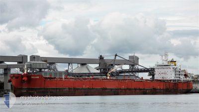
BALLARD
Tanker B
Current Trip
| Time Travelled | 11 days |
|---|---|
| Remaining Time | 8 days |
| Distance Travelled | 2969.93 nm |
| Remaining Distance | 2419.98 nm |
| AVG Speed | 10.1 Knots |
| MAX Speed | 13.6 Knots |
| AVG Wind | 9.4 knots |
| MAX Wind | 19 knots |
| MIN Temp | 26°C / 78.8°F |
| MAX Temp | 34.2°C / 93.56°F |
| Draught | 11.5 m |
| Position Received | 9 d ago |
Current Position
| Longitude | 57.27208° |
|---|---|
| Latitude | 24.80355° |
| Status | Under way using engine |
| Speed | 10.7 Knots |
| Course | 118.3° |
| Area | Gulf of Oman |
| Station | T-AIS |
| Position Received | 9 d ago |
Info
Information
The current position of BALLARD is in Gulf of Oman with coordinates 24.80355° / 57.27208° as reported on 2024-09-16 14:33 by AIS to our vessel tracker app. The vessel's current speed is 10.7 Knots and is heading at the port of BUNBURY. The estimated time of arrival as calculated by MyShipTracking vessel tracking app is 2024-10-04 12:32 LT
The vessel BALLARD (IMO: 9729738, MMSI: 258032000) is a Tanker B It's sailing under the flag of [NO] Norway.
In this page you can find informations about the vessels current position, last detected port calls, and current voyage information. If the vessels is not in coverage by AIS you will find the latest position.
The current position of BALLARD is detected by our AIS receivers and we are not responsible for the reliability of the data. The last position was recorded while the vessel was in Coverage by the Ais receivers of our vessel tracking app.
The current draught of BALLARD as reported by AIS is 11.5 meters
Weather
| Temperature | 27.5°C / 81.5°F |
|---|---|
| Wind Speed | 8 knots |
| Direction | 70° ENE |
| Pressure | 1008.8 hPa |
| Humidity | 76.8 % |
| Cloud Coverage | 70 % |
Featured Company
Last Port Calls
| Port | Arrival | Departure | Time In Port |
|---|---|---|---|
| 2024-09-11 11:33 | 2024-09-14 01:11 | 2 d | |
| 2024-09-05 14:32 | 2024-09-09 07:02 | 3 d | |
| 2024-08-15 23:07 | 2024-08-19 01:32 | 3 d | |
| 2024-08-05 10:01 | 2024-08-06 22:45 | 1 d | |
| 2024-07-19 01:45 | 2024-07-20 23:45 | 1 d | |
| 2024-07-11 05:46 | 2024-07-12 09:34 | 1 d |
Last Trips
| Origin | Departure | Destination | Arrival | Distance | |
|---|---|---|---|---|---|
| 2024-09-09 10:02 | 2024-09-11 14:33 | 164.53 nm | |||
| 2024-08-19 09:32 | 2024-09-05 17:32 | 5300.42 nm | |||
| 2024-08-07 06:45 | 2024-08-16 07:07 | 303.62 nm | |||
| 2024-07-21 07:45 | 2024-08-05 18:01 | 3547.49 nm | |||
| 2024-07-12 17:34 | 2024-07-19 09:45 | 1191.31 nm | |||
| 2024-06-25 18:30 | 2024-07-11 13:46 | 4519.46 nm |
Events
| Time | Event | Details | Position / Dest | Info |
|---|---|---|---|---|
| 2024-09-16 14:41 | Status Changed | Default Under way using engine |
24.79204 / 57.29369
AU BUY
|
Speed: 10.7 kn Course: 118.3° |
| 2024-09-16 14:33 | OUT of Coverage |
24.80355 / 57.27208
Gulf of Oman
AU BUY
|
Speed: 10.7 kn Course: 118.3° |
|
| 2024-09-16 11:07 | Change Sea Area | Omani part of the Gulf of Oman United Arab Emirates part of the Gulf of Oman |
25.05281 / 56.83743
Gulf of Oman
AU BUY
|
Speed: 6.5 kn Course: 118.9° |
| 2024-09-16 07:41 | START Moving | 9 nm, East of FUJAIRAH |
25.18865 / 56.52367
AU BUY
|
Speed: 3.1 kn Course: 40° |
| 2024-09-16 07:27 | Status Changed | Under way using engine At anchor |
25.18736 / 56.51829
AU BUY
|
Speed: 0.1 kn Course: 174° |
| 2024-09-16 07:19 | Destination Changed | AU BUY AU BUN |
25.18835 / 56.51873
AU BUY
|
Speed: 0.2 kn Course: 173° |
| 2024-09-16 06:41 | Destination Changed | AU BUN AU KWI |
25.18899 / 56.51863
AU BUN
|
Speed: Course: 161° |
| 2024-09-16 06:41 | ETA Changed | 2024/10/06 04:00 2024/10/03 04:00 |
25.18899 / 56.51863
AU BUN
|
Speed: Course: 161° |
| 2024-09-16 06:27 | Status Changed | At anchor Default |
25.18901 / 56.51881
AU KWI
|
Speed: 0.1 kn Course: 167° |
| 2024-09-16 06:21 | Status Changed | Default At anchor |
25.18897 / 56.51879
AU KWI
|
Speed: Course: 167° |