
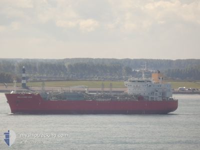
BALEARIC GAS
Tanker D
Current Trip
| Time Travelled | 5 days |
|---|---|
| Remaining Time | 27 days |
| Distance Travelled | 1779.91 nm |
| Remaining Distance | 10089.90 nm |
| AVG Speed | 14.1 Knots |
| MAX Speed | 16 Knots |
| AVG Wind | 12.4 knots |
| MAX Wind | 29.5 knots |
| MIN Temp | 10.8°C / 51.44°F |
| MAX Temp | 19.8°C / 67.64°F |
| Draught | 9.4 m |
| Position Received | Now |
Current Position
| Longitude | -16.41383° |
|---|---|
| Latitude | 27.91586° |
| Status | Under way using engine |
| Speed | 15.4 Knots |
| Course | 216.8° |
| Area | North Atlantic Ocean |
| Station | T-AIS |
| Position Received | Now |
Info
Information
The current position of BALEARIC GAS is in North Atlantic Ocean with coordinates 27.91586° / -16.41383° as reported on 2024-05-07 02:24 by AIS to our vessel tracker app. The vessel's current speed is 15.4 Knots and is heading at the port of SINGAPORE. The estimated time of arrival as calculated by MyShipTracking vessel tracking app is 2024-06-03 10:56 LT
The vessel BALEARIC GAS (IMO: 9682253, MMSI: 219674000) is a Tanker D It's sailing under the flag of [DK] Denmark.
In this page you can find informations about the vessels current position, last detected port calls, and current voyage information. If the vessels is not in coverage by AIS you will find the latest position.
The current position of BALEARIC GAS is detected by our AIS receivers and we are not responsible for the reliability of the data. The last position was recorded while the vessel was in Coverage by the Ais receivers of our vessel tracking app.
The current draught of BALEARIC GAS as reported by AIS is 9.4 meters
Weather
| Temperature | 19.3°C / 66.74°F |
|---|---|
| Wind Speed | 22 knots |
| Direction | 46° NE |
| Pressure | 1013.5 hPa |
| Humidity | 82.5 % |
| Cloud Coverage | 100 % |
Featured Company
Last Port Calls
| Port | Arrival | Departure | Time In Port |
|---|---|---|---|
| 2024-04-26 07:19 | 2024-05-01 22:43 | 5 d | |
| 2024-04-20 22:09 | 2024-04-24 11:06 | 3 d |
Most Visited Ports (Last year)
| Port | Arrivals | |
|---|---|---|
| 6 | ||
| 2 | ||
| 1 | ||
| 1 | ||
| 1 | ||
| 1 |
Last Trips
| Origin | Departure | Destination | Arrival | Distance | |
|---|---|---|---|---|---|
| 2024-04-24 13:06 | 2024-04-26 09:19 | 93.62 nm | |||
| 2024-02-06 07:00 | 2024-04-21 00:09 | 6679.57 nm |
Events
| Time | Event | Details | Position / Dest | Info |
|---|---|---|---|---|
| 2024-05-06 19:55 | Change Sea Area | Spanish (Canary Islands) part of the North Atlantic Ocean Portuguese (Madeira) part of the North Atlantic Ocean |
29.24243 / -15.29114
North Atlantic Ocean
NL VLI > SG SIN
|
Speed: 15.3 kn Course: 208.8° |
| 2024-05-06 18:59 | Status Changed | Under way using engine Default |
29.44607 / -15.14698
NL VLI > SG SIN
|
Speed: 15.2 kn Course: 214° |
| 2024-05-06 18:55 | Status Changed | Default Under way using engine |
29.45868 / -15.13718
NL VLI > SG SIN
|
Speed: 15.3 kn Course: 214.1° |
| 2024-05-06 18:47 | Status Changed | Under way using engine Default |
29.49042 / -15.11608
NL VLI > SG SIN
|
Speed: 15.3 kn Course: 208° |
| 2024-05-06 18:41 | Status Changed | Default Under way using engine |
29.51319 / -15.10230
NL VLI > SG SIN
|
Speed: 15.2 kn Course: 205.7° |
| 2024-05-06 18:13 | Destination Changed | NL VLI > SG SIN NLVLI - SGSIN |
29.61757 / -15.03724
NL VLI > SG SIN
|
Speed: 15.4 kn Course: 211.3° |
| 2024-05-06 17:48 | Status Changed | Under way using engine Default |
29.71321 / -14.97796
NLVLI - SGSIN
|
Speed: 15.3 kn Course: 207° |
| 2024-05-06 17:10 | Status Changed | Default Under way using engine |
29.85813 / -14.88945
NLVLI - SGSIN
|
Speed: 15.4 kn Course: 207.7° |
| 2024-05-06 16:58 | Status Changed | Under way using engine Default |
29.90124 / -14.86284
NLVLI - SGSIN
|
Speed: 15.6 kn Course: 207° |
| 2024-05-06 16:37 | Status Changed | Default Under way using engine |
29.98333 / -14.81333
NLVLI - SGSIN
|
Speed: 15.8 kn Course: 205.9° |