

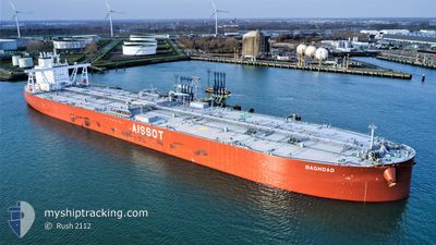
BAGHDAD
Tanker

Current Trip
| Time Travelled | --- |
|---|---|
| Remaining Time | --- |
| Distance Travelled | 3862.76 nm |
| Remaining Distance | --- |
| AVG Speed | 7.9 Knots |
| MAX Speed | 12.8 Knots |
| AVG Wind | 10.9 knots |
| MAX Wind | 32.3 knots |
| MIN Temp | -19°C / -2.2°F |
| MAX Temp | 26°C / 78.8°F |
| Draught | 10.8 m |
| Position Received | 17 h, 52 m ago |
Current Position
| Longitude | --- |
|---|---|
| Latitude | --- |
| Status | Under way using engine |
| Speed | 1.1 Knots |
| Course | 171° |
| Area | North Atlantic Ocean |
| Station | T-AIS |
| Position Received | 17 h, 52 m ago |
Information
The current position of BAGHDAD is in North Atlantic Ocean with coordinates 24.47503° / -79.64663° as reported on 2025-03-26 13:28 by AIS to our vessel tracker app. The vessel's current speed is 1.1 Knots
The vessel BAGHDAD (IMO: 9876414, MMSI: 636020128) is a Tanker It's sailing under the flag of [LR] Liberia.
In this page you can find informations about the vessels current position, last detected port calls, and current voyage information. If the vessels is not in coverage by AIS you will find the latest position.
The current position of BAGHDAD is detected by our AIS receivers and we are not responsible for the reliability of the data. The last position was recorded while the vessel was in Coverage by the Ais receivers of our vessel tracking app.
The current draught of BAGHDAD as reported by AIS is 10.8 meters
Weather
| Temperature | 24.5°C / 76.1°F |
|---|---|
| Wind Speed | 15 knots |
| Direction | 53° NE |
| Pressure | 1019.5 hPa |
| Humidity | 70.8 % |
| Cloud Coverage | --- |


Featured Company
Most Visited Ports (Last year)
| Port | Arrivals | |
|---|---|---|
| 1 | ||
| 1 | ||
| 1 | ||
| 1 | ||
| 1 |
Last Trips
| Origin | Departure | Destination | Arrival | Distance |
|---|
Events
| Time | Event | Details | Position / Dest | Info |
|---|---|---|---|---|
| 2025-03-27 04:32 | STOP Moving |
24.41513 / -79.81126
BS FPO>
|
Speed: 0.3 kn Course: 137° |
|
| 2025-03-26 13:29 | Status Changed | Default Under way using engine |
24.47473 / -79.64695
BS FPO>
|
Speed: 1.1 kn Course: 171° |
| 2025-03-26 13:28 | OUT of Coverage |
24.47503 / -79.64663
North Atlantic Ocean
|
Speed: 1.1 kn Course: 225.8° |
|
| 2025-03-26 13:16 | Status Changed | Under way using engine Default |
24.47736 / -79.64409
BS FPO>
|
Speed: 1 kn Course: 163° |
| 2025-03-26 12:53 | Status Changed | Default Under way using engine |
24.48224 / -79.63887
BS FPO>
|
Speed: 1 kn Course: 163° |
| 2025-03-26 12:52 | Status Changed | Under way using engine Default |
24.48246 / -79.63862
BS FPO>
|
Speed: 1 kn Course: 163° |
| 2025-03-26 12:52 | IN Coverage |
24.48246 / -79.63862
North Atlantic Ocean
|
Speed: 1 kn Course: 223.4° |
|
| 2025-03-26 09:07 | Status Changed | Default Under way using engine |
24.52559 / -79.60281
BS FPO>
|
Speed: 0.8 kn Course: 144° |
| 2025-03-26 08:59 | OUT of Coverage |
24.52686 / -79.60174
North Atlantic Ocean
|
Speed: 0.8 kn Course: 216.5° |
|
| 2025-03-26 08:58 | Status Changed | Under way using engine Default |
24.52700 / -79.60163
BS FPO>
|
Speed: 0.8 kn Course: 148° |