
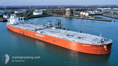
BAGHDAD
Tanker
Current Trip
| Time Travelled | 59 days |
|---|---|
| Remaining Time | --- |
| Distance Travelled | 3272.49 nm |
| Remaining Distance | --- |
| AVG Speed | 7.7 Knopen |
| MAX Speed | 12.8 Knopen |
| AVG Wind | 11.6 knots |
| MAX Wind | 32.3 knots |
| MIN Temp | -19°C / -2.2°F |
| MAX Temp | 26°C / 78.8°F |
| Diepgang | 10.8 M |
| Positie ontvangen | 1 m geleden |
Current Position
| Lengtegraad | --- |
|---|---|
| Breedtegraat | --- |
| Status | Under way using engine |
| Snelheid | 2.2 Knopen |
| Koers | 115° |
| Gebied | North Atlantic Ocean |
| Station | T-AIS |
| Positie ontvangen | 1 m geleden |
Information
The current position of BAGHDAD is in North Atlantic Ocean with coordinates 24.16921° / -79.46145° as reported on 2025-03-18 15:25 by AIS to our vessel tracker app. The vessel's current speed is 2.2 Knopen and is heading at the port of TERNEUZEN. The estimated time of arrival as calculated by MyShipTracking vessel tracking app is 2025-03-22 23:00 LT
The vessel BAGHDAD (IMO: 9876414, MMSI: 636020128) is a Tanker It's sailing under the flag of [LR] Liberia.
In this page you can find informations about the vessels current position, last detected port calls, and current voyage information. If the vessels is not in coverage by AIS you will find the latest position.
The current position of BAGHDAD is detected by our AIS receivers and we are not responsible for the reliability of the data. The last position was recorded while the vessel was in Coverage by the Ais receivers of our vessel tracking app.
The current draught of BAGHDAD as reported by AIS is 10.8 meters
Weather
| Temperature | 21.5°C / 70.7°F |
|---|---|
| Wind Speed | 18 knots |
| Direction | 25° NNE |
| Pressure | 1021.3 hPa |
| Humidity | 60.9 % |
| Cloud Coverage | --- |
Featured Company
Most Visited Ports (Last year)
| Port | Arrivals | |
|---|---|---|
| 1 | ||
| 1 | ||
| 1 | ||
| 1 | ||
| 1 |
Last Trips
| Origin | Departure | Destination | Arrival | Distance |
|---|
Events
| Tijd | Evenement | Details | Positie / Bestemming | Info |
|---|---|---|---|---|
| 2025-03-18 14:53 | ETA Changed | 2025/03/22 23:00 2025/03/21 23:00 |
24.18707 / -79.47385
FOR ORDERS
|
Snelheid: 2.3 kn Koers: 113° |
| 2025-03-18 14:17 | Status Changed | Under way using engine Default |
24.20646 / -79.48638
FOR ORDERS
|
Snelheid: 2.2 kn Koers: 109° |
| 2025-03-18 14:05 | Status Changed | Default Under way using engine |
24.21240 / -79.49062
FOR ORDERS
|
Snelheid: 2.3 kn Koers: 110° |
| 2025-03-18 13:41 | Status Changed | Under way using engine Default |
24.22496 / -79.49936
FOR ORDERS
|
Snelheid: 2.1 kn Koers: 106° |
| 2025-03-18 13:41 | Binnenbereik |
24.22473 / -79.49918
North Atlantic Ocean
FOR ORDERS
|
Snelheid: 2.1 kn Koers: 144.9° |
|
| 2025-03-17 09:31 | Status Changed | Default Under way using engine |
24.81526 / -79.49877
FOR ORDERS
|
Snelheid: 2.4 kn Koers: 91° |
| 2025-03-17 09:12 | Buitenbereik |
24.80669 / -79.50984
North Atlantic Ocean
FOR ORDERS
|
Snelheid: 2.4 kn Koers: 47.8° |
|
| 2025-03-17 09:00 | Status Changed | Under way using engine Default |
24.80134 / -79.51556
FOR ORDERS
|
Snelheid: 2.4 kn Koers: 80° |
| 2025-03-17 09:00 | Binnenbereik |
24.80134 / -79.51556
North Atlantic Ocean
FOR ORDERS
|
Snelheid: 2.4 kn Koers: 40.8° |
|
| 2025-03-17 05:12 | Buitenbereik |
24.67652 / -79.60237
North Atlantic Ocean
FOR ORDERS
|
Snelheid: 2.8 kn Koers: 36.4° |