

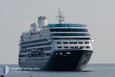
AZAMARA JOURNEY
Passengers Ship

Current Trip
| Time Travelled | 3 days |
|---|---|
| Remaining Time | --- |
| Distance Travelled | 977.42 nm |
| Remaining Distance | --- |
| AVG Speed | 15.4 Knots |
| MAX Speed | 20.5 Knots |
| AVG Wind | 3.6 knots |
| MAX Wind | 15.8 knots |
| MIN Temp | 22.2°C / 71.96°F |
| MAX Temp | 31.1°C / 87.98°F |
| Draught | 5.8 m |
| Position Received | 2 d ago |
Current Position
| Longitude | --- |
|---|---|
| Latitude | --- |
| Status | Under way using engine |
| Speed | 12.8 Knots |
| Course | 12.8° |
| Area | South Atlantic Ocean |
| Station | T-AIS |
| Position Received | 2 d ago |
Information
The current position of AZAMARA JOURNEY is in South Atlantic Ocean with coordinates -2.96375° / -58.15179° as reported on 2025-03-16 04:09 by AIS to our vessel tracker app. The vessel's current speed is 12.8 Knots and is heading at the port of PARINTINS. The estimated time of arrival as calculated by MyShipTracking vessel tracking app is 2025-03-16 09:00 LT
The vessel AZAMARA JOURNEY (IMO: 9200940, MMSI: 256204000) is a Passengers Ship that was built in 2000 ( 25 years old ). It's sailing under the flag of [MT] Malta.
In this page you can find informations about the vessels current position, last detected port calls, and current voyage information. If the vessels is not in coverage by AIS you will find the latest position.
The current position of AZAMARA JOURNEY is detected by our AIS receivers and we are not responsible for the reliability of the data. The last position was recorded while the vessel was in Coverage by the Ais receivers of our vessel tracking app.
The current draught of AZAMARA JOURNEY as reported by AIS is 5.8 meters
Weather
| Temperature | 27.1°C / 80.78°F |
|---|---|
| Wind Speed | 15 knots |
| Direction | 62° ENE |
| Pressure | 1013.4 hPa |
| Humidity | 81.1 % |
| Cloud Coverage | 100 % |


Featured Company
Last Port Calls
| Port | Arrival | Departure | Time In Port |
|---|---|---|---|
| 2025-03-14 07:33 | 2025-03-15 15:20 | 1 d | |
| 2025-03-06 12:47 | 2025-03-07 00:14 | 11 h | |
| 2025-03-02 08:30 | 2025-03-04 13:18 | 2 d | |
| 2025-02-27 07:14 | 2025-02-27 17:30 | 10 h | |
| 2025-02-24 05:52 | 2025-02-26 22:44 | 2 d | |
| 2025-02-22 16:26 | 2025-02-23 18:46 | 1 d | |
| 2025-02-20 09:04 | 2025-02-20 18:22 | 9 h | |
| 2025-02-11 01:09 | 2025-02-11 22:08 | 20 h | |
| 2025-02-09 06:04 | 2025-02-09 22:21 | 16 h | |
| 2025-02-04 16:49 | 2025-02-04 22:47 | 5 h |
Last Trips
| Origin | Departure | Destination | Arrival | Distance | |
|---|---|---|---|---|---|
| 2025-03-07 00:14 | 2025-03-14 07:33 | 2432.00 nm | |||
| 2025-03-04 13:18 | 2025-03-06 12:47 | 754.73 nm | |||
| 2025-02-27 17:30 | 2025-03-02 08:30 | 1036.75 nm | |||
| 2025-02-26 22:44 | 2025-02-27 07:14 | 131.17 nm | |||
| 2025-02-23 18:46 | 2025-02-24 05:52 | 130.89 nm | |||
| 2025-02-20 18:22 | 2025-02-22 16:26 | 720.18 nm | |||
| 2025-02-11 22:08 | 2025-02-20 09:04 | 2686.60 nm | |||
| 2025-02-09 22:21 | 2025-02-11 01:09 | 371.70 nm | |||
| 2025-02-04 22:47 | 2025-02-09 06:04 | 1247.91 nm | |||
| 2025-02-02 17:29 | 2025-02-04 16:49 | 600.47 nm |
Events
| Time | Event | Details | Position / Dest | Info |
|---|---|---|---|---|
| 2025-03-17 09:54 | STOP Moving | 2.59 nm, West of SANTAREM |
-2.39914 / -54.75180
BR MAO > BR PIN
|
Speed: Course: 355° |
| 2025-03-16 14:05 | STOP Moving | 0.94 nm, North of PARINTINS |
-2.60857 / -56.73274
BR MAO > BR PIN
|
Speed: Course: 282° |
| 2025-03-16 04:13 | Status Changed | Default Under way using engine |
-2.95049 / -58.14828
BR MAO > BR PIN
|
Speed: 12.8 kn Course: 12.8° |
| 2025-03-16 04:09 | OUT of Coverage |
-2.96375 / -58.15179
South Atlantic Ocean
BR MAO > BR PIN
|
Speed: 12.8 kn Course: 12.8° |
|
| 2025-03-16 03:43 | Status Changed | Under way using engine Default |
-3.06256 / -58.17048
BR MAO > BR PIN
|
Speed: 13.9 kn Course: 360° |
| 2025-03-16 03:34 | Status Changed | Default Under way using engine |
-3.09641 / -58.16978
BR MAO > BR PIN
|
Speed: 13.6 kn Course: 3.7° |
| 2025-03-16 00:00 | Status Changed | Under way using engine Default |
-3.32944 / -58.81790
BR MAO > BR PIN
|
Speed: 19 kn Course: 119° |
| 2025-03-15 23:56 | Status Changed | Default Under way using engine |
-3.32052 / -58.83440
BR MAO > BR PIN
|
Speed: 19.2 kn Course: 122.5° |
| 2025-03-15 23:49 | Status Changed | Under way using engine Default |
-3.29834 / -58.86906
BR MAO > BR PIN
|
Speed: 19.6 kn Course: 126° |
| 2025-03-15 23:39 | IN Coverage |
-3.30194 / -58.86435
South Atlantic Ocean
BR MAO > BR PIN
|
Speed: 19.4 kn Course: 126.4° |