
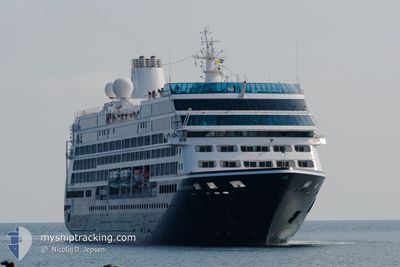
AZAMARA JOURNEY
Passengers Ship
Current Trip
FK PSY
| Time Travelled | 5 days |
|---|---|
| Remaining Time | --- |
| Distance Travelled | 1852.24 nm |
| Remaining Distance | --- |
| AVG Speed | 12.5 Knopen |
| MAX Speed | 18.1 Knopen |
| AVG Wind | 7.9 knots |
| MAX Wind | 20.9 knots |
| MIN Temp | -5.1°C / 22.82°F |
| MAX Temp | 5.4°C / 41.72°F |
| Diepgang | 5.8 M |
| Positie ontvangen | 1 d geleden |
Current Position
| Lengtegraad | --- |
|---|---|
| Breedtegraat | --- |
| Status | Under way using engine |
| Snelheid | 16.1 Knopen |
| Koers | 355.8° |
| Gebied | Southern Ocean |
| Station | T-AIS |
| Positie ontvangen | 1 d geleden |
Info
Information
The current position of AZAMARA JOURNEY is in Southern Ocean with coordinates -64.62424° / -64.83069° as reported on 2025-02-16 01:19 by AIS to our vessel tracker app. The vessel's current speed is 16.1 Knopen
The vessel AZAMARA JOURNEY (IMO: 9200940, MMSI: 256204000) is a Passengers Ship that was built in 2000 ( 25 Jaar oud ). It's sailing under the flag of [MT] Malta.
In this page you can find informations about the vessels current position, last detected port calls, and current voyage information. If the vessels is not in coverage by AIS you will find the latest position.
The current position of AZAMARA JOURNEY is detected by our AIS receivers and we are not responsible for the reliability of the data. The last position was recorded while the vessel was in Coverage by the Ais receivers of our vessel tracking app.
The current draught of AZAMARA JOURNEY as reported by AIS is 5.8 meters
Weather
| Temperature | 5.2°C / 41.36°F |
|---|---|
| Wind Speed | 21 knots |
| Direction | 269° W |
| Pressure | 1006.4 hPa |
| Humidity | 68.6 % |
| Cloud Coverage | 93 % |
Featured Company
Last Port Calls
| Port | Arrival | Departure | Time In Port |
|---|---|---|---|
| 2025-02-11 04:09 | 2025-02-12 01:08 | 20 h | |
| 2025-02-09 09:04 | 2025-02-10 01:21 | 16 h | |
| 2025-02-04 19:49 | 2025-02-05 01:47 | 5 h | |
| 2025-02-01 11:18 | 2025-02-02 20:29 | 1 d | |
| 2025-01-29 11:18 | 2025-01-30 01:08 | 13 h | |
| 2025-01-28 10:16 | 2025-01-28 19:49 | 9 h | |
| 2025-01-27 10:30 | 2025-01-28 01:42 | 15 h | |
| 2025-01-22 17:53 | 2025-01-24 23:30 | 2 d | |
| 2025-01-21 12:00 | 2025-01-21 22:17 | 10 h | |
| 2025-01-18 12:27 | 2025-01-18 19:23 | 6 h |
Last Trips
| Origin | Departure | Destination | Arrival | Distance | |
|---|---|---|---|---|---|
| 2025-02-09 22:21 | 2025-02-11 01:09 | 371.70 nm | |||
| 2025-02-04 22:47 | 2025-02-09 06:04 | 1247.91 nm | |||
| 2025-02-02 17:29 | 2025-02-04 16:49 | 600.47 nm | |||
| 2025-01-29 22:08 | 2025-02-01 08:18 | 636.06 nm | |||
| 2025-01-28 16:49 | 2025-01-29 08:18 | 224.02 nm | |||
| 2025-01-27 22:42 | 2025-01-28 07:16 | 114.93 nm | |||
| 2025-01-24 18:30 | 2025-01-27 07:30 | 634.77 nm | |||
| 2025-01-21 17:17 | 2025-01-22 12:53 | 270.13 nm | |||
| 2025-01-18 14:23 | 2025-01-21 07:00 | 672.61 nm | |||
| 2025-01-15 11:10 | 2025-01-18 07:27 | 918.58 nm |
Events
| Tijd | Evenement | Details | Positie / Bestemming | Info |
|---|---|---|---|---|
| 2025-02-16 01:24 | Status Changed | Default Under way using engine |
-64.60313 / -64.83223
FK PSY
|
Snelheid: 16.1 kn Koers: 355.8° |
| 2025-02-16 01:19 | Buitenbereik |
-64.62424 / -64.83069
Southern Ocean
FK PSY
|
Snelheid: 16.1 kn Koers: 355.8° |
|
| 2025-02-15 23:33 | Destination Changed | FK PSY PARADISE BAY |
-64.94099 / -64.36878
FK PSY
|
Snelheid: 13.9 kn Koers: 288.3° |
| 2025-02-15 23:33 | ETA Changed | 2025/02/18 09:30 2025/02/14 14:30 |
-64.94099 / -64.36878
FK PSY
|
Snelheid: 13.9 kn Koers: 288.3° |
| 2025-02-15 21:22 | Status Changed | Under way using engine Default |
-64.91197 / -63.65833
PARADISE BAY
|
Snelheid: 10.7 kn Koers: 174° |
| 2025-02-15 21:18 | Status Changed | Default Under way using engine |
-64.89902 / -63.66164
PARADISE BAY
|
Snelheid: 10.8 kn Koers: 172.8° |
| 2025-02-15 21:08 | Status Changed | Under way using engine Default |
-64.87185 / -63.66856
PARADISE BAY
|
Snelheid: 10.4 kn Koers: 207° |
| 2025-02-15 20:57 | Status Changed | Default Under way using engine |
-64.84325 / -63.63870
PARADISE BAY
|
Snelheid: 10.6 kn Koers: 211° |
| 2025-02-15 20:23 | Status Changed | Under way using engine Default |
-64.78035 / -63.47129
PARADISE BAY
|
Snelheid: 6.5 kn Koers: 257° |
| 2025-02-15 20:15 | Status Changed | Default Under way using engine |
-64.77910 / -63.43622
PARADISE BAY
|
Snelheid: 8.1 kn Koers: 275.8° |