
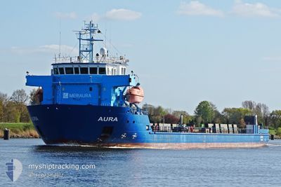
AURA
Cable Layer
Current Trip
| Time Travelled | 17 h, 19 mins |
|---|---|
| Remaining Time | --- |
| Distance Travelled | 169.07 nm |
| Remaining Distance | --- |
| AVG Speed | 10.4 Knots |
| MAX Speed | 12.3 Knots |
| AVG Wind | 21.1 knots |
| MAX Wind | 29.4 knots |
| MIN Temp | 6.1°C / 42.98°F |
| MAX Temp | 9.5°C / 49.1°F |
| Draught | 4 m |
| Position Received | 1 h, 13 m ago |
Current Position
| Longitude | --- |
|---|---|
| Latitude | --- |
| Status | Under way using engine |
| Speed | 10.8 Knots |
| Course | 314.4° |
| Area | Gulf of Bothnia |
| Station | T-AIS |
| Position Received | 1 h, 13 m ago |
Info
Information
The current position of AURA is in Gulf of Bothnia with coordinates 60.70128° / 20.99447° as reported on 2024-11-26 12:13 by AIS to our vessel tracker app. The vessel's current speed is 10.8 Knots and is heading at the port of KEMI. The estimated time of arrival as calculated by MyShipTracking vessel tracking app is 2024-11-28 00:00 LT
The vessel AURA (IMO: 9395276, MMSI: 230601000) is a Cable Layer that was built in 2008 ( 16 years old ). It's sailing under the flag of [FI] Finland.
In this page you can find informations about the vessels current position, last detected port calls, and current voyage information. If the vessels is not in coverage by AIS you will find the latest position.
The current position of AURA is detected by our AIS receivers and we are not responsible for the reliability of the data. The last position was recorded while the vessel was in Coverage by the Ais receivers of our vessel tracking app.
The current draught of AURA as reported by AIS is 4 meters
Weather
| Temperature | 6.4°C / 43.52°F |
|---|---|
| Wind Speed | 18 knots |
| Direction | 206° SSW |
| Pressure | 1004 hPa |
| Humidity | 82.7 % |
| Cloud Coverage | 100 % |
Featured Company
Last Port Calls
| Port | Arrival | Departure | Time In Port |
|---|---|---|---|
| 2024-11-24 22:06 | 2024-11-25 22:07 | 1 d | |
| 2024-11-16 13:01 | 2024-11-18 12:40 | 1 d | |
| 2024-11-10 20:17 | 2024-11-13 20:24 | 3 d | |
| 2024-11-08 15:38 | 2024-11-09 16:49 | 1 d | |
| 2024-11-06 09:06 | 2024-11-07 14:37 | 1 d | |
| 2024-10-30 10:21 | 2024-10-30 10:49 | 27 m | |
| 2024-10-24 13:43 | 2024-10-27 06:18 | 2 d | |
| 2024-10-21 13:34 | 2024-10-21 14:11 | 37 m | |
| 2024-10-17 06:21 | 2024-10-18 14:21 | 1 d | |
| 2024-10-09 12:56 | 2024-10-14 17:51 | 5 d |
Most Visited Ports (Last year)
| Port | Arrivals | |
|---|---|---|
| 8 | ||
| 4 | ||
| 4 | ||
| 4 | ||
| 4 | ||
| 2 |
Last Trips
| Origin | Departure | Destination | Arrival | Distance | |
|---|---|---|---|---|---|
| 2024-11-18 12:40 | 2024-11-24 22:06 | 1482.01 nm | |||
| 2024-11-13 20:24 | 2024-11-16 13:01 | 517.91 nm | |||
| 2024-11-09 16:49 | 2024-11-10 20:17 | 279.45 nm | |||
| 2024-11-07 14:37 | 2024-11-08 15:38 | 205.98 nm | |||
| 2024-10-30 10:49 | 2024-11-06 09:06 | 1531.44 nm | |||
| 2024-10-27 06:18 | 2024-10-30 10:21 | 924.71 nm | |||
| 2024-10-21 14:11 | 2024-10-24 13:43 | 763.54 nm | |||
| 2024-10-18 14:21 | 2024-10-21 13:34 | 418.04 nm | |||
| 2024-10-14 17:51 | 2024-10-17 06:21 | 475.24 nm | |||
| 2024-10-05 12:53 | 2024-10-09 12:56 | 949.12 nm |
Events
| Time | Event | Details | Position / Dest | Info |
|---|---|---|---|---|
| 2024-11-26 12:14 | Status Changed | Default Under way using engine |
60.70376 / 20.98936
FIKEM
|
Speed: 10.8 kn Course: 314.4° |
| 2024-11-26 12:13 | OUT of Coverage |
60.70128 / 20.99447
Gulf of Bothnia
FIKEM
|
Speed: 10.8 kn Course: 314.4° |
|
| 2024-11-26 12:03 | Status Changed | Under way using engine Default |
60.68045 / 21.03589
FIKEM
|
Speed: 10.8 kn Course: 341° |
| 2024-11-26 12:03 | IN Coverage |
60.68085 / 21.03542
Gulf of Bothnia
FIKEM
|
Speed: 10.9 kn Course: 329.9° |
|
| 2024-11-26 09:59 | Status Changed | Default Under way using engine |
60.45549 / 21.48630
FIKEM
|
Speed: 10.5 kn Course: 310.9° |
| 2024-11-26 09:29 | OUT of Coverage |
60.38334 / 21.58009
Gulf of Bothnia
FIKEM
|
Speed: 10.5 kn Course: 310.9° |
|
| 2024-11-26 03:07 | Change Sea Area | Finnish part of the Gulf of Bothnia Finnish part of the Baltic Sea |
59.79889 / 22.86704
Gulf of Bothnia
FIKEM
|
Speed: 10.7 kn Course: 321.2° |
| 2024-11-26 02:58 | Change Sea Area | Finnish part of the Baltic Sea Finnish part of the Gulf of Finland |
59.78355 / 22.90701
Baltic Sea
FIKEM
|
Speed: 10.1 kn Course: 278.6° |
| 2024-11-26 01:49 | Status Changed | Under way using engine Default |
59.63528 / 23.08066
FIKEM
|
Speed: 10.3 kn Course: 353° |
| 2024-11-26 01:43 | Change Sea Area | Finnish part of the Gulf of Finland Finnish part of the Baltic Sea |
59.61541 / 23.08503
Gulf of Finland
FIKEM
|
Speed: 10.6 kn Course: 350.8° |