
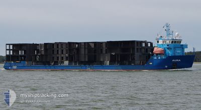
AURA
Cable Layer
Current Trip
| Time Travelled | 4 days |
|---|---|
| Remaining Time | 5 h, 37 mins |
| Distance Travelled | 767.80 nm |
| Remaining Distance | 65.80 nm |
| AVG Speed | 10.6 Noeuds |
| MAX Speed | 12.3 Noeuds |
| AVG Wind | 15.4 knots |
| MAX Wind | 25 knots |
| MIN Temp | -1°C / 30.2°F |
| MAX Temp | 5.7°C / 42.26°F |
| Tirant d eau | 3.9 m |
| Position reçue | Maintenant |
Current Position
| Longitude | 13.21532° |
|---|---|
| Latitude | 54.88696° |
| Etat | Under way using engine |
| Vitesse | 11.2 Noeuds |
| Parcours | 252.1° |
| Zone | Baltic Sea |
| Station | T-AIS |
| Position reçue | Maintenant |
Info
Information
The current position of AURA is in Baltic Sea with coordinates 54.88696° / 13.21532° as reported on 2024-04-24 14:55 by AIS to our vessel tracker app. The vessel's current speed is 11.2 Noeuds and is heading at the port of ROSTOCK. The estimated time of arrival as calculated by MyShipTracking vessel tracking app is 2024-04-24 20:33 LT
The vessel AURA (IMO: 9395276, MMSI: 230601000) is a Cable Layer that was built in 2008 ( 16 Age ). It's sailing under the flag of [FI] Finland.
In this page you can find informations about the vessels current position, last detected port calls, and current voyage information. If the vessels is not in coverage by AIS you will find the latest position.
The current position of AURA is detected by our AIS receivers and we are not responsible for the reliability of the data. The last position was recorded while the vessel was in Coverage by the Ais receivers of our vessel tracking app.
The current draught of AURA as reported by AIS is 3.9 meters
Weather
| Temperature | 5.6°C / 42.08°F |
|---|---|
| Wind Speed | 15 knots |
| Direction | 97° E |
| Pressure | 1006.9 hPa |
| Humidity | 75 % |
| Cloud Coverage | 38 % |
Featured Company
Last Port Calls
| Port | Arrival | Departure | Time In Port |
|---|---|---|---|
| 2024-04-19 04:47 | 2024-04-20 10:43 | 1 d | |
| 2024-04-17 04:04 | 2024-04-17 16:09 | 12 h | |
| 2024-04-09 10:18 | 2024-04-11 14:03 | 2 d | |
| 2024-03-25 19:45 | 2024-04-02 12:45 | 7 d | |
| 2024-03-08 06:20 | 2024-03-20 07:58 | 12 d | |
| 2024-02-29 07:40 | 2024-03-02 05:40 | 1 d | |
| 2024-02-17 17:03 | 2024-02-21 22:11 | 4 d | |
| 2024-02-07 11:41 | 2024-02-11 14:52 | 4 d | |
| 2024-02-02 07:47 |
Last Trips
| Origin | Departure | Destination | Arrival | Distance | |
|---|---|---|---|---|---|
| 2024-04-17 18:09 | 2024-04-19 07:47 | 337.48 nm | |||
| 2024-04-11 15:03 | 2024-04-17 06:04 | 1289.69 nm | |||
| 2024-04-02 14:45 | 2024-04-09 11:18 | 1282.43 nm | |||
| 2024-03-20 10:58 | 2024-03-25 20:45 | 1420.89 nm | |||
| 2024-03-02 06:40 | 2024-03-08 09:20 | 1375.12 nm | |||
| 2024-02-22 01:11 | 2024-02-29 08:40 | 1517.03 nm | |||
| 2024-02-11 15:52 | 2024-02-17 20:03 | 1412.72 nm | |||
| 2024-02-02 10:47 | 2024-02-07 12:41 | 1412.47 nm |
Events
| Heure | Evenement | Détails | Position/ Destination | Info |
|---|---|---|---|---|
| 2024-04-24 12:59 | Detecté en mer | German part of the Baltic Sea |
55.01079 / 13.82047
Baltic Sea
ROSTOCK
|
Vitesse: 11.3 kn Parcours: 250.4° |
| 2024-04-24 09:23 | Detecté en mer | Swedish part of the Baltic Sea |
55.44710 / 14.66219
Baltic Sea
ROSTOCK
|
Vitesse: 11.1 kn Parcours: 241.3° |
| 2024-04-24 07:20 | Changement de zone | Danish part of the Kattegat Swedish part of the Baltic Sea |
55.63884 / 15.24940
Kattegat
ROSTOCK
|
Vitesse: 11.2 kn Parcours: 241.2° |
| 2024-04-24 02:17 | Etat Changé | Under way using engine Default |
56.10254 / 16.66389
ROSTOCK
|
Vitesse: 10.7 kn Parcours: 239° |
| 2024-04-24 02:12 | Etat Changé | Default Under way using engine |
56.11023 / 16.68678
ROSTOCK
|
Vitesse: 10.7 kn Parcours: 239.1° |
| 2024-04-24 01:52 | Changement de zone | Swedish part of the Baltic Sea Finnish part of the Baltic Sea |
56.14284 / 16.78004
Baltic Sea
ROSTOCK
|
Vitesse: 10.7 kn Parcours: 236.7° |
| 2024-04-24 01:51 | Etat Changé | Under way using engine Default |
56.14340 / 16.78159
ROSTOCK
|
Vitesse: 10.6 kn Parcours: 237° |
| 2024-04-24 01:39 | Dans la zone couverte |
56.14284 / 16.78004
Baltic Sea
ROSTOCK
|
Vitesse: 10.7 kn Parcours: 236.7° |
|
| 2024-04-23 02:00 | Etat Changé | Default Under way using engine |
59.45227 / 21.11035
ROSTOCK
|
Vitesse: 10.2 kn Parcours: 205.3° |
| 2024-04-23 01:43 | Hors de la zone couverte |
59.49678 / 21.14921
Baltic Sea
ROSTOCK
|
Vitesse: 10.2 kn Parcours: 205.3° |