
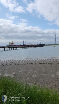
ATLANTIC TWIN
Oil/Chemical Tanker
Current Trip
| Time Travelled | 2 days |
|---|---|
| Remaining Time | 8 h, 46 mins |
| Distance Travelled | 644.97 nm |
| Remaining Distance | 126.45 nm |
| AVG Speed | 11.7 Knots |
| MAX Speed | 14.9 Knots |
| AVG Wind | 9.3 knots |
| MAX Wind | 16.2 knots |
| MIN Temp | 4.1°C / 39.38°F |
| MAX Temp | 11°C / 51.8°F |
| Draught | 6.5 m |
| Position Received | 1 h, 39 m ago |
Current Position
| Longitude | --- |
|---|---|
| Latitude | --- |
| Status | Under way using engine |
| Speed | 14.3 Knots |
| Course | 46.9° |
| Area | North Sea |
| Station | T-AIS |
| Position Received | 1 h, 39 m ago |
Info
Information
The current position of ATLANTIC TWIN is in North Sea with coordinates 51.11457° / 1.77586° as reported on 2024-11-28 23:25 by AIS to our vessel tracker app. The vessel's current speed is 14.3 Knots and is heading at the port of AMSTERDAM. The estimated time of arrival as calculated by MyShipTracking vessel tracking app is 2024-11-29 09:50 LT
The vessel ATLANTIC TWIN (IMO: 9341328, MMSI: 236112059) is a Oil/Chemical Tanker that was built in 2008 ( 16 years old ). It's sailing under the flag of [GI] Gibraltar.
In this page you can find informations about the vessels current position, last detected port calls, and current voyage information. If the vessels is not in coverage by AIS you will find the latest position.
The current position of ATLANTIC TWIN is detected by our AIS receivers and we are not responsible for the reliability of the data. The last position was recorded while the vessel was in Coverage by the Ais receivers of our vessel tracking app.
The current draught of ATLANTIC TWIN as reported by AIS is 6.5 meters
Weather
| Temperature | 8.2°C / 46.76°F |
|---|---|
| Wind Speed | 12 knots |
| Direction | 158° SSE |
| Pressure | 1030.4 hPa |
| Humidity | 78.6 % |
| Cloud Coverage | 10 % |
Featured Company
Last Port Calls
| Port | Arrival | Departure | Time In Port |
|---|---|---|---|
| 2024-11-26 17:50 | 2024-11-26 18:43 | 52 m | |
| 2024-11-25 11:36 | 2024-11-26 17:21 | 1 d | |
| 2024-11-25 07:03 | 2024-11-25 11:04 | 4 h | |
| 2024-11-23 04:29 | 2024-11-24 04:57 | 1 d | |
| 2024-11-20 17:07 | 2024-11-21 20:10 | 1 d | |
| 2024-11-17 14:59 | 2024-11-18 15:36 | 1 d | |
| 2024-11-11 18:50 | 2024-11-13 02:37 | 1 d | |
| 2024-11-08 22:09 | 2024-11-10 12:06 | 1 d | |
| 2024-11-03 17:13 | 2024-11-03 17:22 | 9 m | |
| 2024-10-31 16:53 | 2024-11-02 09:09 | 1 d |
Last Trips
| Origin | Departure | Destination | Arrival | Distance | |
|---|---|---|---|---|---|
| 2024-11-26 17:21 | 2024-11-26 17:50 | 1.88 nm | |||
| 2024-11-25 11:04 | 2024-11-25 11:36 | 1.47 nm | |||
| 2024-11-24 04:57 | 2024-11-25 07:03 | 242.70 nm | |||
| 2024-11-21 20:10 | 2024-11-23 04:29 | 307.65 nm | |||
| 2024-11-18 16:36 | 2024-11-20 17:07 | 536.16 nm | |||
| 2024-11-13 03:37 | 2024-11-17 15:59 | 276.61 nm | |||
| 2024-11-10 13:06 | 2024-11-11 19:50 | 348.69 nm | |||
| 2024-11-03 17:22 | 2024-11-08 23:09 | 661.51 nm | |||
| 2024-11-02 10:09 | 2024-11-03 17:13 | 366.26 nm | |||
| 2024-10-28 23:54 | 2024-10-31 17:53 | 449.65 nm |
Events
| Time | Event | Details | Position / Dest | Info |
|---|---|---|---|---|
| 2024-11-28 23:33 | Status Changed | Default Under way using engine |
51.13605 / 1.81178
NL AMS
|
Speed: 14.3 kn Course: 46.9° |
| 2024-11-28 23:25 | OUT of Coverage |
51.11457 / 1.77586
North Sea
NL AMS
|
Speed: 14.3 kn Course: 46.9° |
|
| 2024-11-28 23:19 | Status Changed | Under way using engine Default |
51.09922 / 1.75184
NL AMS
|
Speed: 14.4 kn Course: 43° |
| 2024-11-28 23:17 | Status Changed | Default Under way using engine |
51.09130 / 1.74022
NL AMS
|
Speed: 14.5 kn Course: 42.8° |
| 2024-11-28 22:59 | Change Sea Area | French part of the North Sea French part of the English Channel |
51.03779 / 1.66353
North Sea
NL AMS
|
Speed: 14.5 kn Course: 41.8° |
| 2024-11-28 22:59 | Status Changed | Under way using engine Default |
51.03779 / 1.66353
NL AMS
|
Speed: 14.6 kn Course: 44° |
| 2024-11-28 22:41 | Status Changed | Default Under way using engine |
50.98655 / 1.57845
NL AMS
|
Speed: 14.8 kn Course: 41.1° |
| 2024-11-28 22:35 | Status Changed | Under way using engine Default |
50.96993 / 1.55520
NL AMS
|
Speed: 14.9 kn Course: 41° |
| 2024-11-28 22:33 | Status Changed | Default Under way using engine |
50.96185 / 1.54399
NL AMS
|
Speed: 14.7 kn Course: 31.8° |
| 2024-11-28 22:24 | Status Changed | Under way using engine Default |
50.93485 / 1.50932
NL AMS
|
Speed: 14.8 kn Course: 24° |