
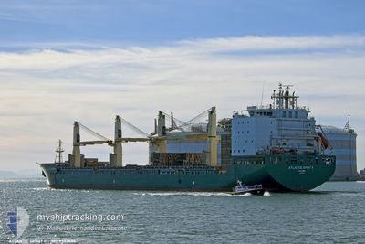
ATLANTIC SPIRIT II
General Cargo
Current Trip
| Time Travelled | 5 h, 54 mins |
|---|---|
| Remaining Time | 2 days |
| Distance Travelled | 41.92 nm |
| Remaining Distance | 759.15 nm |
| AVG Speed | 12.3 Knots |
| MAX Speed | 13.4 Knots |
| AVG Wind | 7 knots |
| MAX Wind | 10 knots |
| MIN Temp | 12.5°C / 54.5°F |
| MAX Temp | 13.8°C / 56.84°F |
| Draught | 8.5 m |
| Position Received | 1 h, 41 m ago |
Current Position
| Longitude | --- |
|---|---|
| Latitude | --- |
| Status | Under way using engine |
| Speed | 13 Knots |
| Course | 244.7° |
| Area | Sea of Marmara |
| Station | T-AIS |
| Position Received | 1 h, 41 m ago |
Info
Information
The current position of ATLANTIC SPIRIT II is in Sea of Marmara with coordinates 40.76421° / 27.59952° as reported on 2024-11-22 12:26 by AIS to our vessel tracker app. The vessel's current speed is 13 Knots and is heading at the port of MERSIN. The estimated time of arrival as calculated by MyShipTracking vessel tracking app is 2024-11-25 01:09 LT
The vessel ATLANTIC SPIRIT II (IMO: 9594509, MMSI: 538010610) is a General Cargo that was built in 2012 ( 12 years old ). It's sailing under the flag of [MH] Marshall Is.
In this page you can find informations about the vessels current position, last detected port calls, and current voyage information. If the vessels is not in coverage by AIS you will find the latest position.
The current position of ATLANTIC SPIRIT II is detected by our AIS receivers and we are not responsible for the reliability of the data. The last position was recorded while the vessel was in Coverage by the Ais receivers of our vessel tracking app.
The current draught of ATLANTIC SPIRIT II as reported by AIS is 8.5 meters
Weather
| Temperature | 15.8°C / 60.44°F |
|---|---|
| Wind Speed | 7 knots |
| Direction | 211° SSW |
| Pressure | 1009.6 hPa |
| Humidity | 60.5 % |
| Cloud Coverage | 100 % |
Featured Company
Last Port Calls
| Port | Arrival | Departure | Time In Port |
|---|---|---|---|
| 2024-11-21 18:00 | 2024-11-22 08:13 | 14 h | |
| 2024-11-20 19:57 | 2024-11-21 11:12 | 15 h | |
| 2024-11-17 05:57 | 2024-11-17 15:24 | 9 h | |
| 2024-11-12 21:33 | 2024-11-14 01:40 | 1 d | |
| 2024-11-07 22:13 | 2024-11-10 13:11 | 2 d | |
| 2024-11-04 05:04 | 2024-11-04 14:14 | 9 h | |
| 2024-10-31 10:19 | 2024-11-02 02:48 | 1 d | |
| 2024-10-26 04:34 | 2024-10-26 18:40 | 14 h | |
| 2024-10-24 22:44 | 2024-10-25 15:43 | 16 h | |
| 2024-10-20 22:11 | 2024-10-21 15:18 | 17 h |
Most Visited Ports (Last year)
| Port | Arrivals | |
|---|---|---|
| 9 | ||
| 8 | ||
| 7 | ||
| 5 | ||
| 5 | ||
| 4 |
Last Trips
| Origin | Departure | Destination | Arrival | Distance | |
|---|---|---|---|---|---|
| 2024-11-21 14:12 | 2024-11-21 21:00 | 61.69 nm | |||
| 2024-11-14 04:40 | 2024-11-20 22:57 | 1568.80 nm | |||
| 2024-11-14 04:40 | 2024-11-17 07:57 | 640.14 nm | |||
| 2024-11-10 15:11 | 2024-11-13 00:33 | 230.51 nm | |||
| 2024-11-02 05:48 | 2024-11-08 00:13 | 1162.80 nm | |||
| 2024-11-02 05:48 | 2024-11-04 07:04 | 369.43 nm | |||
| 2024-10-26 21:40 | 2024-10-31 13:19 | 809.42 nm | |||
| 2024-10-25 18:43 | 2024-10-26 07:34 | 67.64 nm | |||
| 2024-10-17 18:08 | 2024-10-25 01:44 | 1563.37 nm | |||
| 2024-10-17 18:08 | 2024-10-21 00:11 | 634.47 nm |
Events
| Time | Event | Details | Position / Dest | Info |
|---|---|---|---|---|
| 2024-11-22 12:26 | Status Changed | Default Under way using engine |
40.76366 / 27.59801
TR MER
|
Speed: 13 kn Course: 244.7° |
| 2024-11-22 12:26 | OUT of Coverage |
40.76421 / 27.59952
Sea of Marmara
TR MER
|
Speed: 13 kn Course: 244.7° |
|
| 2024-11-22 12:19 | Status Changed | Under way using engine Default |
40.77381 / 27.62656
TR MER
|
Speed: 12.8 kn Course: 262° |
| 2024-11-22 11:57 | Status Changed | Default Under way using engine |
40.78597 / 27.72884
TR MER
|
Speed: 12.7 kn Course: 260.2° |
| 2024-11-22 11:18 | Status Changed | Under way using engine Default |
40.81162 / 27.91249
TR MER
|
Speed: 12.6 kn Course: 261° |
| 2024-11-22 11:18 | IN Coverage |
40.81038 / 27.90283
Sea of Marmara
TR MER
|
Speed: 13.4 kn Course: 260.1° |
|
| 2024-11-22 09:51 | Status Changed | Default Under way using engine |
40.85645 / 28.30062
TR MER
|
Speed: 12.3 kn Course: 260.4° |
| 2024-11-22 09:49 | OUT of Coverage |
40.85758 / 28.30950
Sea of Marmara
TR MER
|
Speed: 12.3 kn Course: 260.4° |
|
| 2024-11-22 09:26 | ETA Changed | 2024/11/25 04:00 2024/11/25 07:00 |
40.87303 / 28.41185
TR MER
|
Speed: 12.5 kn Course: 259.7° |
| 2024-11-22 08:57 | Destination Changed | TR MER TR AMB |
40.88907 / 28.54773
TR MER
|
Speed: 11.8 kn Course: 259.8° |