
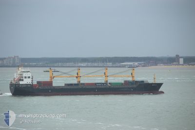
ATLANTIC RUNNER II
General Cargo
Current Trip
| Time Travelled | 9 days |
|---|---|
| Remaining Time | --- |
| Distance Travelled | 2723.64 nm |
| Remaining Distance | --- |
| AVG Speed | 12.1 Knots |
| MAX Speed | 13.3 Knots |
| AVG Wind | 14.7 knots |
| MAX Wind | 23.1 knots |
| MIN Temp | 16.8°C / 62.24°F |
| MAX Temp | 28.1°C / 82.58°F |
| Draught | 9.4 m |
| Position Received | 6 d ago |
Current Position
| Longitude | -15.45665° |
|---|---|
| Latitude | 27.25437° |
| Status | Under way using engine |
| Speed | 12 Knots |
| Course | 208.5° |
| Area | North Atlantic Ocean |
| Station | T-AIS |
| Position Received | 6 d ago |
Info
Information
The current position of ATLANTIC RUNNER II is in North Atlantic Ocean with coordinates 27.25437° / -15.45665° as reported on 2024-06-02 07:31 by AIS to our vessel tracker app. The vessel's current speed is 12 Knots and is heading at the port of SAO TOME. The estimated time of arrival as calculated by MyShipTracking vessel tracking app is 2024-06-11 11:00 LT
The vessel ATLANTIC RUNNER II (IMO: 9509619, MMSI: 538010196) is a General Cargo that was built in 2010 ( 14 years old ). It's sailing under the flag of [MH] Marshall Is.
In this page you can find informations about the vessels current position, last detected port calls, and current voyage information. If the vessels is not in coverage by AIS you will find the latest position.
The current position of ATLANTIC RUNNER II is detected by our AIS receivers and we are not responsible for the reliability of the data. The last position was recorded while the vessel was in Coverage by the Ais receivers of our vessel tracking app.
The current draught of ATLANTIC RUNNER II as reported by AIS is 9.4 meters
Weather
| Temperature | 26.5°C / 79.7°F |
|---|---|
| Wind Speed | 12 knots |
| Direction | 190° S |
| Pressure | 1014 hPa |
| Humidity | 72.7 % |
| Cloud Coverage | 47 % |
Featured Company
Last Port Calls
| Port | Arrival | Departure | Time In Port |
|---|---|---|---|
| 2024-05-29 10:46 | 2024-05-30 18:11 | 1 d | |
| 2024-05-27 00:35 | 2024-05-28 19:42 | 1 d | |
| 2024-05-20 23:58 | 2024-05-23 20:42 | 2 d | |
| 2024-05-06 02:53 | 2024-05-12 12:05 | 6 d | |
| 2024-04-29 13:28 | 2024-05-02 23:36 | 3 d | |
| 2024-04-24 00:04 | 2024-04-25 22:48 | 1 d | |
| 2024-04-05 14:39 | 2024-04-07 13:07 | 1 d | |
| 2024-04-03 00:23 | 2024-04-05 09:51 | 2 d |
Last Trips
| Origin | Departure | Destination | Arrival | Distance | |
|---|---|---|---|---|---|
| 2024-05-28 19:42 | 2024-05-29 10:46 | 191.47 nm | |||
| 2024-05-23 20:42 | 2024-05-27 00:35 | 518.04 nm | |||
| 2024-05-12 12:05 | 2024-05-20 23:58 | 2008.80 nm | |||
| 2024-05-02 23:36 | 2024-05-06 02:53 | 20.31 nm | |||
| 2024-04-25 22:48 | 2024-04-29 13:28 | 1069.42 nm | |||
| 2024-04-07 13:07 | 2024-04-24 00:04 | 2344.05 nm | |||
| 2024-04-05 09:51 | 2024-04-05 14:39 | 13.72 nm | |||
| 2024-03-26 23:53 | 2024-04-03 00:23 | 1658.04 nm |
Events
| Time | Event | Details | Position / Dest | Info |
|---|---|---|---|---|
| 2024-06-02 07:32 | Status Changed | Default Under way using engine |
27.25050 / -15.45893
STTMS
|
Speed: 12 kn Course: 208.5° |
| 2024-06-02 07:31 | Status Changed | Under way using engine Default |
27.25437 / -15.45665
STTMS
|
Speed: 12.1 kn Course: 208° |
| 2024-06-02 07:31 | OUT of Coverage |
27.25437 / -15.45665
North Atlantic Ocean
STTMS
|
Speed: 12 kn Course: 208.5° |
|
| 2024-06-02 07:24 | IN Coverage |
27.25437 / -15.45665
North Atlantic Ocean
STTMS
|
Speed: 12 kn Course: 208.5° |
|
| 2024-06-02 05:12 | Status Changed | Default Under way using engine |
27.68778 / -15.20875
STTMS
|
Speed: 12.9 kn Course: 208° |
| 2024-06-02 05:05 | Status Changed | Under way using engine Default |
27.70837 / -15.19632
STTMS
|
Speed: 12.9 kn Course: 206° |
| 2024-06-02 05:05 | OUT of Coverage |
27.70837 / -15.19632
North Atlantic Ocean
STTMS
|
Speed: 12.9 kn Course: 208° |
|
| 2024-06-02 05:00 | Status Changed | Default Under way using engine |
27.72563 / -15.18670
STTMS
|
Speed: 12.9 kn Course: 208° |
| 2024-06-01 23:59 | Status Changed | Under way using engine Default |
28.70174 / -14.73452
STTMS
|
Speed: 12.5 kn Course: 203° |
| 2024-06-01 23:56 | Status Changed | Default Under way using engine |
28.71138 / -14.72981
STTMS
|
Speed: 12.5 kn Course: 202.8° |