

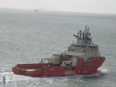
ATLANTIC KESTREL
Anchor Handling Vessel

Current Trip
SALVAGE AREA
| Time Travelled | 3 days |
|---|---|
| Remaining Time | --- |
| Distance Travelled | 117.18 nm |
| Remaining Distance | --- |
| AVG Speed | 6.3 Knots |
| MAX Speed | 13.6 Knots |
| AVG Wind | 10.5 knots |
| MAX Wind | 21.7 knots |
| MIN Temp | 2.1°C / 35.78°F |
| MAX Temp | 5.8°C / 42.44°F |
| Draught | 7 m |
| Position Received | 1 m ago |
Current Position
| Longitude | --- |
|---|---|
| Latitude | --- |
| Status | Under way using engine |
| Speed | 2.4 Knots |
| Course | 7° |
| Area | North Sea |
| Station | T-AIS |
| Position Received | 1 m ago |
Information
The current position of ATLANTIC KESTREL is in North Sea with coordinates 53.39093° / 0.58401° as reported on 2025-03-15 20:49 by AIS to our vessel tracker app. The vessel's current speed is 2.4 Knots
The vessel ATLANTIC KESTREL (IMO: 9557446, MMSI: 316023651) is a Anchor Handling Vessel that was built in 2012 ( 13 years old ). It's sailing under the flag of [CA] Canada.
In this page you can find informations about the vessels current position, last detected port calls, and current voyage information. If the vessels is not in coverage by AIS you will find the latest position.
The current position of ATLANTIC KESTREL is detected by our AIS receivers and we are not responsible for the reliability of the data. The last position was recorded while the vessel was in Coverage by the Ais receivers of our vessel tracking app.
The current draught of ATLANTIC KESTREL as reported by AIS is 7 meters
Weather
| Temperature | 5.4°C / 41.72°F |
|---|---|
| Wind Speed | 10 knots |
| Direction | 44° NE |
| Pressure | 1025.6 hPa |
| Humidity | 69.4 % |
| Cloud Coverage | 6 % |


Featured Company
Last Port Calls
| Port | Arrival | Departure | Time In Port |
|---|---|---|---|
| 2025-03-11 17:49 | 2025-03-12 00:43 | 6 h | |
| 2025-03-08 09:03 | 2025-03-10 23:48 | 2 d | |
| 2025-03-04 04:21 | 2025-03-05 17:26 | 1 d | |
| 2025-02-22 21:38 | 2025-02-27 00:52 | 4 d | |
| 2025-02-14 21:15 | 2025-02-22 10:59 | 7 d | |
| 2025-01-30 15:25 | 2025-02-04 18:30 | 5 d | |
| 2025-01-22 20:32 | 2025-01-27 12:40 | 4 d | |
| 2025-01-10 20:35 | 2025-01-19 04:51 | 8 d | |
| 2025-01-10 10:47 |
Last Trips
| Origin | Departure | Destination | Arrival | Distance | |
|---|---|---|---|---|---|
| 2025-03-10 23:48 | 2025-03-11 17:49 | 230.84 nm | |||
| 2025-03-05 17:26 | 2025-03-08 09:03 | 9.92 nm | |||
| 2025-02-27 00:52 | 2025-03-04 04:21 | 449.74 nm | |||
| 2025-02-22 10:59 | 2025-02-22 21:38 | 62.51 nm | |||
| 2025-02-04 18:30 | 2025-02-14 21:15 | 366.20 nm | |||
| 2025-01-27 12:40 | 2025-01-30 15:25 | 15.04 nm | |||
| 2025-01-19 04:51 | 2025-01-22 20:32 | 15.61 nm | |||
| 2025-01-10 10:47 | 2025-01-10 20:35 | 29.48 nm |
Events
| Time | Event | Details | Position / Dest | Info |
|---|---|---|---|---|
| 2025-03-15 16:05 | START Moving |
53.39094 / .54101
SALVAGE AREA
|
Speed: 3.7 kn Course: 204° |
|
| 2025-03-15 15:01 | STOP Moving |
53.39285 / .54236
SALVAGE AREA
|
Speed: 0.3 kn Course: 62° |
|
| 2025-03-15 14:33 | START Moving |
53.46553 / .51013
SALVAGE AREA
|
Speed: 7.7 kn Course: 163.8° |
|
| 2025-03-15 13:17 | STOP Moving |
53.46742 / .50923
SALVAGE AREA
|
Speed: 0.3 kn Course: 156° |
|
| 2025-03-15 10:51 | START Moving |
53.42694 / .50939
SALVAGE AREA
|
Speed: 3.3 kn Course: 289° |
|
| 2025-03-15 02:49 | STOP Moving | 21.12 nm, South East of GRIMSBY |
53.44140 / .47458
SALVAGE AREA
|
Speed: 0.3 kn Course: 40° |
| 2025-03-15 02:25 | Status Changed | Under way using engine Default |
53.44595 / .47033
SALVAGE AREA
|
Speed: 0.9 kn Course: 102° |
| 2025-03-15 02:22 | Status Changed | Default Under way using engine |
53.44681 / .47062
SALVAGE AREA
|
Speed: 0.9 kn Course: 103° |
| 2025-03-15 02:05 | START Moving | 20.55 nm, East of GRIMSBY |
53.45322 / .46549
SALVAGE AREA
|
Speed: 3.5 kn Course: 131° |
| 2025-03-15 01:08 | STOP Moving | 20.69 nm, East of GRIMSBY |
53.45640 / .47170
SALVAGE AREA
|
Speed: 0.2 kn Course: 155° |