
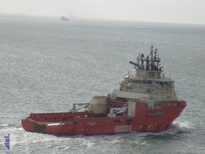
ATLANTIC KESTREL
Anchor Handling Vessel
Current Trip
| Time Travelled | 1 day |
|---|---|
| Remaining Time | 2 days |
| Distance Travelled | 490.41 nm |
| Remaining Distance | 654.58 nm |
| AVG Speed | 10.5 Knopen |
| MAX Speed | 13.3 Knopen |
| AVG Wind | 7.3 knots |
| MAX Wind | 13 knots |
| MIN Temp | 9.7°C / 49.46°F |
| MAX Temp | 17.9°C / 64.22°F |
| Diepgang | 6.9 M |
| Positie ontvangen | 3 h, 3 m geleden |
Current Position
| Lengtegraad | 11.31566° |
|---|---|
| Breedtegraat | 57.54650° |
| Status | Under way using engine |
| Snelheid | 11.8 Knopen |
| Koers | 132° |
| Gebied | Kattegat |
| Station | T-AIS |
| Positie ontvangen | 3 h, 3 m geleden |
Info
Information
The current position of ATLANTIC KESTREL is in Kattegat with coordinates 57.54650° / 11.31566° as reported on 2024-05-12 08:24 by AIS to our vessel tracker app. The vessel's current speed is 11.8 Knopen and is heading at the port of RAUMA. The estimated time of arrival as calculated by MyShipTracking vessel tracking app is 2024-05-14 19:36 LT
The vessel ATLANTIC KESTREL (IMO: 9557446, MMSI: 316023651) is a Anchor Handling Vessel that was built in 2012 ( 12 Jaar oud ). It's sailing under the flag of [CA] Canada.
In this page you can find informations about the vessels current position, last detected port calls, and current voyage information. If the vessels is not in coverage by AIS you will find the latest position.
The current position of ATLANTIC KESTREL is detected by our AIS receivers and we are not responsible for the reliability of the data. The last position was recorded while the vessel was in Coverage by the Ais receivers of our vessel tracking app.
The current draught of ATLANTIC KESTREL as reported by AIS is 6.9 meters
Weather
| Temperature | 11.2°C / 52.16°F |
|---|---|
| Wind Speed | 7 knots |
| Direction | 182° S |
| Pressure | 1026.5 hPa |
| Humidity | 71.8 % |
| Cloud Coverage | 78 % |
Featured Company
Last Port Calls
| Port | Arrival | Departure | Time In Port |
|---|---|---|---|
| 2024-05-10 02:51 | 2024-05-10 15:10 | 12 h | |
| 2024-04-16 08:57 | 2024-05-08 01:36 | 21 d | |
| 2024-04-03 08:50 | 2024-04-08 13:58 | 5 d | |
| 2024-03-29 03:00 | 2024-04-03 05:12 | 5 d | |
| 2024-03-21 23:55 | 2024-03-27 15:58 | 5 d | |
| 2024-03-14 14:46 | 2024-03-14 16:06 | 1 h | |
| 2024-03-14 14:25 |
Last Trips
| Origin | Departure | Destination | Arrival | Distance | |
|---|---|---|---|---|---|
| 2024-05-08 02:36 | 2024-05-10 03:51 | 11.68 nm | |||
| 2024-04-08 14:58 | 2024-04-16 09:57 | 480.74 nm | |||
| 2024-04-03 06:12 | 2024-04-03 09:50 | 29.40 nm | |||
| 2024-03-27 16:58 | 2024-03-29 03:00 | 326.72 nm | |||
| 2024-03-14 16:06 | 2024-03-22 00:55 | 376.79 nm | |||
| 2024-03-14 14:25 | 2024-03-14 14:46 | 0.41 nm |
Events
| Tijd | Evenement | Details | Positie / Bestemming | Info |
|---|---|---|---|---|
| 2024-05-12 08:24 | Buitenbereik |
57.54650 / 11.31566
Kattegat
FI RAU
|
Snelheid: 11.8 kn Koers: 132° |
|
| 2024-05-12 08:24 | Gevonden in zee | Swedish part of the Kattegat |
57.54650 / 11.31566
Kattegat
FI RAU
|
Snelheid: 11.8 kn Koers: 132° |
| 2024-05-12 06:39 | Wijzig zee gebeid | Danish part of the Kattegat Danish part of the Skaggerak |
57.77330 / 10.85693
Kattegat
FI RAU
|
Snelheid: 11.2 kn Koers: 133° |
| 2024-05-12 04:31 | Draught Changed | 6.9 6.8 |
57.78333 / 10.19633
FI RAU
|
Snelheid: 11.2 kn Koers: 86° |
| 2024-05-12 04:31 | Destination Changed | FI RAU MONTROSE |
57.78333 / 10.19633
FI RAU
|
Snelheid: 11.2 kn Koers: 86° |
| 2024-05-12 04:31 | ETA Changed | 2024/05/15 06:00 2024/04/16 07:00 |
57.78333 / 10.19633
FI RAU
|
Snelheid: 11.2 kn Koers: 86° |
| 2024-05-12 03:56 | Wijzig zee gebeid | Danish part of the Skaggerak United Kingdom part of the North Sea |
57.78133 / 9.98450
Skaggerak
|
Snelheid: 11.3 kn Koers: 91° |
| 2024-05-12 03:55 | Binnenbereik |
57.78133 / 9.98450
Skaggerak
|
Snelheid: 11.3 kn Koers: 91° |
|
| 2024-05-10 15:17 | Start beweging | 0.89 nm, East of MONTROSE |
56.70344 / -2.44160
MONTROSE
|
Snelheid: 8.4 kn Koers: 90° |
| 2024-05-10 15:10 | Vertrekhaven |
|
56.70344 / -2.44160
MONTROSE
|
Snelheid: 0.6 kn Koers: 307° |