
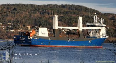
ATLANTIC DAWN
General Cargo
Current Trip
| Time Travelled | 4 days |
|---|---|
| Remaining Time | --- |
| Distance Travelled | 41.12 nm |
| Remaining Distance | --- |
| AVG Speed | 4.3 Knots |
| MAX Speed | 7.9 Knots |
| AVG Wind | 13.7 knots |
| MAX Wind | 20 knots |
| MIN Temp | 20.1°C / 68.18°F |
| MAX Temp | 27.6°C / 81.68°F |
| Draught | 5.4 m |
| Position Received | 1 m ago |
Current Position
| Longitude | --- |
|---|---|
| Latitude | --- |
| Status | Under way using engine |
| Speed | 5 Knots |
| Course | 104.2° |
| Area | Indian Ocean |
| Station | T-AIS |
| Position Received | 1 m ago |
Info
Information
The current position of ATLANTIC DAWN is in Indian Ocean with coordinates -32.02636° / 115.67788° as reported on 2026-01-06 07:32 by AIS to our vessel tracker app. The vessel's current speed is 5 Knots
The vessel ATLANTIC DAWN (IMO: 9671450, MMSI: 244790606) is a General Cargo that was built in 2013 ( 13 years old ). It's sailing under the flag of [NL] Netherlands.
In this page you can find informations about the vessels current position, last detected port calls, and current voyage information. If the vessels is not in coverage by AIS you will find the latest position.
The current position of ATLANTIC DAWN is detected by our AIS receivers and we are not responsible for the reliability of the data. The last position was recorded while the vessel was in Coverage by the Ais receivers of our vessel tracking app.
The current draught of ATLANTIC DAWN as reported by AIS is 5.4 meters
Weather
| Temperature | 22.2°C / 71.96°F |
|---|---|
| Wind Speed | 20 knots |
| Direction | 211° SSW |
| Pressure | 1010.6 hPa |
| Humidity | 67.4 % |
| Cloud Coverage | --- |
Featured Company
Last Port Calls
| Port | Arrival | Departure | Time In Port |
|---|---|---|---|
| 2025-12-30 16:26 | 2026-01-01 08:55 | 1 d | |
| 2025-12-12 23:07 | 2025-12-14 15:24 | 1 d | |
| 2025-11-26 18:23 | 2025-11-27 03:51 | 9 h | |
| 2025-11-11 10:07 | 2025-11-11 16:23 | 6 h | |
| 2025-11-08 04:25 | 2025-11-08 12:37 | 8 h | |
| 2025-11-05 06:33 | 2025-11-05 16:09 | 9 h |
Last Trips
| Origin | Departure | Destination | Arrival | Distance | |
|---|---|---|---|---|---|
| 2025-12-14 19:24 | 2025-12-31 00:26 | 5284.98 nm | |||
| 2025-11-27 05:51 | 2025-12-13 03:07 | 4956.65 nm | |||
| 2025-11-11 17:23 | 2025-11-26 20:23 | 5125.52 nm | |||
| 2025-11-08 13:37 | 2025-11-11 11:07 | 179.07 nm | |||
| 2025-11-05 17:09 | 2025-11-08 05:25 | 726.88 nm |
Events
| Time | Event | Details | Position / Dest | Info |
|---|---|---|---|---|
| 2026-01-06 07:07 | START Moving | 3.78 nm, North West of FREMANTLE |
-32.03384 / 115.66888
AUFRE
|
Speed: 3.3 kn Course: 106° |
| 2026-01-06 07:01 | Status Changed | Under way using engine At anchor |
-32.03599 / 115.66528
AUFRE
|
Speed: 1.1 kn Course: 166° |
| 2026-01-06 06:36 | Status Changed | At anchor Default |
-32.03476 / 115.66609
AUFRE
|
Speed: Course: -1° |
| 2026-01-06 06:31 | Status Changed | Default At anchor |
-32.03333 / 115.66500
AUFRE
|
Speed: 1 kn Course: 239° |
| 2026-01-06 04:57 | Status Changed | At anchor Default |
-32.03443 / 115.66474
AUFRE
|
Speed: 1.1 kn Course: 239° |
| 2026-01-06 04:54 | Status Changed | Default At anchor |
-32.03443 / 115.66518
AUFRE
|
Speed: 0.1 kn Course: 209° |
| 2026-01-06 01:33 | Status Changed | At anchor Default |
-32.03438 / 115.66442
AUFRE
|
Speed: 0.1 kn Course: 195° |
| 2026-01-06 01:30 | Status Changed | Default At anchor |
-32.03459 / 115.66463
AUFRE
|
Speed: 0.4 kn Course: 177° |
| 2026-01-05 22:24 | Status Changed | At anchor Default |
-32.03456 / 115.66376
AUFRE
|
Speed: Course: -1° |
| 2026-01-05 22:19 | Status Changed | Default At anchor |
-32.03333 / 115.66333
AUFRE
|
Speed: 0.3 kn Course: 148° |