
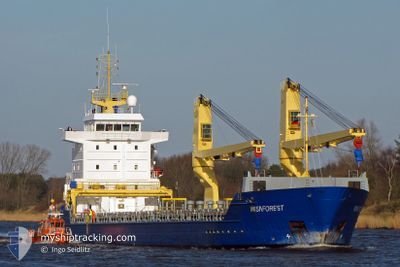
ASG KHERSON
General Cargo
Current Trip
| Time Travelled | 6 days |
|---|---|
| Remaining Time | --- |
| Distance Travelled | 911.63 nm |
| Remaining Distance | --- |
| AVG Speed | 9.6 Knots |
| MAX Speed | 12.5 Knots |
| AVG Wind | 6.7 knots |
| MAX Wind | 11 knots |
| MIN Temp | 24.2°C / 75.56°F |
| MAX Temp | 29.6°C / 85.28°F |
| Draught | 5.2 m |
| Position Received | 3 m ago |
Current Position
| Longitude | --- |
|---|---|
| Latitude | --- |
| Status | At anchor |
| Speed | |
| Course | 95° |
| Area | Caribbean Sea |
| Station | T-AIS |
| Position Received | 3 m ago |
Info
Information
The current position of ASG KHERSON is in Caribbean Sea with coordinates 10.62794° / -61.60193° as reported on 2024-11-26 23:44 by AIS to our vessel tracker app. The vessel's current speed is 0 Knots
The vessel ASG KHERSON (IMO: 9255579, MMSI: 511101311) is a General Cargo that was built in 2002 ( 22 years old ). It's sailing under the flag of [PW] Palau.
In this page you can find informations about the vessels current position, last detected port calls, and current voyage information. If the vessels is not in coverage by AIS you will find the latest position.
The current position of ASG KHERSON is detected by our AIS receivers and we are not responsible for the reliability of the data. The last position was recorded while the vessel was in Coverage by the Ais receivers of our vessel tracking app.
The current draught of ASG KHERSON as reported by AIS is 5.2 meters
Weather
| Temperature | 25.1°C / 77.18°F |
|---|---|
| Wind Speed | 4 knots |
| Direction | 99° E |
| Pressure | 1011.3 hPa |
| Humidity | 86.4 % |
| Cloud Coverage | 91 % |
Featured Company
Last Trips
| Origin | Departure | Destination | Arrival | Distance | |
|---|---|---|---|---|---|
| 2024-10-12 15:33 | 2024-11-17 17:56 | 4135.27 nm | |||
| 2024-10-07 21:30 | 2024-10-11 15:23 | 910.44 nm | |||
| 2024-10-01 23:18 | 2024-10-05 01:26 | 704.47 nm |
Events
| Time | Event | Details | Position / Dest | Info |
|---|---|---|---|---|
| 2024-11-26 16:59 | IN Coverage |
10.62740 / -61.60004
Caribbean Sea
|
Speed: 0.1 kn Course: 197.3° |
|
| 2024-11-26 15:38 | OUT of Coverage |
10.62765 / -61.59957
Caribbean Sea
|
Speed: Course: 44.5° |
|
| 2024-11-26 15:38 | IN Coverage |
10.62765 / -61.59957
Caribbean Sea
|
Speed: Course: 44.5° |
|
| 2024-11-26 11:41 | OUT of Coverage |
10.62693 / -61.60052
Caribbean Sea
|
Speed: 0.1 kn Course: 115.9° |
|
| 2024-11-25 20:23 | IN Coverage |
10.62815 / -61.60197
Caribbean Sea
|
Speed: 0.2 kn Course: 188.4° |
|
| 2024-11-25 13:17 | OUT of Coverage |
10.62758 / -61.59958
Caribbean Sea
|
Speed: Course: 75.8° |
|
| 2024-11-25 09:17 | IN Coverage |
10.62744 / -61.60166
Caribbean Sea
|
Speed: 0.1 kn Course: 75.8° |
|
| 2024-11-25 06:20 | OUT of Coverage |
10.62725 / -61.60147
Caribbean Sea
|
Speed: 0.1 kn Course: 75.8° |
|
| 2024-11-25 02:32 | IN Coverage |
10.62735 / -61.60003
Caribbean Sea
|
Speed: Course: 75.8° |
|
| 2024-11-25 00:56 | OUT of Coverage |
10.62686 / -61.60070
Caribbean Sea
|
Speed: Course: 333.6° |