

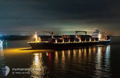
AS PETRONIA
Container Ship

Current Trip
| Time Travelled | 4 days |
|---|---|
| Remaining Time | --- |
| Distance Travelled | 1801.92 nm |
| Remaining Distance | --- |
| AVG Speed | 18.7 Knots |
| MAX Speed | 22.5 Knots |
| AVG Wind | 13.7 knots |
| MAX Wind | 29 knots |
| MIN Temp | 1.4°C / 34.52°F |
| MAX Temp | 17.1°C / 62.78°F |
| Draught | 11.6 m |
| Position Received | 1 m ago |
Current Position
| Longitude | --- |
|---|---|
| Latitude | --- |
| Status | Under way using engine |
| Speed | 16.1 Knots |
| Course | 257.5° |
| Area | North Atlantic Ocean |
| Station | T-AIS |
| Position Received | 1 m ago |
Information
The current position of AS PETRONIA is in North Atlantic Ocean with coordinates 38.52715° / -24.76068° as reported on 2025-02-04 06:36 by AIS to our vessel tracker app. The vessel's current speed is 16.1 Knots and is heading at the port of VERACRUZ. The estimated time of arrival as calculated by MyShipTracking vessel tracking app is 2025-02-13 03:00 LT
The vessel AS PETRONIA (IMO: 9286786, MMSI: 255806064) is a Container Ship that was built in 2004 ( 21 years old ). It's sailing under the flag of [PT] Portugal.
In this page you can find informations about the vessels current position, last detected port calls, and current voyage information. If the vessels is not in coverage by AIS you will find the latest position.
The current position of AS PETRONIA is detected by our AIS receivers and we are not responsible for the reliability of the data. The last position was recorded while the vessel was in Coverage by the Ais receivers of our vessel tracking app.
The current draught of AS PETRONIA as reported by AIS is 11.6 meters
Weather
| Temperature | 15.2°C / 59.36°F |
|---|---|
| Wind Speed | 14 knots |
| Direction | 20° NNE |
| Pressure | 1027.4 hPa |
| Humidity | 64.3 % |
| Cloud Coverage | 100 % |


Featured Company
Last Port Calls
| Port | Arrival | Departure | Time In Port |
|---|---|---|---|
| 2025-01-30 03:44 | 2025-01-31 04:16 | 1 d | |
| 2025-01-28 22:46 | 2025-01-29 17:49 | 19 h | |
| 2025-01-26 13:30 | 2025-01-27 16:40 | 1 d | |
| 2025-01-24 23:38 | 2025-01-25 19:55 | 20 h | |
| 2025-01-12 13:30 | 2025-01-13 19:54 | 1 d | |
| 2025-01-04 16:38 | 2025-01-06 00:08 | 1 d | |
| 2024-12-15 23:02 | 2024-12-17 06:51 | 1 d | |
| 2024-12-12 10:24 | 2024-12-14 04:28 | 1 d | |
| 2024-12-10 00:19 | 2024-12-11 06:49 | 1 d | |
| 2024-12-06 12:19 | 2024-12-09 03:44 | 2 d |
Most Visited Ports (Last year)
| Port | Arrivals | |
|---|---|---|
| 6 | ||
| 5 | ||
| 5 | ||
| 5 | ||
| 5 | ||
| 4 |
Last Trips
| Origin | Departure | Destination | Arrival | Distance | |
|---|---|---|---|---|---|
| 2025-01-29 18:49 | 2025-01-30 04:44 | 127.78 nm | |||
| 2025-01-27 17:40 | 2025-01-28 23:46 | 424.11 nm | |||
| 2025-01-25 19:55 | 2025-01-26 14:30 | 260.38 nm | |||
| 2025-01-13 14:54 | 2025-01-24 23:38 | 4363.56 nm | |||
| 2025-01-05 19:08 | 2025-01-12 08:30 | 430.83 nm | |||
| 2024-12-17 07:51 | 2025-01-04 11:38 | 7156.95 nm | |||
| 2024-12-14 05:28 | 2024-12-16 00:02 | 139.37 nm | |||
| 2024-12-11 07:49 | 2024-12-12 11:24 | 420.21 nm | |||
| 2024-12-09 03:44 | 2024-12-10 01:19 | 259.98 nm | |||
| 2024-11-25 14:43 | 2024-12-06 12:19 | 4353.61 nm |
Events
| Time | Event | Details | Position / Dest | Info |
|---|---|---|---|---|
| 2025-02-04 05:52 | Status Changed | Under way using engine Default |
38.57191 / -24.55423
VERACRUZ, MX
|
Speed: 7.4 kn Course: 253° |
| 2025-02-04 05:50 | Status Changed | Default Under way using engine |
38.57281 / -24.55022
VERACRUZ, MX
|
Speed: 3.8 kn Course: 263° |
| 2025-02-04 04:41 | Status Changed | Under way using engine Default |
38.59147 / -24.54613
VERACRUZ, MX
|
Speed: 1 kn Course: 244° |
| 2025-02-04 04:31 | Status Changed | Default Under way using engine |
38.59362 / -24.54862
VERACRUZ, MX
|
Speed: 1 kn Course: 245° |
| 2025-02-04 04:05 | Status Changed | Under way using engine Default |
38.59892 / -24.55552
VERACRUZ, MX
|
Speed: 1 kn Course: 274° |
| 2025-02-04 04:01 | Status Changed | Default Under way using engine |
38.59990 / -24.55654
VERACRUZ, MX
|
Speed: 14.6 kn Course: 259.4° |
| 2025-02-04 03:26 | Detected in Sea | Portuguese (Azores) part of the North Atlantic Ocean |
38.58987 / -24.54166
North Atlantic Ocean
VERACRUZ, MX
|
Speed: 14.6 kn Course: 259.4° |
| 2025-02-04 03:26 | Status Changed | Under way using engine Default |
38.58987 / -24.54166
VERACRUZ, MX
|
Speed: 18 kn Course: 255° |
| 2025-02-04 03:26 | IN Coverage |
38.58987 / -24.54166
North Atlantic Ocean
VERACRUZ, MX
|
Speed: 14.6 kn Course: 259.4° |
|
| 2025-02-01 15:02 | OUT of Coverage |
49.34875 / -5.36538
Celtic Sea
VERACRUZ, MX
|
Speed: 19.4 kn Course: 240.4° |