
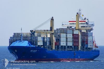
AS FILIPPA
Container Ship
Current Trip
JMKIN
| Time Travelled | 2 days |
|---|---|
| Remaining Time | --- |
| Distance Travelled | 831.19 nm |
| Remaining Distance | --- |
| AVG Speed | 12.7 Knots |
| MAX Speed | 16.9 Knots |
| AVG Wind | 14 knots |
| MAX Wind | 24.7 knots |
| MIN Temp | 23.8°C / 74.84°F |
| MAX Temp | 31.1°C / 87.98°F |
| Draught | 7.8 m |
| Position Received | 4 h, 38 m ago |
Current Position
| Longitude | --- |
|---|---|
| Latitude | --- |
| Status | Under way using engine |
| Speed | 1.7 Knots |
| Course | 24° |
| Area | Gulf of Mexico |
| Station | T-AIS |
| Position Received | 4 h, 38 m ago |
Information
The current position of AS FILIPPA is in Gulf of Mexico with coordinates 21.66383° / -89.67661° as reported on 2025-03-27 07:58 by AIS to our vessel tracker app. The vessel's current speed is 1.7 Knots
The vessel AS FILIPPA (IMO: 9368742, MMSI: 255806110) is a Container Ship that was built in 2008 ( 17 years old ). It's sailing under the flag of [PT] Portugal.
In this page you can find informations about the vessels current position, last detected port calls, and current voyage information. If the vessels is not in coverage by AIS you will find the latest position.
The current position of AS FILIPPA is detected by our AIS receivers and we are not responsible for the reliability of the data. The last position was recorded while the vessel was in Coverage by the Ais receivers of our vessel tracking app.
The current draught of AS FILIPPA as reported by AIS is 7.8 meters
Weather
| Temperature | 23.8°C / 74.84°F |
|---|---|
| Wind Speed | 17 knots |
| Direction | 110° ESE |
| Pressure | 1017.4 hPa |
| Humidity | 79.4 % |
| Cloud Coverage | --- |
Featured Company
Last Port Calls
| Port | Arrival | Departure | Time In Port |
|---|---|---|---|
| 2025-03-24 02:04 | 2025-03-24 16:52 | 14 h | |
| 2025-03-21 23:54 | 2025-03-22 21:01 | 21 h | |
| 2025-03-19 09:18 | 2025-03-20 05:54 | 20 h | |
| 2025-03-16 07:08 | 2025-03-17 00:19 | 17 h | |
| 2025-03-10 14:18 | 2025-03-11 04:18 | 13 h | |
| 2025-03-07 22:06 | 2025-03-08 06:53 | 8 h | |
| 2025-02-25 21:19 | 2025-02-27 06:53 | 1 d | |
| 2025-02-24 11:05 | 2025-02-25 05:51 | 18 h | |
| 2025-02-21 01:35 | 2025-02-22 02:35 | 1 d | |
| 2025-02-14 20:29 | 2025-02-15 14:23 | 17 h |
Most Visited Ports (Last year)
| Port | Arrivals | |
|---|---|---|
| 24 | ||
| 17 | ||
| 16 | ||
| 16 | ||
| 12 | ||
| 10 |
Last Trips
| Origin | Departure | Destination | Arrival | Distance | |
|---|---|---|---|---|---|
| 2025-03-22 17:01 | 2025-03-23 21:04 | 437.19 nm | |||
| 2025-03-20 01:54 | 2025-03-21 19:54 | 276.38 nm | |||
| 2025-03-16 19:19 | 2025-03-19 05:18 | 646.83 nm | |||
| 2025-03-10 22:18 | 2025-03-16 02:08 | 1296.70 nm | |||
| 2025-03-08 00:53 | 2025-03-10 08:18 | 511.37 nm | |||
| 2025-02-27 02:53 | 2025-03-07 16:06 | 2077.81 nm | |||
| 2025-02-25 01:51 | 2025-02-25 17:19 | 222.24 nm | |||
| 2025-02-21 21:35 | 2025-02-24 07:05 | 657.97 nm | |||
| 2025-02-15 08:23 | 2025-02-20 20:35 | 1290.92 nm | |||
| 2025-02-10 14:43 | 2025-02-14 14:29 | 726.43 nm |
Events
| Time | Event | Details | Position / Dest | Info |
|---|---|---|---|---|
| 2025-03-27 08:06 | Status Changed | Default Under way using engine |
21.66441 / -89.67976
JMKIN
|
Speed: 1.7 kn Course: 24° |
| 2025-03-27 07:58 | Change Sea Area | Mexican part of the Gulf of Mexico Domican Republic part of the Caribbean Sea |
21.66383 / -89.67661
Gulf of Mexico
|
Speed: 1.7 kn Course: 303.2° |
| 2025-03-27 07:58 | Status Changed | Under way using engine Default |
21.66383 / -89.67661
JMKIN
|
Speed: 6.3 kn Course: 258° |
| 2025-03-27 07:58 | OUT of Coverage |
21.66383 / -89.67661
Gulf of Mexico
|
Speed: 1.7 kn Course: 303.2° |
|
| 2025-03-27 07:46 | IN Coverage |
21.66383 / -89.67661
Gulf of Mexico
|
Speed: 1.7 kn Course: 303.2° |
|
| 2025-03-24 16:52 | PORT DEPARTURE |
|
17.96138 / -76.84522
JMKIN
|
Speed: 10.7 kn Course: 244° |
| 2025-03-24 16:44 | START Moving |
17.97391 / -76.82588
[JM] KINGSTON (JM)
|
Speed: 6.1 kn Course: 206° |
|
| 2025-03-24 02:28 | STOP Moving |
17.97794 / -76.82995
[JM] KINGSTON (JM)
|
Speed: 0.1 kn Course: 133° |
|
| 2025-03-24 02:04 | PORT ARRIVAL |
|
17.96690 / -76.83537
[JM] KINGSTON (JM)
|
Speed: 8.9 kn Course: 55° |
| 2025-03-22 22:48 | OUT of Coverage |
18.17620 / -69.91746
Caribbean Sea
JMKIN
|
Speed: 14.4 kn Course: 242.4° |