
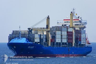
AS FILIPPA
Container Ship
Current Trip
| Time Travelled | 23 h, 17 mins |
|---|---|
| Remaining Time | 18 h, 25 mins |
| Distance Travelled | 291.63 nm |
| Remaining Distance | 223.32 nm |
| AVG Speed | 12.1 Noeuds |
| MAX Speed | 13 Noeuds |
| AVG Wind | 12.8 knots |
| MAX Wind | 19 knots |
| MIN Temp | 26.7°C / 80.06°F |
| MAX Temp | 28.4°C / 83.12°F |
| Tirant d eau | 7.5 m |
| Position reçue | 20 h, 57 m depuis |
Current Position
| Longitude | -69.97431° |
|---|---|
| Latitude | 18.13457° |
| Etat | Under way using engine |
| Vitesse | 11.9 Noeuds |
| Parcours | 237.2° |
| Zone | Caribbean Sea |
| Station | T-AIS |
| Position reçue | 20 h, 57 m depuis |
Info
Information
The current position of AS FILIPPA is in Caribbean Sea with coordinates 18.13457° / -69.97431° as reported on 2024-04-25 23:10 by AIS to our vessel tracker app. The vessel's current speed is 11.9 Noeuds and is heading at the port of MONTEGO BAY. The estimated time of arrival as calculated by MyShipTracking vessel tracking app is 2024-04-27 14:32 LT
The vessel AS FILIPPA (IMO: 9368742, MMSI: 255806110) is a Container Ship that was built in 2008 ( 16 Age ). It's sailing under the flag of [PT] Portugal.
In this page you can find informations about the vessels current position, last detected port calls, and current voyage information. If the vessels is not in coverage by AIS you will find the latest position.
The current position of AS FILIPPA is detected by our AIS receivers and we are not responsible for the reliability of the data. The last position was recorded while the vessel was in Coverage by the Ais receivers of our vessel tracking app.
The current draught of AS FILIPPA as reported by AIS is 7.5 meters
Weather
| Temperature | 27.9°C / 82.22°F |
|---|---|
| Wind Speed | 10 knots |
| Direction | 95° E |
| Pressure | 1011.9 hPa |
| Humidity | 72.9 % |
| Cloud Coverage | 100 % |
Featured Company
Last Port Calls
| Port | Arrival | Departure | Time In Port |
|---|---|---|---|
| 2024-04-25 01:31 | 2024-04-25 20:50 | 19 h | |
| 2024-04-23 11:21 | 2024-04-24 05:45 | 18 h | |
| 2024-04-20 11:54 | 2024-04-20 12:02 | 8 m | |
| 2024-04-19 01:46 | 2024-04-20 02:50 | 1 d | |
| 2024-04-14 20:11 | 2024-04-15 14:47 | 18 h | |
| 2024-04-12 22:57 | 2024-04-13 12:41 | 13 h | |
| 2024-04-11 05:29 | 2024-04-11 17:15 | 11 h | |
| 2024-04-05 03:08 | 2024-04-05 21:46 | 18 h | |
| 2024-04-02 19:08 | 2024-04-03 15:34 | 20 h | |
| 2024-03-30 13:35 | 2024-03-31 11:15 | 21 h |
Most Visited Ports (Last year)
| Port | Arrivals | |
|---|---|---|
| 28 | ||
| 28 | ||
| 25 | ||
| 22 | ||
| 7 | ||
| 6 |
Last Trips
| Origin | Departure | Destination | Arrival | Distance | |
|---|---|---|---|---|---|
| 2024-04-24 01:45 | 2024-04-24 21:31 | 230.39 nm | |||
| 2024-04-20 07:02 | 2024-04-23 07:21 | 669.00 nm | |||
| 2024-04-19 21:50 | 2024-04-20 06:54 | 4.76 nm | |||
| 2024-04-15 09:47 | 2024-04-18 20:46 | 1280.56 nm | |||
| 2024-04-13 07:41 | 2024-04-14 15:11 | 279.46 nm | |||
| 2024-04-11 12:15 | 2024-04-12 17:57 | 403.39 nm | |||
| 2024-04-05 17:46 | 2024-04-11 00:29 | 1259.23 nm | |||
| 2024-04-03 11:34 | 2024-04-04 23:08 | 242.31 nm | |||
| 2024-03-31 06:15 | 2024-04-02 15:08 | 647.60 nm | |||
| 2024-03-25 06:36 | 2024-03-30 08:35 | 1324.56 nm |
Events
| Heure | Evenement | Détails | Position/ Destination | Info |
|---|---|---|---|---|
| 2024-04-25 23:14 | Etat Changé | Default Under way using engine |
18.12667 / -69.98500
JMMBJ
|
Vitesse: 11.9 kn Parcours: 237.2° |
| 2024-04-25 23:10 | Hors de la zone couverte |
18.13457 / -69.97431
Caribbean Sea
JMMBJ
|
Vitesse: 11.9 kn Parcours: 237.2° |
|
| 2024-04-25 20:50 | PORT DE DEPART |
|
18.42561 / -69.61571
JMMBJ
|
Vitesse: 6.6 kn Parcours: 105° |
| 2024-04-25 20:38 | Démarrage |
18.42882 / -69.62776
[DO] BOCA CHIKA
|
Vitesse: 3.9 kn Parcours: 213° |
|
| 2024-04-25 20:34 | Dans la zone couverte |
18.42512 / -69.62829
Caribbean Sea
[DO] BOCA CHIKA
|
Vitesse: 2.3 kn Parcours: 351.4° |
|
| 2024-04-25 20:33 | Etat Changé | Under way using engine Default |
18.42459 / -69.62812
[DO] BOCA CHIKA
|
Vitesse: Parcours: -1° |
| 2024-04-25 19:17 | Etat Changé | Default Moored |
18.42333 / -69.62666
[DO] BOCA CHIKA
|
Vitesse: Parcours: 182° |
| 2024-04-25 19:08 | Etat Changé | Moored Default |
18.42457 / -69.62815
[DO] BOCA CHIKA
|
Vitesse: Parcours: -1° |
| 2024-04-25 19:08 | Hors de la zone couverte |
18.42457 / -69.62815
Caribbean Sea
[DO] BOCA CHIKA
|
Vitesse: Parcours: 70.9° |
|
| 2024-04-25 19:02 | Dans la zone couverte |
18.42457 / -69.62815
Caribbean Sea
[DO] BOCA CHIKA
|
Vitesse: Parcours: 70.9° |