
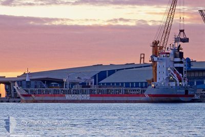
ARNE
General Cargo
Current Trip
| Time Travelled | 9 days |
|---|---|
| Remaining Time | --- |
| Distance Travelled | 977.88 nm |
| Remaining Distance | --- |
| AVG Speed | 9.4 Knots |
| MAX Speed | 13.6 Knots |
| AVG Wind | 20.4 knots |
| MAX Wind | 30.3 knots |
| MIN Temp | -3.8°C / 25.16°F |
| MAX Temp | 2.2°C / 35.96°F |
| Draught | 5.6 m |
| Position Received | 7 d ago |
Current Position
| Longitude | 33.56256° |
|---|---|
| Latitude | 70.22665° |
| Status | Under way using engine |
| Speed | 7.8 Knots |
| Course | 138° |
| Area | Barentsz Sea |
| Station | T-AIS |
| Position Received | 7 d ago |
Info
Information
The current position of ARNE is in Barentsz Sea with coordinates 70.22665° / 33.56256° as reported on 2024-04-24 00:09 by AIS to our vessel tracker app. The vessel's current speed is 7.8 Knots
The vessel ARNE (IMO: 9142564, MMSI: 305681000) is a General Cargo that was built in 1998 ( 26 years old ). It's sailing under the flag of [AG] Antigua Barbuda.
In this page you can find informations about the vessels current position, last detected port calls, and current voyage information. If the vessels is not in coverage by AIS you will find the latest position.
The current position of ARNE is detected by our AIS receivers and we are not responsible for the reliability of the data. The last position was recorded while the vessel was in Coverage by the Ais receivers of our vessel tracking app.
The current draught of ARNE as reported by AIS is 5.6 meters
Weather
| Temperature | -1.5°C / 29.3°F |
|---|---|
| Wind Speed | 8 knots |
| Direction | 87° E |
| Pressure | 1028.9 hPa |
| Humidity | 93.8 % |
| Cloud Coverage | 79 % |
Featured Company
Last Port Calls
| Port | Arrival | Departure | Time In Port |
|---|---|---|---|
| 2024-04-19 17:53 | 2024-04-21 08:39 | 1 d | |
| 2024-04-09 05:09 | 2024-04-11 05:50 | 2 d | |
| 2024-04-05 03:02 | 2024-04-07 09:21 | 2 d | |
| 2024-03-25 00:48 | 2024-03-28 02:28 | 3 d | |
| 2024-03-18 14:43 | 2024-03-20 20:37 | 2 d | |
| 2024-03-11 02:59 | 2024-03-15 12:23 | 4 d | |
| 2024-03-07 18:14 | 2024-03-09 02:52 | 1 d | |
| 2024-03-03 19:14 | 2024-03-05 07:49 | 1 d | |
| 2024-03-01 11:01 |
Most Visited Ports (Last year)
| Port | Arrivals | |
|---|---|---|
| 6 | ||
| 3 | ||
| 3 | ||
| 3 | ||
| 3 | ||
| 2 |
Last Trips
| Origin | Departure | Destination | Arrival | Distance | |
|---|---|---|---|---|---|
| 2024-04-11 08:50 | 2024-04-19 20:53 | 2206.70 nm | |||
| 2024-04-07 12:21 | 2024-04-09 08:09 | 478.09 nm | |||
| 2024-03-28 02:28 | 2024-04-05 06:02 | 1860.92 nm | |||
| 2024-03-20 21:37 | 2024-03-25 00:48 | 973.55 nm | |||
| 2024-03-15 14:23 | 2024-03-18 15:43 | 492.96 nm | |||
| 2024-03-09 03:52 | 2024-03-11 04:59 | 69.21 nm | |||
| 2024-03-05 10:49 | 2024-03-07 19:14 | 530.38 nm | |||
| 2024-03-01 12:01 | 2024-03-03 22:14 | 544.64 nm |
Events
| Time | Event | Details | Position / Dest | Info |
|---|---|---|---|---|
| 2024-04-24 00:46 | Status Changed | Default Under way using engine |
70.17181 / 33.74255
RUARH
|
Speed: 7.8 kn Course: 138° |
| 2024-04-24 00:09 | OUT of Coverage |
70.22665 / 33.56256
Barentsz Sea
RUARH
|
Speed: 7.8 kn Course: 138° |
|
| 2024-04-24 00:03 | Status Changed | Under way using engine Default |
70.23590 / 33.52948
RUARH
|
Speed: 7.9 kn Course: 131° |
| 2024-04-23 23:55 | Status Changed | Default Under way using engine |
70.24680 / 33.48958
RUARH
|
Speed: 7.9 kn Course: 124° |
| 2024-04-23 20:04 | Detected in Sea | Russian part of the Barentsz Sea |
70.53224 / 32.45844
Barentsz Sea
RUARH
|
Speed: 5.2 kn Course: 135° |
| 2024-04-22 21:58 | Detected in Sea | Norwegian part of the Barentsz Sea |
71.60904 / 24.83330
Barentsz Sea
RUARH
|
Speed: 8.9 kn Course: 81° |
| 2024-04-22 14:44 | Destination Changed | RUARH SKAGEN |
71.52456 / 22.27361
RUARH
|
Speed: 7.5 kn Course: 249° |
| 2024-04-22 09:58 | Change Sea Area | Norwegian part of the Norwegian Sea Norwegian part of the Barentsz Sea |
71.68396 / 24.64987
Norwegian Sea
SKAGEN
|
Speed: 10.3 kn Course: 254° |
| 2024-04-21 18:25 | Detected in Sea | Norwegian part of the Barentsz Sea |
70.51616 / 32.41516
Barentsz Sea
SKAGEN
|
Speed: 11.7 kn Course: 329° |
| 2024-04-21 15:53 | Destination Changed | SKAGEN TO ORDER |
70.11150 / 33.14466
SKAGEN
|
Speed: 11 kn Course: 328° |