
ARNE
General Cargo
Current Trip
| Trip Time | --- |
|---|---|
| Trip Distance | --- |
| AVG Speed | --- |
| MAX Speed | --- |
| Dybgang | --- |
| AVG Wind | --- |
| MAX Wind | --- |
| MIN Temp | --- |
| MAX Temp | --- |
| Position Modtaget | 1 d siden |
Current Position
| Longitude | --- |
|---|---|
| Latitude | --- |
| Status | Under way using engine |
| Fart | 12.7 Knots |
| Kurs | 18° |
| Område | North Atlantic Ocean |
| Station | T-AIS |
| Position Modtaget | 1 d siden |
Info
Information
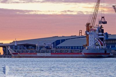
The current position of ARNE is in North Atlantic Ocean with coordinates 36.98232° / -6.16784° as reported on 2025-03-01 15:55 by AIS to our vessel tracker app. The vessel's current speed is 12.7 Knots and is currently inside the port of SEVILLA.
The vessel ARNE (IMO: 9142564, MMSI: 305681000) is a General Cargo that was built in 1998 ( 27 år gamle ). It's sailing under the flag of [AG] Antigua Barbuda.
In this page you can find informations about the vessels current position, last detected port calls, and current voyage information. If the vessels is not in coverage by AIS you will find the latest position.
The current position of ARNE is detected by our AIS receivers and we are not responsible for the reliability of the data. The last position was recorded while the vessel was in Coverage by the Ais receivers of our vessel tracking app.
The current draught of ARNE as reported by AIS is 7 meters
Weather
| Temperature | 10.3°C / 50.54°F |
|---|---|
| Wind Speed | 9 knots |
| Direction | 38° NE |
| Pressure | 1012.3 hPa |
| Humidity | 96.3 % |
| Cloud Coverage | 100 % |
Featured Company
Events
| Tid | Hændelsen | Detaljer | Position / Dest | Info |
|---|---|---|---|---|
| 2025-03-01 17:57 | Skibe i havn |
|
37.31590 / -6.01428
[ES] SEVILLA
|
Fart: 10.8 kn Kurs: 358° |
| 2025-03-01 16:01 | Status er ændret | Default Under way using engine |
36.99888 / -6.16519
ES SVQ
|
Fart: 12.7 kn Kurs: 18° |
| 2025-03-01 15:55 | Udenfor Dækning |
36.98232 / -6.16784
North Atlantic Ocean
|
Fart: 12.7 kn Kurs: 18° |
|
| 2025-03-01 12:42 | START Sejllads | 13.7 nm, North West of CHIPIONA |
36.85887 / -6.67727
ES SVQ
|
Fart: 3.2 kn Kurs: 128° |
| 2025-03-01 11:17 | Status er ændret | Under way using engine Default |
36.84587 / -6.68595
ES SVQ
|
Fart: 0.6 kn Kurs: 38° |
| 2025-03-01 10:36 | Status er ændret | Default Under way using engine |
36.83947 / -6.68641
ES SVQ
|
Fart: 0.6 kn Kurs: 7° |
| 2025-03-01 02:43 | STOP Sejllads | 10.51 nm, North West of CHIPIONA |
36.82573 / -6.62418
ES SVQ
|
Fart: 0.3 kn Kurs: 67° |
| 2025-02-28 23:00 | START Sejllads | 6.15 nm, West of CHIPIONA |
36.77168 / -6.55308
ES SVQ
|
Fart: 4.5 kn Kurs: 226° |
| 2025-02-28 22:50 | STOP Sejllads | 6.2 nm, West of CHIPIONA |
36.77351 / -6.55359
ES SVQ
|
Fart: 0.3 kn Kurs: 188° |
| 2025-02-28 21:37 | Status er ændret | Under way using engine Default |
36.75949 / -6.75912
ES SVQ
|
Fart: 12.3 kn Kurs: 88° |