
ARMONIA A
Cargo
Current Trip
| Time Travelled | 34 days |
|---|---|
| Remaining Time | 4 days |
| Distance Travelled | 6291.14 nm |
| Remaining Distance | 2118.81 nm |
| AVG Speed | 11.2 Knots |
| MAX Speed | 15.7 Knots |
| AVG Wind | 12 knots |
| MAX Wind | 27.8 knots |
| MIN Temp | 14.2°C / 57.56°F |
| MAX Temp | 29.2°C / 84.56°F |
| Draught | 7.9 m |
| Position Received | 7 d ago |
Current Position
| Longitude | --- |
|---|---|
| Latitude | --- |
| Status | Under way using engine |
| Speed | 12.7 Knots |
| Course | 181.7° |
| Area | South China Sea |
| Station | T-AIS |
| Position Received | 7 d ago |
Info
Information
The current position of ARMONIA A is in South China Sea with coordinates 22.24420° / 113.79963° as reported on 2025-12-05 04:19 by AIS to our vessel tracker app. The vessel's current speed is 12.7 Knots and is heading at the port of KWINANA. The estimated time of arrival as calculated by MyShipTracking vessel tracking app is 2025-12-17 00:10 LT
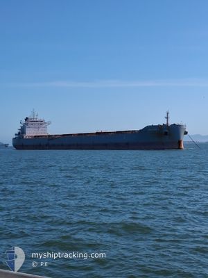
The vessel ARMONIA A (IMO: 9752151, MMSI: 538007871) is a Cargo It's sailing under the flag of [MH] Marshall Is.
In this page you can find informations about the vessels current position, last detected port calls, and current voyage information. If the vessels is not in coverage by AIS you will find the latest position.
The current position of ARMONIA A is detected by our AIS receivers and we are not responsible for the reliability of the data. The last position was recorded while the vessel was in Coverage by the Ais receivers of our vessel tracking app.
The current draught of ARMONIA A as reported by AIS is 7.9 meters
Weather
| Temperature | 28.6°C / 83.48°F |
|---|---|
| Wind Speed | 9 knots |
| Direction | 315° NW |
| Pressure | 1007.1 hPa |
| Humidity | 74.9 % |
| Cloud Coverage | 70 % |
Featured Company
Last Trips
| Origin | Departure | Destination | Arrival | Distance | |
|---|---|---|---|---|---|
| 2025-10-20 18:40 | 2025-11-05 21:58 | 4171.94 nm | |||
| 2025-09-24 00:43 | 2025-10-16 09:44 | 4987.66 nm |
Events
| Time | Event | Details | Position / Dest | Info |
|---|---|---|---|---|
| 2025-12-05 04:23 | Status Changed | Default Under way using engine |
22.22847 / 113.79834
AU KWI
|
Speed: 12.7 kn Course: 181.7° |
| 2025-12-05 04:19 | OUT of Coverage |
22.24420 / 113.79963
South China Sea
AU KWI
|
Speed: 12.7 kn Course: 181.7° |
|
| 2025-12-05 04:16 | Status Changed | Under way using engine Default |
22.25320 / 113.79960
AU KWI
|
Speed: 12.9 kn Course: 178° |
| 2025-12-05 04:13 | Status Changed | Default Under way using engine |
22.26451 / 113.79926
AU KWI
|
Speed: 11.9 kn Course: 179.3° |
| 2025-12-05 01:56 | Draught Changed | 7.9 12.7 |
22.64424 / 113.69358
AU KWI
|
Speed: 11.5 kn Course: 167.8° |
| 2025-12-05 01:56 | Destination Changed | AU KWI CN XNA |
22.64424 / 113.69358
AU KWI
|
Speed: 11.5 kn Course: 167.8° |
| 2025-12-05 01:56 | ETA Changed | 2025/12/25 09:00 2025/11/23 07:00 |
22.64424 / 113.69358
AU KWI
|
Speed: 11.5 kn Course: 167.8° |
| 2025-12-05 01:51 | Status Changed | Under way using engine Default |
22.65968 / 113.69008
CN XNA
|
Speed: 10.9 kn Course: 168° |
| 2025-12-05 01:49 | Status Changed | Default Under way using engine |
22.66558 / 113.68868
CN XNA
|
Speed: 10.8 kn Course: 169.8° |
| 2025-12-05 01:48 | Status Changed | Under way using engine Default |
22.66908 / 113.68799
CN XNA
|
Speed: 10.9 kn Course: 165° |