
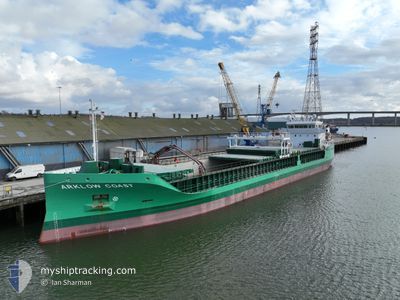
ARKLOW COAST
Cargo
Current Trip
| Time Travelled | 8 days |
|---|---|
| Remaining Time | 1 day |
| Distance Travelled | 2034.79 nm |
| Remaining Distance | 357.39 nm |
| AVG Speed | 9.2 Knots |
| MAX Speed | 11.8 Knots |
| AVG Wind | 14.5 knots |
| MAX Wind | 26.3 knots |
| MIN Temp | 7.8°C / 46.04°F |
| MAX Temp | 20.4°C / 68.72°F |
| Draught | 6.5 m |
| Position Received | 1 m ago |
Current Position
| Longitude | 3.83814° |
|---|---|
| Latitude | 63.27356° |
| Status | Under way using engine |
| Speed | 9.8 Knots |
| Course | 48.7° |
| Area | Norwegian Sea |
| Station | T-AIS |
| Position Received | 1 m ago |
Info
Information
The current position of ARKLOW COAST is in Norwegian Sea with coordinates 63.27356° / 3.83814° as reported on 2024-05-05 01:19 by AIS to our vessel tracker app. The vessel's current speed is 9.8 Knots and is heading at the port of GLOMFJORD. The estimated time of arrival as calculated by MyShipTracking vessel tracking app is 2024-05-06 13:40 LT
The vessel ARKLOW COAST (IMO: 9757151, MMSI: 250006644) is a Cargo It's sailing under the flag of [IE] Ireland.
In this page you can find informations about the vessels current position, last detected port calls, and current voyage information. If the vessels is not in coverage by AIS you will find the latest position.
The current position of ARKLOW COAST is detected by our AIS receivers and we are not responsible for the reliability of the data. The last position was recorded while the vessel was in Coverage by the Ais receivers of our vessel tracking app.
The current draught of ARKLOW COAST as reported by AIS is 6.5 meters
Weather
| Temperature | 7.8°C / 46.04°F |
|---|---|
| Wind Speed | 16 knots |
| Direction | 67° ENE |
| Pressure | 1012.1 hPa |
| Humidity | 82.9 % |
| Cloud Coverage | 100 % |
Featured Company
Last Port Calls
| Port | Arrival | Departure | Time In Port |
|---|---|---|---|
| 2024-04-25 12:17 | 2024-04-26 11:23 | 23 h | |
| 2024-04-23 06:05 | 2024-04-23 10:12 | 4 h | |
| 2024-04-20 12:48 | |||
| 2024-04-15 04:43 | 2024-04-15 10:01 | 5 h | |
| 2024-04-09 16:13 | 2024-04-11 17:20 | 2 d | |
| 2024-04-07 15:06 | 2024-04-09 06:14 | 1 d | |
| 2024-04-02 23:10 | 2024-04-03 19:49 | 20 h | |
| 2024-03-28 14:29 | 2024-04-02 17:44 | 5 d | |
| 2024-03-25 20:25 | 2024-03-25 21:14 | 49 m | |
| 2024-03-20 08:16 | 2024-03-25 19:33 | 5 d |
Last Trips
| Origin | Departure | Destination | Arrival | Distance | |
|---|---|---|---|---|---|
| 2024-04-23 12:12 | 2024-04-25 13:17 | 205.24 nm | |||
| 2024-04-20 14:48 | 2024-04-23 08:05 | 701.23 nm | |||
| 2024-04-11 19:20 | 2024-04-15 06:43 | 739.20 nm | |||
| 2024-04-09 08:14 | 2024-04-09 18:13 | 69.54 nm | |||
| 2024-04-03 20:49 | 2024-04-07 17:06 | 710.77 nm | |||
| 2024-04-02 18:44 | 2024-04-03 00:10 | 65.78 nm | |||
| 2024-03-25 22:14 | 2024-03-28 14:29 | 573.25 nm | |||
| 2024-03-25 20:33 | 2024-03-25 21:25 | 3.05 nm | |||
| 2024-03-20 08:36 | 2024-03-20 09:16 | 2.79 nm | |||
| 2024-03-17 13:55 | 2024-03-20 08:02 | 415.90 nm |
Events
| Time | Event | Details | Position / Dest | Info |
|---|---|---|---|---|
| 2024-05-04 15:28 | Change Sea Area | Norwegian part of the Norwegian Sea United Kingdom part of the Norwegian Sea |
62.20659 / 1.24145
Norwegian Sea
NO GLO
|
Speed: 9.7 kn Course: 51.9° |
| 2024-05-04 07:04 | Status Changed | Under way using engine Default |
61.20880 / -.61222
NO GLO
|
Speed: 9.6 kn Course: 36° |
| 2024-05-04 06:47 | IN Coverage |
61.20880 / -.61222
Norwegian Sea
NO GLO
|
Speed: 9.5 kn Course: 36.2° |
|
| 2024-05-04 06:06 | Status Changed | Default Under way using engine |
61.08936 / -.81359
NO GLO
|
Speed: 10.9 kn Course: 39.5° |
| 2024-05-04 05:59 | OUT of Coverage |
61.07285 / -.84212
Norwegian Sea
NO GLO
|
Speed: 10.9 kn Course: 39.5° |
|
| 2024-05-04 05:34 | Detected in Sea | United Kingdom part of the Norwegian Sea |
61.01569 / -.94114
Norwegian Sea
NO GLO
|
Speed: 11 kn Course: 39.4° |
| 2024-05-04 05:28 | Status Changed | Under way using engine Default |
61.00046 / -.96737
NO GLO
|
Speed: 11.1 kn Course: 40° |
| 2024-05-04 05:06 | Status Changed | Default Under way using engine |
60.95028 / -1.05349
NO GLO
|
Speed: 11.1 kn Course: 39.3° |
| 2024-05-04 04:50 | Status Changed | Under way using engine Default |
60.91047 / -1.12151
NO GLO
|
Speed: 11 kn Course: 40° |
| 2024-05-04 04:34 | IN Coverage |
60.91047 / -1.12151
North Atlantic Ocean
NO GLO
|
Speed: 11.1 kn Course: 39.8° |