
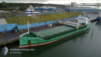
ARKLOW CAPE
Cargo
Current Trip
| Time Travelled | 2 days |
|---|---|
| Remaining Time | 4 days |
| Distance Travelled | 542.60 nm |
| Remaining Distance | 973.49 nm |
| AVG Speed | 9.3 Knots |
| MAX Speed | 12.7 Knots |
| AVG Wind | 16.6 knots |
| MAX Wind | 35.8 knots |
| MIN Temp | 4.5°C / 40.1°F |
| MAX Temp | 9.1°C / 48.38°F |
| Draught | 6.3 m |
| Position Received | 1 m ago |
Current Position
| Longitude | --- |
|---|---|
| Latitude | --- |
| Status | Under way using engine |
| Speed | 7.8 Knots |
| Course | 26.9° |
| Area | North Sea |
| Station | T-AIS |
| Position Received | 1 m ago |
Info
Information
The current position of ARKLOW CAPE is in North Sea with coordinates 51.34932° / 2.15043° as reported on 2026-01-07 21:16 by AIS to our vessel tracker app. The vessel's current speed is 7.8 Knots and is heading at the port of SLITE. The estimated time of arrival as calculated by MyShipTracking vessel tracking app is 2026-01-12 20:21 LT
The vessel ARKLOW CAPE (IMO: 9757096, MMSI: 250004214) is a Cargo It's sailing under the flag of [IE] Ireland.
In this page you can find informations about the vessels current position, last detected port calls, and current voyage information. If the vessels is not in coverage by AIS you will find the latest position.
The current position of ARKLOW CAPE is detected by our AIS receivers and we are not responsible for the reliability of the data. The last position was recorded while the vessel was in Coverage by the Ais receivers of our vessel tracking app.
The current draught of ARKLOW CAPE as reported by AIS is 6.3 meters
Weather
| Temperature | 6°C / 42.8°F |
|---|---|
| Wind Speed | 21 knots |
| Direction | 278° W |
| Pressure | 1005.6 hPa |
| Humidity | 75.8 % |
| Cloud Coverage | 99 % |
Featured Company
Last Port Calls
| Port | Arrival | Departure | Time In Port |
|---|---|---|---|
| 2026-01-02 19:07 | 2026-01-05 13:07 | 2 d | |
| 2025-12-15 17:48 | 2025-12-20 04:20 | 4 d | |
| 2025-12-10 15:21 | 2025-12-13 13:40 | 2 d | |
| 2025-12-04 04:04 | 2025-12-05 18:07 | 1 d | |
| 2025-11-30 01:49 | 2025-12-02 19:54 | 2 d | |
| 2025-11-30 00:10 | 2025-11-30 00:22 | 12 m | |
| 2025-11-19 09:33 | 2025-11-27 02:42 | 7 d | |
| 2025-11-17 10:14 | 2025-11-17 23:07 | 12 h | |
| 2025-11-13 14:45 | 2025-11-13 15:21 | 35 m | |
| 2025-11-13 14:03 | 2025-11-13 14:24 | 21 m |
Last Trips
| Origin | Departure | Destination | Arrival | Distance | |
|---|---|---|---|---|---|
| 2025-12-20 04:20 | 2026-01-02 19:07 | 945.67 nm | |||
| 2025-12-13 13:40 | 2025-12-15 17:48 | 236.07 nm | |||
| 2025-12-05 18:07 | 2025-12-10 15:21 | 766.05 nm | |||
| 2025-12-02 19:54 | 2025-12-04 04:04 | 222.63 nm | |||
| 2025-11-30 00:22 | 2025-11-30 01:49 | 10.40 nm | |||
| 2025-11-27 02:42 | 2025-11-30 00:10 | 568.09 nm | |||
| 2025-11-17 23:07 | 2025-11-19 09:33 | 314.22 nm | |||
| 2025-11-13 15:21 | 2025-11-17 10:14 | 609.38 nm | |||
| 2025-11-13 14:24 | 2025-11-13 14:45 | 2.05 nm | |||
| 2025-11-13 13:19 | 2025-11-13 14:03 | 4.48 nm |
Events
| Time | Event | Details | Position / Dest | Info |
|---|---|---|---|---|
| 2026-01-07 18:02 | Detected in Sea | French part of the North Sea |
51.00042 / 1.61620
North Sea
SE SLI
|
Speed: 10.6 kn Course: 45° |
| 2026-01-07 16:07 | Detected in Sea | French part of the English Channel |
50.71320 / 1.32473
English Channel
SE SLI
|
Speed: 10.7 kn Course: 50.7° |
| 2026-01-07 16:06 | Status Changed | Under way using engine Default |
50.71160 / 1.32167
SE SLI
|
Speed: 10.6 kn Course: 51° |
| 2026-01-07 15:57 | IN Coverage |
50.71320 / 1.32473
English Channel
SE SLI
|
Speed: 10.7 kn Course: 50.7° |
|
| 2026-01-06 03:32 | Status Changed | Default Under way using engine |
47.99992 / -5.18278
SE SLI
|
Speed: 9.6 kn Course: 330.3° |
| 2026-01-06 03:24 | OUT of Coverage |
47.97915 / -5.16573
Celtic Sea
SE SLI
|
Speed: 9.6 kn Course: 330.3° |
|
| 2026-01-06 01:52 | Status Changed | Under way using engine Default |
47.84777 / -4.84352
SE SLI
|
Speed: 10 kn Course: 300° |
| 2026-01-06 01:47 | Status Changed | Default Under way using engine |
47.84167 / -4.82667
SE SLI
|
Speed: 9.9 kn Course: 298.5° |
| 2026-01-06 01:17 | Change Sea Area | French part of the Celtic Sea French part of the Bay of Biscay |
47.80307 / -4.71665
Celtic Sea
SE SLI
|
Speed: 9.9 kn Course: 300.7° |
| 2026-01-06 01:13 | Status Changed | Under way using engine Default |
47.79822 / -4.70433
SE SLI
|
Speed: 10 kn Course: 300° |