

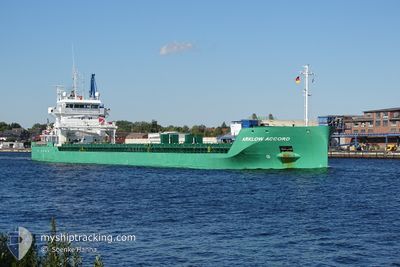
ARKLOW ACCORD
Cargo

Current Trip
| Trip Time | 2 days |
|---|---|
| Trip Distance | 639.20 nm |
| AVG Speed | 9 Knots |
| MAX Speed | 12 Knots |
| Draught | 4.6 m |
| AVG Wind | 21.8 knots |
| MAX Wind | 28.9 knots |
| MIN Temp | 6.5°C / 43.7°F |
| MAX Temp | 16.4°C / 61.52°F |
| Position Received | 2 m ago |
Current Position
| Longitude | --- |
|---|---|
| Latitude | --- |
| Status | Moored |
| Speed | |
| Course | 135° |
| Area | Bay of Biscay |
| Station | T-AIS |
| Position Received | 2 m ago |
Information
The current position of ARKLOW ACCORD is in Bay of Biscay with coordinates 43.73490° / -7.86484° as reported on 2025-02-21 11:23 by AIS to our vessel tracker app. The vessel's current speed is 0 Knots and is currently inside the port of CARINO.
The vessel ARKLOW ACCORD (IMO: 9851945, MMSI: 250005849) is a Cargo It's sailing under the flag of [IE] Ireland.
In this page you can find informations about the vessels current position, last detected port calls, and current voyage information. If the vessels is not in coverage by AIS you will find the latest position.
The current position of ARKLOW ACCORD is detected by our AIS receivers and we are not responsible for the reliability of the data. The last position was recorded while the vessel was in Coverage by the Ais receivers of our vessel tracking app.
The current draught of ARKLOW ACCORD as reported by AIS is 4.6 meters
Weather
| Temperature | 14.8°C / 58.64°F |
|---|---|
| Wind Speed | 22 knots |
| Direction | 237° WSW |
| Pressure | 1010.7 hPa |
| Humidity | 79.8 % |
| Cloud Coverage | 100 % |

Featured Company
Last Port Calls
| Port | Arrival | Departure | Time In Port |
|---|---|---|---|
| 2025-02-20 16:34 | |||
| 2025-02-16 12:27 | 2025-02-17 20:27 | 1 d | |
| 2025-02-02 07:39 | 2025-02-03 22:23 | 1 d | |
| 2025-01-28 20:59 | 2025-01-30 04:57 | 1 d | |
| 2025-01-25 21:39 | 2025-01-28 15:53 | 2 d | |
| 2025-01-20 09:13 | 2025-01-21 12:09 | 1 d | |
| 2025-01-15 18:27 | 2025-01-17 06:19 | 1 d | |
| 2025-01-14 11:56 | 2025-01-14 12:34 | 37 m | |
| 2025-01-11 19:20 | 2025-01-14 11:19 | 2 d | |
| 2025-01-11 08:26 | 2025-01-11 18:18 | 9 h |
Most Visited Ports (Last year)
| Port | Arrivals | |
|---|---|---|
| 6 | ||
| 5 | ||
| 4 | ||
| 3 | ||
| 3 | ||
| 3 |
Last Trips
| Origin | Departure | Destination | Arrival | Distance | |
|---|---|---|---|---|---|
| 2025-02-17 20:27 | 2025-02-20 17:34 | 639.20 nm | |||
| 2025-02-03 22:23 | 2025-02-16 12:27 | 1420.76 nm | |||
| 2025-01-30 05:57 | 2025-02-02 07:39 | 728.14 nm | |||
| 2025-01-28 16:53 | 2025-01-28 21:59 | 36.66 nm | |||
| 2025-01-21 13:09 | 2025-01-25 22:39 | 739.12 nm | |||
| 2025-01-17 07:19 | 2025-01-20 10:13 | 799.37 nm | |||
| 2025-01-14 13:34 | 2025-01-15 19:27 | 301.74 nm | |||
| 2025-01-14 12:19 | 2025-01-14 12:56 | 2.96 nm | |||
| 2025-01-11 19:18 | 2025-01-11 20:20 | 3.79 nm | |||
| 2025-01-11 05:36 | 2025-01-11 09:26 | 22.98 nm |
Events
| Time | Event | Details | Position / Dest | Info |
|---|---|---|---|---|
| 2025-02-20 17:08 | Status Changed | Moored Under way using engine |
43.73491 / -7.86486
[ES] CARINO
|
Speed: 0.1 kn Course: 134° |
| 2025-02-20 16:39 | STOP Moving |
43.73480 / -7.86496
[ES] CARINO
|
Speed: 0.3 kn Course: 134° |
|
| 2025-02-20 16:34 | PORT ARRIVAL |
|
43.73313 / -7.86580
[ES] CARINO
|
Speed: 2.7 kn Course: 353° |
| 2025-02-20 16:04 | START Moving | 1.86 nm, North East of CARINO |
43.75293 / -7.83069
CARINO
|
Speed: 4.4 kn Course: 206° |
| 2025-02-20 15:06 | STOP Moving | 2.6 nm, North East of CARINO |
43.76625 / -7.82371
CARINO
|
Speed: 0.3 kn Course: 206° |
| 2025-02-20 14:33 | Change Sea Area | Spanish part of the Bay of Biscay Spanish part of the North Atlantic Ocean |
43.81556 / -7.80271
Bay of Biscay
CARINO
|
Speed: 10.9 kn Course: 192.4° |
| 2025-02-20 14:16 | Change Sea Area | Spanish part of the North Atlantic Ocean United Kingdom part of the Celtic Sea |
43.86652 / -7.78789
North Atlantic Ocean
CARINO
|
Speed: 9.9 kn Course: 189.7° |
| 2025-02-20 14:15 | Status Changed | Under way using engine Default |
43.86788 / -7.78758
CARINO
|
Speed: 10.8 kn Course: 188° |
| 2025-02-20 14:15 | IN Coverage |
43.86652 / -7.78789
North Atlantic Ocean
CARINO
|
Speed: 9.9 kn Course: 189.7° |
|
| 2025-02-19 01:57 | OUT of Coverage |
49.65430 / -6.08336
Celtic Sea
CARINO
|
Speed: 10.3 kn Course: 191.6° |