
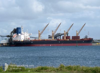
ARCH SEALTIEL
Cargo
Current Trip
| Trip Time | 2 days |
|---|---|
| Trip Distance | 106.84 nm |
| AVG Speed | 6.8 Knots |
| MAX Speed | 6.8 Knots |
| Draught | 6.5 m |
| AVG Wind | 6.9 knots |
| MAX Wind | 12 knots |
| MIN Temp | 28.1°C / 82.58°F |
| MAX Temp | 31.1°C / 87.98°F |
| Position Received | 2 m ago |
Current Position
| Longitude | 55.38325° |
|---|---|
| Latitude | 25.36742° |
| Status | Moored |
| Speed | 0.1 Knots |
| Course | 227° |
| Area | Persian Gulf |
| Station | T-AIS |
| Position Received | 2 m ago |
Info
Information
The current position of ARCH SEALTIEL is in Persian Gulf with coordinates 25.36742° / 55.38325° as reported on 2024-05-23 01:53 by AIS to our vessel tracker app. The vessel's current speed is 0.1 Knots and is currently inside the port of SHARJAH.
The vessel ARCH SEALTIEL (IMO: 9805661, MMSI: 538009838) is a Cargo It's sailing under the flag of [MH] Marshall Is.
In this page you can find informations about the vessels current position, last detected port calls, and current voyage information. If the vessels is not in coverage by AIS you will find the latest position.
The current position of ARCH SEALTIEL is detected by our AIS receivers and we are not responsible for the reliability of the data. The last position was recorded while the vessel was in Coverage by the Ais receivers of our vessel tracking app.
The current draught of ARCH SEALTIEL as reported by AIS is 6.5 meters
Weather
| Temperature | 31°C / 87.8°F |
|---|---|
| Wind Speed | 6 knots |
| Direction | 189° S |
| Pressure | 1002.8 hPa |
| Humidity | 31 % |
| Cloud Coverage | --- |
Featured Company
Last Port Calls
| Port | Arrival | Departure | Time In Port |
|---|---|---|---|
| 2024-05-22 15:10 | |||
| 2024-05-15 17:17 | 2024-05-19 22:25 | 4 d | |
| 2024-05-04 00:14 | 2024-05-10 14:30 | 6 d | |
| 2024-04-27 16:14 | 2024-04-29 06:50 | 1 d | |
| 2024-04-13 17:45 | 2024-04-14 19:56 | 1 d | |
| 2024-03-26 03:59 | 2024-03-29 00:35 | 2 d | |
| 2024-03-12 20:23 | 2024-03-13 20:16 | 23 h |
Last Trips
| Origin | Departure | Destination | Arrival | Distance | |
|---|---|---|---|---|---|
| 2024-05-19 22:25 | 2024-05-22 15:10 | 106.84 nm | |||
| 2024-05-10 14:30 | 2024-05-15 17:17 | 1385.20 nm | |||
| 2024-04-29 06:50 | 2024-05-04 00:14 | 251.35 nm | |||
| 2024-04-14 19:56 | 2024-04-27 16:14 | 3604.49 nm | |||
| 2024-03-29 00:35 | 2024-04-13 17:45 | 3867.75 nm | |||
| 2024-02-07 09:38 | 2024-03-12 20:23 | 6151.02 nm |
Events
| Time | Event | Details | Position / Dest | Info |
|---|---|---|---|---|
| 2024-05-22 11:47 | Status Changed | Moored Under way using engine |
25.36745 / 55.38324
[AE] SHARJAH
|
Speed: Course: 226° |
| 2024-05-22 11:44 | STOP Moving |
25.36748 / 55.38320
[AE] SHARJAH
|
Speed: 0.3 kn Course: 225° |
|
| 2024-05-22 11:10 | PORT ARRIVAL |
|
25.37264 / 55.37107
[AE] SHARJAH
|
Speed: 4.6 kn Course: 192° |
| 2024-05-22 08:09 | START Moving | 6.88 nm, North West of AJMAN |
25.49647 / 55.35190
AESHJ
|
Speed: 3.2 kn Course: 218° |
| 2024-05-22 08:00 | Status Changed | Under way using engine At anchor |
25.49803 / 55.35395
AESHJ
|
Speed: 0.7 kn Course: 279° |
| 2024-05-22 05:25 | STOP Moving | 6.78 nm, North West of AJMAN |
25.49904 / 55.35667
AESHJ
|
Speed: 0.3 kn Course: 252° |
| 2024-05-22 05:25 | Status Changed | At anchor Under way using engine |
25.49902 / 55.35656
AESHJ
|
Speed: 0.6 kn Course: 252° |
| 2024-05-21 20:03 | Destination Changed | AESHJ TO ORDER |
25.01698 / 54.48945
AESHJ
|
Speed: 7.7 kn Course: 15° |
| 2024-05-21 19:58 | START Moving | 15.55 nm, North West of KHALIFA |
25.00925 / 54.48736
TO ORDER
|
Speed: 3.1 kn Course: 17° |
| 2024-05-21 19:57 | ETA Changed | 2024/05/22 04:00 2024/05/15 08:00 |
25.00825 / 54.48729
TO ORDER
|
Speed: 1.9 kn Course: 13° |